Ehlen (Habichtswald)
|
Ehlen
Community Habichtswald
Coordinates: 51 ° 19 ′ 22 ″ N , 9 ° 18 ′ 31 ″ E
|
|
|---|---|
| Height : | 334 (320-375) m above sea level NHN |
| Residents : | 2705 (Jan 15, 2014) |
| Incorporation : | December 31, 1971 |
| Postal code : | 34317 |
| Area code : | 05606 |
Ehlen is a part of the community Habichtswald in the Kassel district in northern Hesse . It has 2705 inhabitants.
Geographical location
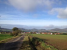
Ehlen is located in the Habichtswald Nature Park about 13.5 km (as the crow flies ) west of Kassel city center between the Zierenberger core town in the north-northwest, the Habichtswald district of Dörnberg in the northeast, Breitenbach in the south, Martinhagen in the south-southwest and Burghasungen in the west. Northeast of the to about 320 to 375 m above sea level. In the village located above sea level rises the Hohe Dörnberg ( 578.7 m ), southeast of the Essigberg (approx. 597.5 m ), west of the Burghasunger Berg ( 479.7 m ) and northwest of the Große Bärenberg ( 600.7 m ). The warmth flows directly west past Ehlen in a south-north direction . The federal road 251 ( Brilon- Kassel) runs through between Burghasungen and Dörnberg ; this crosses the country road 3220 (Zierenberg-Breitenbach) in the village .
Ehlen also includes Gut Bodenhausen , a former manor about 1.5 km northwest of the village in the valley of warmth .
history
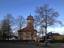
Ehlen was first mentioned in 1024 in a deed of donation from the Hasungen monastery . It is believed that the name Ehlen refers to the ancient name Elen for the elk . The oldest remaining evidence is a bas-relief from the 11th century in the stone barn , a former chapel. The church, whose tower was built in the 12th century as a defense tower , is worth seeing . The nave was added in the 17th century . The old forge "Schnegelsberg", which has been completely restored, is also one of the sights.
About 2 km southwest of Ehlen in the valley of the warmth is the so-called " Ropperode pottery desert ", which was later replaced by an estate.
The previously independent place Ehlen was within the municipality of reorganization on 31 December 1971, the municipality Dörnberg joined the new municipality Habichtswald.
Personalities
- Tilemann Elhen von Wolfhagen (* 1347 ?; † 1406 at the latest), chronicler
Web links
- Habichtswald (official website of the municipality)
- "Ehlen, District of Kassel". Historical local dictionary for Hessen. In: Landesgeschichtliches Informationssystem Hessen (LAGIS).
Individual evidence
- ↑ a b Statistical figures , as of January 15, 2014, on habichtswald.de
- ↑ Map services of the Federal Agency for Nature Conservation ( information )
- ^ Federal Statistical Office (ed.): Historical municipality directory for the Federal Republic of Germany. Name, border and key number changes in municipalities, counties and administrative districts from May 27, 1970 to December 31, 1982 . W. Kohlhammer GmbH, Stuttgart / Mainz 1983, ISBN 3-17-003263-1 , p. 411 .


