Burghasunger Berg
| Burghasunger Berg / Hasunger Berg | ||
|---|---|---|
|
Burghasunger Berg with Burghasungen (middle) and Bosenberg |
||
| height | 479.7 m above sea level NHN | |
| location | at Burghasungen ; District of Kassel , Hessen ( Germany ) | |
| Mountains | Hinterhabichtswälder knolls , hawk forests uplands | |
| Coordinates | 51 ° 19 '22 " N , 9 ° 16' 25" E | |
|
|
||
| particularities | former location of Hasungen Monastery | |

The Burghasunger Berg , also called Hasunger Berg , in the Zierenberg district of Burghasungen in the northern Hessian district of Kassel is 479.7 m above sea level. NHN high table mountain of the Hinterhabichtswälder peaks in the Habichtswälder Bergland, unforested in its high elevations .
The steep mountain in sections was the location of the former Hasungen monastery . Its woodless summit plateau offers good prospects.
geography
location
The Burghasunger Berg is located in the Habichtswald Nature Park about 16 km (as the crow flies ) west of the city center of Kassel . On its flank that slopes east towards the Diemel tributary Warmth, the village of Burghasungen extends up to around 450 m . The summit plateau and the north, east and south flanks of the mountain belong to the district of Zierenberg, the wooded west flank to that of Wolfhagen 7 km to the west , whose Wenigenhasungen district is 2.25 km west-northwest of the mountain.
Natural allocation
The Burghasunger Berg belongs in the natural spatial main unit group West Hessian mountain and sink country (No. 34) and in the main unit Habichtswälder Bergland (342) to the Hinterhabichtswälder Kuppen (342.2). This subunit continues to the north to the Großer Bärenberg . On the eastern flank of the mountain runs roughly along the federal motorway 44, the border to the natural area Zierenberger Grund (342.11), which, with the warmth flowing there, belongs to the subunit Habichtswälder Basin (342.1). In the south, the Hinterhabichtswälder peaks continue over the Hundsberg to the Wattenberg . The landscape falls to the southwest to the west into the Istha plain (341.34) with the upper course of the Erpe near the source and to the northwest into the Altenhasunger Graben (341.33) with Erpe flowing further there; both natural areas belong to the subunit Wolfhager Hügelland (341.3).
Flowing waters
The mountain is passed by the Erpe river to the east and the Twiste tributary to the southwest . Both are fed by streams that come from the slopes of the mountain, and both ultimately flow to the Diemel, which runs approximately 18 km north in a west-east direction.
Protected areas
The plateau of the Burghasunger Berg and the mostly steep and rocky mountain slopes close to its core zone have been designated as a 9-hectare nature reserve Burghasunger Berg ( CDDA no. 162652) since 1986 . The later founded Fauna-Flora-Habitat- Area Burghasunger Berg (FFH-Nr. 4621-302) is roughly congruent with this area .
Earlier were on the mountain parts of the resolution in March 2008 Nature Preserve Nature Park Habichtswald (CDDA No. 329167;. 1968), does not match the Habichtswald Nature Park should be confused and about the areas of all localities and located in this natural park their peripheral areas smaller than the Park was.
history
In the summer of 1071, Duke Otto von Northeim occupied Hasunger Berg in his feud against Emperor Heinrich IV, entrenched on the nearby Hohen Dörnberg .
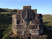
Hasungen Monastery once stood on the mountain , a Benedictine monastery founded in 1080/1081 AD , of which only a few stone piles and the foundation walls of the monastery tower have survived. To the north-west of the tower is a small natural pond in which holy Heimerad († 1019) is said to have bathed. Heimerod had moved to the mountain and looked after the Michael chapel there.
The Hasungen Monastery Museum was located as a branch of the “Regional Museum Wolfhager Land” in the Burghasungen village community center and in 2012 moved into its own museum building.
Bergbühne Burghasungen
On the western flank of the mountain, beneath high cliffs, is the Bergbühne Burghasungen open-air stage , the rows of which were built from the ruins of the former Hasungen monastery.
Possibility of viewing
If visibility is good, there is a comprehensive panoramic view from Burghasunger Berg . Then, among other things, these targets (starting clockwise in the north) can be recognized - with distance in kilometers (km) and altitude in meters (m) above sea level:
|
|
Far away from the Waldecker Wald ( Weidelsberg , 10.5 km southwest, max. 492.3 m ), the Kellerwald ( desert garden , 37 km south-southwest, max. 675.3 m ) and the Rothaar Mountains ( Langenberg , 50 km west, max. 843.2 m ).
Transport links / hiking
The federal motorway 44 runs along the eastern flank of the Burghasunger Berg between the junctions Breuna in the northwest and Zierenberg in the southeast . From the Zierenberg exit, around 500 m south-east of Burghasungen on federal road 251 , you can get to the mountain through Burghasungen - leaving the B 251 shortly after the junction. While you can hike around the mountain on forest paths as well as on the streets and paths of the village, branch paths , such as the donkey path starting at the open-air stage and the cliff path , lead partly steeply up to the summit plateau.
Web links
Individual evidence
- ↑ a b c d Map services of the Federal Agency for Nature Conservation ( information )
- ↑ Martin Bürgener: Geographical Land Survey: The natural spatial units on sheet 111 Arolsen. Federal Institute for Regional Studies, Bad Godesberg 1963. → Online map (PDF; 4.1 MB)
- ↑ Article landscape protection areas dissolved , from March 10, 2008, accessed on June 26, 2015, on hessen.nabu.de
- ↑ Hasungen Monastery Museum, on kloster-hasungen.de
- ↑ Bergbühne Burghasungen , on bergbuehne-burghasungen.de


