Emmerweg
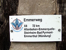
The Emmerweg (marked X8) is a 72-kilometer hiking trail along the Emmer (tributary of the Weser ) from its source to its mouth. The route runs through parts of the German federal states of North Rhine-Westphalia and Lower Saxony .
course
The Emmerweg begins at the source of the Emmer, which lies between Altenbeken and Langeland (district of Bad Driburg ), and runs in a north-easterly direction to its confluence with the Weser near Emmerthal , which is south-south-east or above Hameln .
The Emmerweg is ideal for a three-day tour, it follows the Altenbeken – Hameln railway line. The largely well signposted hiking trail is looked after by the Eggegebirgsverein . The routes between Altenbeken and Steinheim and later from Schieder along the Schiedersee ("Emmerstausee") are considered to be some of the most beautiful hiking and landscape sections .
- Impressions from the Emmerweg
literature
- Eggegebirgsverein (Ed.): X8 Emmerweg. Altenbeken – Emmerthal. (Hiking map with description)
Web links
Coordinates: 51 ° 56 ′ 5.8 " N , 9 ° 11 ′ 30.8" E


