Erlenbach (Erlengraben)
| Erlenbach | ||
|
Swells at the highest kink |
||
| Data | ||
| Water code | DE : 2484832144 | |
| location |
Taunus
|
|
| River system | Rhine | |
| Drain over | Erlengraben → Wiesbach → Usa → Wetter → Nidda → Main → Rhine → North Sea | |
| source | in the eastern Hintertaunus, west-southwest of Wehrheim - Pfaffenwiesbach 50 ° 19 ′ 27 ″ N , 8 ° 35 ′ 7 ″ E |
|
| Source height | 326 m above sea level NHN | |
| muzzle | southwest of Pfaffenwiesbach in the Erlengraben Coordinates: 50 ° 19 ′ 22 " N , 8 ° 35 ′ 41" E 50 ° 19 ′ 22 " N , 8 ° 35 ′ 41" E |
|
| Mouth height | 301 m above sea level NHN | |
| Height difference | 25 m | |
| Bottom slope | 31 ‰ | |
| length | 800 m | |
|
Fortified mouth in Erlengraben (left, partly visible) |
||
The Erlenbach is an almost one kilometer long stream in the eastern Hintertaunus , which flows into the Erlengraben from the left and northwest of the Pfaffenwiesbach district of the municipality of Wehrheim in the Hessian Hochtaunuskreis from the left and northwest and only carries water at times and in sections. Despite the name, other trees usually grow on its banks.
geography
course
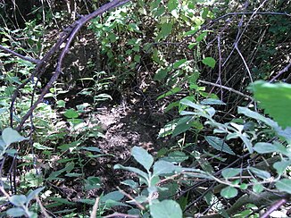
The Erlenbach rises in a continuously narrow piece of land that takes up the water between two meadows, for the first time at the edge of the forest in a bend at an altitude of about 326 m above sea level. NHN . A ditch leads to this bend in the stream from above, from the path at the edge of the forest. Via a culvert diagonally under the path, it has access to drains and isolated seepage springs from the mixed forest area above. While this and the trenches are located in the area of the district of Pfaffenwiesbach , the boundary to Wehrheim at the Quellen im Kink touches the waterfront property and runs along it for about 700 m to the south side of the district road K 728 or Wehrheimer Straße . The Erlenbach begins its arched course, bulging to the north, pointing first to the east-northeast and finally to the east-southeast. In the thick vegetation on both banks, wires and bands of fences are placed on poles made of split wood, an indication that the meadows are still temporarily grazed, as in the past. Grazing animals show up near the Aussiedlerhof Am Weisse Stein .
A few minutes from its first spring, the water has already dried up. In the Erlengrund corridor at river km 0.6, deicing mineral water springs emerge in the stream. They also only wet the Erlenbach a little, as do those on the right bank in the meadow at km 0.4. Only at km 0.2 do the deicing seepage springs gush so strongly that they can wet the stream up to its mouth.
Above the name-giving alders , numerous types of willow were still represented in the wooded border, accompanied by birch , hawthorn and other species . This is a good thing, because it gives large blue butterflies a habitat to lay their eggs and for the caterpillars that have hatched from them. Other butterflies observed are the great ox-eye or the chessboard .
At about 0.25 km, the Erlenbach makes a last bend to the right, in a south-easterly direction. From there it flows in a straight channel to the Erlengraben . Until it is crossed under the K 728 it is still covered with trees, on the north side of the K 728 there is a bar of some tall willows, underneath it, up to the mouth, it flows treeless to the mouth. In an attached left curve it combines with the Erlengraben , the right at the foot of the slope of the overgrown with Mischwald Heßberges holds, which extends as a long spur of sweetness Bergs ( 389.3 m above sea level. NHN extends) northward.
- More views of the Erlenbach
Usa River System
Individual evidence
- ↑ Hessenviewer (Geoportal Hessen) of the Hessian State Office for Soil Management and Geoinformation with property mapping ( information )
- ↑ Google Earth
- ↑ Water map service of the Hessian Ministry for the Environment, Climate Protection, Agriculture and Consumer Protection ( information )
- ↑ Representation of the stream in the WFD viewer. Retrieved June 28, 2020 .
- ↑ Measured in the WFD Viewer


