
Europaviertel (Wiesbaden)


The Europaviertel in Wiesbaden is a former barracks area on the outskirts of the city center of the Hessian state capital . Administratively, it belongs to the Rheingauviertel district . The site has been used for civil purposes since 1993, mainly for apartments and public facilities.
history
Barracks (1868–1945)

Between 1868 and 1945 there were three different barracks in today's Europaviertel:
In 1868 an over 30 hectare parade ground was laid out on the area between Schiersteiner Strasse , Waldstrasse , Homburger Strasse and Hochheimer Strasse (today Konrad-Adenauer-Ring ) . On the southern corner, at the intersection of Schiersteiner Strasse and Waldstrasse , an infantry barracks was built from 1896 to 1897 . The skyrocketing population of Wiesbaden made it necessary to move the 2nd Battalion of the Fusilier Regiment von Gersdorff No. 80 from the city center from Schwalbacher Strasse here. The 3.2 hectare site was 210 m long and reached 150 m deep into the forest road. The barracks was named after Hermann Konstantin von Gersdorff . It initially consisted of eight main buildings, including four team buildings and other auxiliary buildings. A staff building, which was located on the central axis of the symmetrically arranged group of buildings on Schiersteiner Strasse , was laid down during one of the numerous renovation work on the barracks site. Today there is the monument to the fallen from 1874, which was originally erected approx. 100 m closer to the city center after the Franco-Prussian War . Due to the development of the parade ground along Schiersteiner Strasse, the new Gersdorffplatz was moved to the newly laid out Gersdorffplatz in 1896/97 and was moved to the current square in 1936; restoration work has been taking place on the monument since April / May 2015.
From 1908 to 1911 an artillery barracks , the Orange Barracks, was added in the arch of Homburger Strasse and Waldstrasse , into which the 2nd Division of Field Artillery Regiment No. 27 moved because the barracks on Rheinstrasse were also cleared (today it is located there including the Hessian State Library and the Luisenforum). The area was about 3 hectares, so that the parade ground that remained between the two barracks was only about 270 m long and up to 200 m wide.
In 1908/09, Westerwaldstrasse , today's Willy-Brandt-Allee, was laid out as the new main axis parallel to Waldstrasse . In the middle was Gersdorffplatz with the representative entrance to the barracks and the monument to the fallen. On its south side, the expansion of the infantry barracks for the 1st Battalion of the Fusilier Regiment von Gersdorff No. 80 (see above) was built on an area of approx. 37 hectares (today, among other things, public order office and adult education center) and also a military hospital , a laundry and a “ Officer's Dining Establishment ”.
The area northeast of Westerwaldstrasse (later Gersdorffstrasse ) was intended for residential construction around 1910. Cross connections were created between this and Hochheimer Strasse (today Konrad-Adenauer-Ring ): Weilburger Strasse , Dillenburger Strasse , Diezer Strasse and Usinger Strasse . Königsteiner Strasse and Hadamarer Strasse ran parallel .
After the First World War , French occupation soldiers moved into the buildings now known as Foch barracks and Pétain barracks . In 1925 these were replaced by the British Army of the Rhine , and since then they have been called Saint Andrews Barracks and Ypres Barracks . In December 1929 the French took over the site again for half a year. They considered completely demolishing the military buildings, but it was decided to use it for civilian purposes. The barracks were converted into apartments and the parade ground now served as a marketplace for selling fruit and vegetables.
When the National Socialists came to power in 1936, the area was spatially reorganized and returned to military use. The barracks were renovated, buildings rebuilt, demolished and new ones built. The new part of the barracks between Hochheimer Strasse and Gersdorffstrasse for Infantry Regiment No. 87 was named Ochamps Barracks , after the place of the same name in Belgium, where a unit stationed here had fought successfully in the First World War.
Lindsey Air Base / Lindsey Air Station (1945-1993)


After the Second World War , the site was taken over by the US Army and renamed Lindsey Air Base , later Lindsey Air Station (after Captain Darrell R. Lindsey ). Colloquially, however, the residents mostly spoke of Camp Lindsey .
From 1954 to 1973 the Lindsey Air Station was, among other things, the seat of the 17th Air Force , the 65th Air Division and temporarily also the headquarters of the US Air Force for Europe ( USAFE ).
The Erbenheim military airfield was also managed from here .

USAFE coat of arms

17th Air Force (17th Air Fleet)

65th Air Division
October 1, 1987 to June 30, 1991


Europaviertel (since 1993)

In 1993 Camp Lindsey was returned to the Federal Republic of Germany and renamed the Europaviertel . Since then, as part of an armaments conversion plan , the area has been urbanized with modern new owner-occupied buildings. The old barracks from the Wilhelmine era , which are under monument protection , have been renovated and largely put to public use. Today, a property of the Federal Criminal Police Office in Wiesbaden is housed here, as well as the adult education center and some municipal authorities such as the residents' registration office (until 2008), the immigration office, the public order office and the Presidium for technology, logistics and administration of the Hessian police .
With the renaming, the streets also got new names, these now mainly bear the names of European but also American personalities, including: Alcide de Gasperi , Charles de Gaulle , Dwight D. Eisenhower , Franklin Roosevelt , George Marshall , Harry Truman , Jean Monnet , Robert Schuman , Walter Hallstein and Willy Brandt . With Simone Veil the only woman honored with a street name, and unlike the male namesakes lived Simone Veil at the time of the ceremony yet.
The Europaviertel is enclosed in the north by Homburger Strasse , in the east by Konrad-Adenauer-Ring (formerly Hochheimer Strasse) , in the south by Schiersteiner Strasse ( B 262 ) and in the west by Waldstrasse . The exception to this is a section between Waldstrasse, Steinstrasse and the roundabout in the direction of the artists' quarter . There is also a new development area that used to be part of the military area. The street names there also bear the names of European personalities: Carlo Schmid , Heinrich von Brentano and Olof Palme .
On May 30th, 2009, a cultural festival took place in the district for the first time. The exhibition “From the barracks to the residential quarter: The history of the Europaviertel” was opened on May 7, 2009 and was shown until June 19, 2009.
During construction work in September 2013, a Soviet mine projectile from the Second World War was found on the premises of the Federal Criminal Police Office and detonated in a controlled manner.
Culture and sights
Buildings
The development consists of old barracks buildings from the Wilhelmian era and modern new buildings from the 1990s to 2000s.
Mainly in Willy-Brandt-Allee there are buildings that are listed in the list of cultural monuments in Wiesbaden-Rheingauviertel .
Willy-Brandt-Allee
| image | designation | location | description | construction time | Data |
|---|---|---|---|---|---|
 |
Former Officer's dining establishment | Willy-Brandt-Allee 14 / Charles-de-Gaulle-Straße Location hall: 61, parcel: 118 |
The property is part of the overall facility: Europaviertel | 1905/06 | |
 |
Totality of the former Garrison hospital | Willy-Brandt-Allee 16 Location hall: 61, parcel: 71 |
The property is part of the overall facility: Europaviertel | 1907/08 | |
|
|
Gym | Willy-Brandt-Allee 17 Corridor location : 61, parcel: 76/1 |
The property is part of the overall facility: Europaviertel Architect / Planner: (Wiesbaden State Building Authority) |
1949 | |
 |
Totality of the former Garrison hospital | Willy-Brandt-Allee 18 Location floor: 61, parcel: 72 |
The property is part of the overall facility: Europaviertel | 1907/08 | |
 |
Totality of the former Garrison hospital | Willy-Brandt-Allee 20-22 Location hall: 61, parcel: 71 |
The property is part of the overall facility: Europaviertel | 1907/08 |
Green spaces and recreation
The largest green areas in the district are owned by the BKA and PTLV and are therefore not open to the public.
Sports
The sports field with a sports hall is used by the neighboring Heinrich von Kleist School and the Wiesbaden Phantoms . The grass pitch can be used as a baseball , American football and soccer field . There is also an athletics facility at Homburger Strasse . There are grandstands at the sports hall and behind the foul territory of the baseball area.
Regular events
Since 2009, the Europaviertel festival of the initiative for the Europaviertel has been held every year on the last Saturday in May .
Culinary specialties
Due to the American past of the quarter and as the home ground of the American football team Phantoms, the hamburger can be seen as a “local specialty”, which is offered at home games and at the European quarter festival .
Libraries
The mobile library of the state capital Wiesbaden with its district bus stops every two weeks in Harry-Truman-Straße.
Economy and Infrastructure
Companies
Several mostly smaller companies, architects' offices as well as medical, veterinary and legal practices can be found in the Europaviertel.
The ESWE supply AG operates a block-type thermal power station here , the district heating generated is made available to the European and artists' quarters , including the Kleinfeldchen and Kohlheck . The electricity generated is fed into the high-voltage network. In February 2003, the waste heat capacity was increased from 850 to 2,228 kilowatts. The electrical output is 1,802 kW and the heating output is 2,181 kW. With this output, around 1,390 single-family houses can be supplied with energy.
Public facilities
The 3rd police station and the presidium for technology, logistics and administration of the Hessian police , as well as the public order office , the state education office for Wiesbaden and the Rheingau-Taunus district, the institute for quality development , the immigration authority and the municipal day-care center 39 Europaviertel have their place here Seat. There is also a children's playground near the day-care center and, since May 2012, a public bookcase . The city library takes the book bus of the state capital Wiesbaden to the place in front of the day care center every second Wednesday, except during the holidays, between 5.15 and 6.00 p.m.
Furthermore, the Darmstadt Regional Council has housed its 'Occupational Safety and Environment' department here.
education

The Volkshochschule Wiesbaden has its headquarters with training rooms in the Europaviertel. The Defense Division IV had its training center here until the end of the 2010s.
traffic
The entire Europaviertel is a 30 km / h zone , a short section of a dead end street at the day-care center is designated as a traffic-calmed area . In order to keep through traffic out of the quarter, the streets that cross the whole quarter are either partially closed as a play street for vehicles of all kinds (George-Marschall-Strasse) or the passage is only for public transport, taxis and bicycles (Willy-Brandt -All) allowed. Parking is permitted in addition to resident parking , with a parking disc but sometimes also for a fee using a parking ticket machine . In the center of the Europaviertel there is the ESWE Verkehrsgesellschaft bus stop of the same name , the next stops are in Schiersteiner Straße ('Paulinen-Klinik', 'VHS / Willy-Brandt-Allee' and 'Waldstraße'), 'Karlsbader Platz' and in the Homburger Straße (Heinrich von Kleist School and towards the artists' quarter).

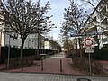
George-Marshall-Strasse is blocked off with bollards so that no vehicles can enter ...
... two table tennis tables are set up for playing.


literature
- From parade ground to residential area - the history of the Europaviertel. Published by the Rheingauviertel / Hollerborn local advisory board in conjunction with the urban development company and the Wiesbaden cultural office / city archive; 72 pages; ISBN 978-3-928085-53-3 ; 2010.
- Christina Bodler: The Camp Lindsey Library (1945–1993) as an example of a US Air Force site library. Mainz, 1997
- Military location Wiesbaden: Camp Lindsey, American Hospital, Camp Schierstein, Camp Pieri, Air Base Erbenheim, Storage Station Kastel, Bundeswehr Administration, Military Community, Liaison Office State of Hesse. Ed .: City Council of the State Capital Wiesbaden, 1990.
Individual evidence
- ^ The new buildings of the army administration in Wiesbaden in: Zentralblatt der Bauverwaltung No. 4/1915
- ^ Historical atlas of the city of Wiesbaden. Christian Spielmann, Julius Krake. Twelve digitized city maps of Wiesbaden 1799–1910, publisher: Stadt Wiesbaden, ISBN 3-9802906-8-9
- ↑ Sigrid Russ, Monument Topography Federal Republic of Germany. Edited by the State Office for Monument Preservation Hessen, Verlag Theiss, Wiesbaden 2005, ISBN 3-8062-2010-7 , page 702.
- ↑ Archived copy ( Memento of the original from March 28, 2009 in the Internet Archive ) Info: The archive link was inserted automatically and has not yet been checked. Please check the original and archive link according to the instructions and then remove this notice.
- ↑ Wiesbaden City Archives
- ↑ Wiesbaden: Russian mine bullet from World War I found on BKA premises in the Europaviertel ( memento of the original from November 4, 2013 in the Internet Archive ) Info: The archive link was automatically inserted and not yet checked. Please check the original and archive link according to the instructions and then remove this notice. by Wolfgang Degen on wiesbadener-kurier.de from September 4, 2013
- ↑ Mobile libraries | State capital Wiesbaden. Retrieved November 15, 2017 .
- ^ "Formula 1 engine" in the district heating network increased capacity for Europaviertel / Diehl: Example for reconciliation of economy and ecology in Frankfurter Allgemeine Zeitung, February 20, 2003, No. 43, p. 46
- ↑ Wiesbaden active in climate protection - energy paths into the future ( page no longer available , search in web archives ) Info: The link was automatically marked as defective. Please check the link according to the instructions and then remove this notice. , Environment Agency State Capital Wiesbaden, July 2009, p. 15; PDF file: 1.5 MB
- ↑ New bookcase in Europaviertel invites young and old to swap free of charge ( page no longer available , search in web archives ) Info: The link was automatically marked as defective. Please check the link according to the instructions and then remove this notice. by Thomas Karschny, in Wiesbadener Tagblatt on May 16, 2012
Web links
- The history of the Rheingauviertel (with Europaviertel and pictures) ( Memento from June 3, 2009 in the Internet Archive )
- Americans evacuate Camp Pieri and Lindsay Air Station
- Pictures from the Gersdorff barracks to Camp Lindsey
- Pictures and floor plans (overview)
- Exhibition of historical photos and postcard motifs - "From the military area to the PTLV"
Coordinates: 50 ° 4 ′ 16.2 ″ N , 8 ° 13 ′ 24.9 ″ E