Bad Hersfeld airfield
| Bad Hersfeld airfield | |
|---|---|

|
|
| Characteristics | |
| ICAO code | EDEN (until 1990 EDOZ) |
| Coordinates | |
| Height above MSL | 296 m (971 ft ) |
| Transport links | |
| Distance from the city center | 2 km south of Bad Hersfeld |
| Street | Schwarzdornweg |
| Local transport | City bus line 2B, stop: Am Flugplatz |
| Basic data | |
| opening | 1952 |
| operator | Motor-Flieger-Club eV Bad Hersfeld |
| surface | 13 ha |
| Start-and runway | |
| 01/19 | 670 m × 18 m asphalt |
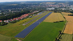
The Bad Hersfeld special airfield is located on the Johannesberg in Bad Hersfeld ( Hesse ), about two kilometers south of the city center.
history
Bad Hersfeld airfield was built in 1952/53 by the US Army on Johannesberg. It was registered under the military ICAO code EDOZ. After the turning point in 1990 and the withdrawal of the US Army, the Motor-Flieger-Club Bad Hersfeld applied for the conversion from military to civil use as a special landing site . After conditions that restricted operations for a long time, the airfield has been approved as a special airfield since January 1, 2008. The civil ICAO code EDEN was assigned in early 2009.
Start-and runway
The airfield has an asphalt runway 670 meters long. The runway runs in a north-south direction and rises from 275 m above sea level. NN in the north at 296 m above sea level. NN in the south.