Fu Shan Hai
|
||||||||||||||||||
|
||||||||||||||||||
|
||||||||||||||||||
|
||||||||||||||||||
|
||||||||||||||||||
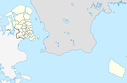
The Fu Shan Hai was a Chinese bulk carrier that sank in Bornholmsgat on May 31, 2003 after colliding with the Cypriot feeder ship Gdynia .
The ships
The Fu Shan Hai (ship data according to the info box) left Ventspils on May 30, 2003 and was on its way to China with 66,000 t of fertilizer .
The Gdynia ( IMO 9213911) was a 3,930 GT feeder ship that was built in 2000 at the Danzig Nordwerft. It was 100.6 m long, 16.6 m long and had a draft of 6.36 m. The ship was propelled by a marine diesel engine , which enabled a speed of 15 knots with 3,840 kW . The Gdynia sailed for the Euroafrica Shipping Lines of Poland , but was registered in Limassol . On the day of the accident, the ship was on its way from Gdynia to Kingston upon Hull .
collision
On May 31, 2003, the Fu Shan Hai was about 4 nautical miles (nm) north of Hammerodde Fyr and was heading south-west. In clear weather the Gdynia was observed at 11:45 am at a distance of 7 nm and with an approaching course. At 12:00 the Gdynia reduced her speed at a distance of 4 nm and 9 minutes later changed course to starboard with the intention of passing the Fu Shan Hai aft . In reality, however, she was now on a collision course . The Fu Shan Hai gave warning signals with the typhon at 12:10 and then stopped the machine after receiving no response from Gdynia . At 12:18 pm, the Gdynia with her ice-reinforced bow hit the port side of the Fu Shan Hai , at right angles between holds 1 and 2.
After the collision, the Fu Shan Hai tried to reach shallow waters, but the ship was no longer steerable. The water poured through the leak and the bow began to sink. At 12:37 pm, the Fu Shan Hai Mayday sent and brought the lifeboats into the water. The crew left the ship at 1:50 p.m. and at 8:49 p.m. the Fu Shan Hai had finally sunk.
The Gdynia returned to port with damage to the bow and arrived in Gdynia on June 1.
examination
The Danish investigation department for marine casualties, comparable to the German Federal Bureau for Maritime Casualty Investigation , found that the second officer on watch in Gdynia had not taken the necessary measures to avoid the collision. The captain of the Fu Shan Hai was accused of not having changed course or ordered the machine back. Both ships did not use the distress and call channels to find out about their intentions.
At the hearing on December 12, 2005 in Rønne , it was determined that the Gdynia's behavior was the sole cause of the collision and that its owners had to pay damages totaling 107 million Swedish kronor (around 10.4 million euros ).
consequences
The wreck of the Fu Shan Hai lies at a water depth of 69 meters. Due to the dangers of the poisonous fertilizer, the ship was not allowed to be dived until spring 2007 . The consequences of the oil spill were worse . The Fu Shan Hai had 1672 tons of heavy fuel oil and 110 tons of diesel fuel on board. The German combat ships Vilm and Scharhörn and a Do 228 surveillance aircraft were also involved in repairing the damage .
Web links
- Collision between Chinese bulk carrier FU SHAN HAI and Cypriot container vessel GDYNIA. (PDF) Danish Maritime Authority, August 7, 2003, accessed November 14, 2018 .
- A video with the last minutes of Fu Shun Hai
Individual evidence
- ↑ 107 miljoner för sinks fartyg. Sydsvenskan , December 13, 2005, accessed November 14, 2018 (Swedish).
- ↑ Fu Shan Hai. WrakiBałtyku, October 14, 2015, accessed November 14, 2018 .
- ↑ German special ships support Sweden and Denmark in combating the consequences of an accident on the Baltic Sea north of Bornholm and off the bordering Swedish coast. (PDF) Havariekommando , June 4, 2003, accessed on November 14, 2018 .
Coordinates: 55 ° 20 ′ 23.3 " N , 14 ° 45 ′ 16.2" E
