Garggler
| Garggler | ||
|---|---|---|
|
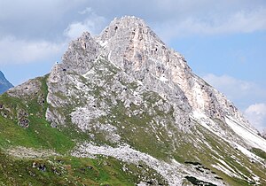
Gargglerin from the south-southeast |
||
| height | 2470 m above sea level A. | |
| location | Tyrol , Austria | |
| Mountains | Stubai Alps , Eastern Alps | |
| Dominance | 1 km → Pflerscher Pinggl | |
| Notch height | 154 m ↓ Badlerscharte | |
| Coordinates | 47 ° 0 '32 " N , 11 ° 19' 43" E | |
|
|
||
| Type | Rock peaks | |
| rock | dolomite | |
| Age of the rock | Triad | |
| First ascent | A. Kerner v. Marilaun, F. Sauter, “Beginning of the 1870s” or H. Waitzenbauer and G. Pittracher, July 1874 | |
| Normal way | marked trail from the south | |
|
Gargglerin from the north-northwest ( hawk ) |
||
The Gargglerin , also Garklerin , is 2470 m above sea level. A. high mountain in the Stubai Alps in the Austrian state of Tyrol . The easily climbed summit is popular because of its view of the rear Gschnitztal , the Tribulaune and the Habicht .
Location and surroundings
The Gargglerin forms the highest point of a mountain ridge, which extends from the main Alpine ridge about 2 kilometers south to the north. In the northwest and north lies the Gschnitztal, in the east the Sandestal , a side valley of the Gschnitztal. The Tribulaunhütte ( 2064 m ) is the most important base for climbing the mountain there. To the northeast, the ridge continues to the upstream Eningkopf , also Nenningkopf ( 2183 m ). In the west is the Badlalm .
Geology and structure
The Gargglerin rises as a distinctive, jagged rock summit made of dolomite rocks from the Brennermesozoic , which, similar to the nearby Weißwandspitze , lie directly on a base made of crystalline rock , especially gneiss and mica schist . The main dolomite from the Triassic , which forms the summit structure, is light gray to white in color and has sericite inclusions . Due to the exposed location of the steep and narrow summit rock, mountain tears occur here , so that the summit structure is divided into numerous individual rock towers.
Bases and paths
The normal route to the Gargglerin leads from the south of the Badlerscharte , one on 2350 m located notch between Gschnitz- and Sandestal, on a marked path to the top. The Badlerscharte can be reached on a marked path from the Gschnitzer district Obertal over the Sandestal, whereby the Tribulaunhütte is often used as a base. Another ascent from Obertal, which leads over the northwest flank to Badlerscharte, was not accessible for a long time due to a rock fall , but has enabled a transition again since it was relocated in 2010. Alpine climbing routes lead through the south and east walls in the II. And III. Degree .
Literature and map
- Walter Klier : Alpine Club Guide Stubai Alps . Rother Bergverlag, Munich 2006, ISBN 978-3-7633-1271-9 , p. 356 .
- Alpine Club Map 1: 50,000, sheet 31/3, Brenner Mountains
Individual evidence
- ↑ a b Garklerin. Stein & Kraut, accessed August 29, 2009 .
- ↑ Horst Kübler, Wolf-Eberhard Müller: The geology of the Brenner Mesozoic between the Stubai and Pflersch valley (Tyrol) . In: Yearbook of the Federal Geological Institute . tape 105 . Vienna December 1962, p. 173–242 ( geologie.ac.at [PDF; accessed on August 29, 2009]).


