Geistown
| Geistown | ||
|---|---|---|
|
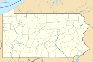
Location in Pennsylvania
|
||
| Basic data | ||
| Foundation : | 1930 | |
| State : | United States | |
| State : | Pennsylvania | |
| County : | Cambria County | |
| Coordinates : | 40 ° 18 ′ N , 78 ° 52 ′ W | |
| Time zone : | Eastern ( UTC − 5 / −4 ) | |
| Residents : | 2,467 (as of 2010) | |
| Population density : | 897.1 inhabitants per km 2 | |
| Area : | 2.75 km 2 (approx. 1 mi 2 ) of which 2.75 km 2 (approx. 1 mi 2 ) is land |
|
| Postal code : | 15904 | |
| Area code : | +1 814 | |
Geistown is a borough in Cambria County , Pennsylvania , United States , between Johnstown in the northwest and Windber in the southeast. Geistown is named after the German immigrant Joseph Geis from Aschaffenburg , who settled here with his family in the mid-19th century. In 1930 Geistown was granted Borough status, and in 2010 the population was 2,467 (according to the 2010 census ).
history
| growth of population | |||
|---|---|---|---|
| Census | Residents | ± in% | |
| 1930 | 871 | - | |
| 1940 | 1037 | 19.1% | |
| 1950 | 2148 | 107.1% | |
| 1960 | 3186 | 48.3% | |
| 1970 | 3633 | 14% | |
| 1980 | 3304 | -9.1% | |
| 1990 | 2749 | -16.8% | |
| 2000 | 2555 | -7.1% | |
| 2010 | 2467 | -3.4% | |
| Source: United States Census | |||
William Slick and his wife came in 1812 when the first settlers of Johnstown in the area of today's Geistown, where he more than twenty years as a magistrate (justice of the peace) was active. The slicks lived on their farm, which was also part of the Underground Railroad , until 1866 . This network of secret routes, shelters, and escape helpers like William Slick supported slaves fleeing north from the southern states .
In the middle of the 19th century William Slick sold parts of the farm, from which the German immigrant Joseph Geis from Aschaffenburg later bought some, who settled here with his family and later founded the village of Geistown. Until the turn of the century, the village included three taverns , two blacksmiths, a post office and a few shops in addition to the houses . The first school opened in 1899, followed by a high school in 1915/16 . Between Geistown and Johnstown was previously only a dirt track (dirt road) , which was asphalted until the 1923rd In 1930 Borough Geistown was founded from a part of the Stonycreek Township and the Richland Township and had about 900 inhabitants at that time.
The population grew steadily until the 1970s, rising to over 3,500. In the 1960s, the sewer system , a new fire station and the parish hall were built. In 1977 Geistown was also affected by the Johnstown Flood, which was caused by the rupture of the Laurel Run Dam and caused 380,000 m³ of water to flow along the Laurel Run towards Johnstown on July 20, 1977 . The search of the residents of Johnstown for higher residential areas brought Geistown and the Richland Township one last boom in the 1980s, and almost the entire area of Geistown was built on. After that there was a decline in population as families became smaller and the younger generation largely moved away.
Web links
- The Borough of Geistown. Official website.
- Bernice Tkacik: From fruitful farming to suburb charming 1842-1976: Geistown borough. Geistown Borough Council, 1976.
Individual evidence
- ^ Pennsylvania: 2010, Population and Housing Unit Counts. US Department of Commerce Economics and Statistics Administration, 2012. Retrieved February 25, 2015.
- ^ Census of Population and Housing 1790-2010. US Census Bureau. Retrieved February 25, 2015.
- ↑ a b Bernice Tkacik: From fruitful farming to suburb charming 1842-1976: Geistown borough. ( Memento from March 5, 2016 in the Internet Archive ) Geistown Borough Council, 1976.
- ↑ William J. Switala: Underground Railroad in Pennsylvania. Stackpole Books, 2001, ISBN 0-8117-1629-5 , pp. 33-35.
- ↑ The 1960's and '70's. ( Memento of February 3, 2017 in the Internet Archive ) and 2000 and Present Day. ( Memento from February 3, 2017 in the Internet Archive ) The Borough of Geistown - History. Retrieved April 11, 2018.

