Gallitzin, Pennsylvania
| Gallitzin | ||
|---|---|---|
|
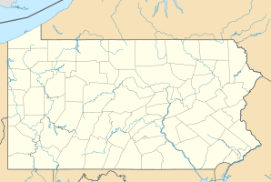
Location in Pennsylvania
|
||
| Basic data | ||
| Foundation : | 1873 | |
| State : | United States | |
| State : | Pennsylvania | |
| County : | Cambria County | |
| Coordinates : | 40 ° 29 ′ N , 78 ° 33 ′ W | |
| Time zone : | Eastern ( UTC − 5 / −4 ) | |
| Residents : | 1,756 (as of: 2000) | |
| Population density : | 975.6 inhabitants per km 2 | |
| Area : | 1.8 km 2 (approx. 1 mi 2 ) | |
| Height : | 677 m | |
| Postal code : | 16641 | |
| Area code : | +1 814 | |
| FIPS : | 42-28328 | |
| GNIS ID : | 1215022 | |
Gallitzin is a borough in Pennsylvania .
geography
Geographical location
The small town is located in the Allegheny Mountains in central Pennsylvania at an altitude of 677 meters and has an area of 1.8 km². The hill is part of the Eastern Continental Divide , Gallitzin is already in the catchment area of the Mississippi .
The place belongs to Cambria County . Gallitzin Township surrounds the community to the north, west and south, and Tunnelhill to the east .
Residents
At the 2000 census, Gallitzin had 1,756 residents.
| Population development | |||
|---|---|---|---|
| Census | Residents | ± in% | |
| 1870 | 977 | - | |
| 1880 | 799 | -18.2% | |
| 1890 | 2392 | 199.4% | |
| 1900 | 2759 | 15.3% | |
| 1910 | 3504 | 27% | |
| 1920 | 3580 | 2.2% | |
| 1930 | 3458 | -3.4% | |
| 1940 | 3618 | 4.6% | |
| 1950 | 3102 | -14.3% | |
| 1960 | 2783 | -10.3% | |
| 1970 | 2496 | -10.3% | |
| 1980 | 2315 | -7.3% | |
| 1990 | 2003 | -13.5% | |
| 2000 | 1756 | -12.3% | |
history
Gallitzin is named after the Roman Catholic priest and missionary Demetrius Augustinus Gallitzin , who also founded the nearby settlement of Loretto . Gallitzin itself was founded around 1850 as part of the construction of the railway line over the Allegheny Mountains and was part of the Gallitzin Township until 1873. Since December 3, 1873 Gallitzin is an independent municipality with the status of a borough.
Like much of Cambria County, the place was shaped by coal mining, which began around 1850 and was an important industry. Companies such as the Gallitzin Coal & Coke Company and the Taylor & McCoy Coal & Coke Company mined hard coal and produced coke . After the Second World War, coal production declined and jobs were lost. The population of Gallitzin gradually decreased from the peak of 3,618 inhabitants in 1940.
traffic
The Gallitzin tunnels have been crossing the hill on which Gallitzin lies since the 1850s and are part of an important east-west railway corridor. On February 18, 1947, the Pennsylvania Railroad's Red Arrow Express, pulled by two steam locomotives, derailed due to excessive speed in the narrow bends on the line . Neither of the two locomotives was equipped with a speedometer . 24 people died.
Individual evidence
- ^ Gallitzin, Pennsylvania: centennial celebration, 1873-1973
- ↑ History of Coal in Cambria County ( Memento of the original from January 16, 2012 in the Internet Archive ) Info: The archive link was inserted automatically and has not yet been checked. Please check the original and archive link according to the instructions and then remove this notice. (English)
- ↑ Directory of mining companies around Gallizin ( Memento of the original from April 11, 2010 in the Internet Archive ) Info: The archive link was inserted automatically and has not yet been checked. Please check the original and archive link according to the instructions and then remove this notice. (English)
- ^ Peter WB Semmens: Catastrophes on rails. A worldwide documentation. Transpress, Stuttgart 1996, ISBN 3-344-71030-3 , p. 119.


