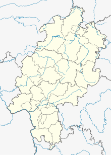
Gershausen (Altenstädt)
Coordinates: 51 ° 15 ′ 46 ″ N , 9 ° 12 ′ 16 ″ E
Gershausen was first mentioned in 1209 and in the first half of the 15th century desolate fallen village settlement in today's district of Altenstädt , a district of Naumburg in northern Hesse Kassel district .
Geographical location
The place was about 1.5 km southeast of Altenstädt, 2.5 km southwest of Balhorn and 6 km northeast of Naumburg at an altitude of 300 m in a north loop of the Spolebach, which runs generally from east to west . There the level map of the Electorate of Hesse from 1840–1861 and the topographical map from 1900 show the field name "Gershausen".
history
Little is known about the history of the place, the name of which has changed several times over the years. It was mentioned in writing for the first time in 1209 as "Yerdeshusen" in a property register of the Fritzlar St. Petri-Stift ; the pin was to the 14th century tithe income from the field Mark the location. In the year 1209 the document of a complicated property exchange mentions a "curia" in "Gershusen". In 1253, Count Berthold von Felsberg donated all of his property and fiefs , including three hooves in Gershausen, which probably came from the dowry of his wife Bertha von Naumburg, to the Breitenau monastery as his eternal soul tool . The noble family Hund residing in Kirchberg had Mainz fiefdom in the place, which belonged to the Elben court . In 1403 there is still talk of a village, but by 1441 the place was desolate. The field mark of the abandoned village remained until the second half of the 19th century; only then was it incorporated into the districts of Altenstädt and Balhorn.
Gershausen was a church village at least from the 14th century : a church is mentioned in 1343. In 1422 and 1507 Gershausen is mentioned as the seat of a parish , although the latter is described as vacant from 1502 . The church patronage lay with the Johannis monastery in Mainz . The church is still mentioned in the Naumburg Salbuch from 1654; when it fell into disrepair and its remains were used for other purposes is unknown. Only the field names “near the old church” or in dialect “of` d`r ahlen Kerch” still refer to it and the former village.
Footnotes
- ^ Electorate of Hesse 1840-1861 - 21. Niedenstein, in: Historical maps
- ↑ Variations of the place name were "Gershusen" (1209, 1457), "Gerharteshusen" (1235), "Gertshusen" (1310) and "Gehrhausen" and "Giershausen" (1654), the latter two as field names in the Naumburger and Altenstädter District.
- ↑ HStAM Fund, Document 16, No. 16 . In the on-line Historical Ortlexikon Hessen at LAGIS this is erroneously assigned to the deserted Gerzhausen near Waltersbrück ( Gerzhausen, Schwalm-Eder-Kreis. Historical Ortlexikon für Hessen. In: Landesgeschichtliches Informationssystem Hessen (LAGIS).).
- ↑ Georg Landau : Historical-topographical description of the desolate localities in the Electorate of Hesse and in the grand-ducal Hessian parts of Hessengaue, Oberlahngaue and Ittergaue (= journal of the Association for Hessian History and Regional Studies. Supplement 7, ZDB -ID 200295-4 ). Theodor Fischer, Kassel 1858, p. 172 (Holzkirchen) .
literature
- Georg Landau : Historical-topographical description of the desolate localities in the Electorate of Hesse and in the grand-ducal Hessian parts of Hessengaue, Oberlahngaue and Ittergaue (= journal of the Association for Hessian History and Regional Studies. Supplement 7, ZDB -ID 200295-4 ). Theodor Fischer, Kassel 1858, p. 162 .
- Heinrich Reimer (Hrsg.): Historical local lexicon for Kurhessen (publications of the historical commission for Hessen). Elwert, Marburg, 1974, p. 167.
Web links
- Gershausen, district of Kassel. Historical local dictionary for Hessen. In: Landesgeschichtliches Informationssystem Hessen (LAGIS).
