
Gilfert
| Gilfert | ||
|---|---|---|
 Gilfert, in front of it the Sonntagsköpfl, seen from the Holzalm (from the east) |
||
| height | 2506 m above sea level A. | |
| location | Tyrol , Austria | |
| Mountains | Tux Alps | |
| Dominance | 4.97 km → Roßkopf | |
| Notch height | 253 m ↓ southwest. Lamarkalm | |
| Coordinates | 47 ° 16 '13 " N , 11 ° 44' 35" E | |
|
||
| Normal way | Easy hike or ski tour | |

The Gilfert is a 2,506 meter high mountain in the Tux Alps . It is the part of the Rastkogel massif that protrudes furthest to the north and can therefore be seen almost everywhere from the lower Inn Valley .
Location and landscape
The summit bears a large summit cross , as do the two north-western pre-summits ( weather cross ) and the north-eastern Sonntagsköpfl (2,244 m). Notched into the eastern flank is Das Kar , a rock basin that is almost three-quarters closed. It drains over the Lamarkbach into the lower Zillertal .
Although the Gilfert - Rastkogel massif has a very pronounced, multiply branching ridge , the rock faces are largely oriented in a north-south direction. This geological peculiarity gives the strongly structured mountain group its own character.
ways
The summit of Gilfert is easy to reach from Innerst near Weerberg (southern slope of the Inn Valley) via the Nonsalm (1,785 m) . The Innerst - Nonsalm route is often climbed with skis or snowshoes in winter and spring , because the ascent is relatively safe from avalanches. A second ascent leads from Pill or the district capital Schwaz almost parallel to the summit.
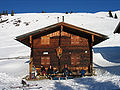
Nonsalm am Gilfert
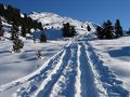
Ski ascent to Gilfert in December


See also: Kellerjoch , Pangert
Ski area or protected area?
The development of the Gilfert as a ski area (see also the longstanding debate on the expansion of the Kellerjoch area), or the designation as a protected area, has been discussed for many years. On the one hand, a Gilfert - Rastkogel quiet area has long been considered, on the other hand, the Inntal communities around Weer are trying to gain access to the Hochfügen-Hochzillertal ski area , whose facilities would open up the ridge. A basic spatial planning decision on the future of the central Tux Alps is pending.
Web links
- Gilfert ski tour via Hochfügen - route description and pictures
- Gilfert mountain tour - route description from the Loassattel with pictures
- Gilfert Skitour - route description from Innerst with pictures
Individual evidence
- ↑ Development of Weer-Weerberg over the Gilfert to Hochfügen. In: alpenverein.at → Nature conservation → Alpine spatial planning → Ski development projects → 9. Weer. Retrieved March 16, 2011 .