
Pill
|
Pill
|
||
|---|---|---|
| coat of arms | Austria map | |
 |
|
|
| Basic data | ||
| Country: | Austria | |
| State : | Tyrol | |
| Political District : | black | |
| License plate : | SZ | |
| Surface: | 20.94 km² | |
| Coordinates : | 47 ° 19 ' N , 11 ° 41' E | |
| Height : | 556 m above sea level A. | |
| Residents : | 1,198 (January 1, 2020) | |
| Population density : | 57 inhabitants per km² | |
| Postal code : | 6136 | |
| Area code : | 05242 | |
| Community code : | 7 09 21 | |
| NUTS region | AT335 | |
| UN / LOCODE | AT PLL | |
| Address of the municipal administration: |
Village 9 6136 Pill |
|
| Website: | ||
| politics | ||
| Mayor : | Hannes Fender | |
|
Municipal Council : (2016) (13 members) |
||
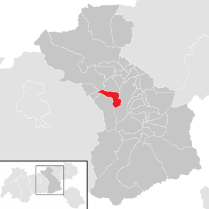
| Location of Pill in the Schwaz district | ||
  |
||
| Source: Municipal data from Statistics Austria | ||

Pill is a municipality with 1198 inhabitants (as of January 1, 2020) in the Schwaz district in Tyrol ( Austria ). The community is located in the judicial district of Schwaz .
geography
Pill is located in the Lower Inn Valley near Schwaz. The settlement is formed by the village center in the valley, at the foot of the rubble cone of the Pillbach, and scattered settlements on the slope of the Kellerjoch (Niederberg, Hochpillberg). At the Maschentalbach , the municipality extends over into the Zillertal .
The once marshy valley floor was only turned into arable land in the 18th and 19th centuries.

Place name
The place name Pill was first mentioned in 1288 as "super Pulle iuxta ripam". Since the forms of the document refer to an original -u-, which was later renamed with a -i- the following syllable, the place name, following K. Finsterwalder, can be interpreted as an area on the water. The same basic word form can also be found in Apulia . Pill is therefore an apa name with the labial not shifted. The etymology is also geographically coherent, as the town center is both close to the Inn and is traversed by the Pillerbach.
Culture and sights
Economy and Infrastructure
Today Pill is an out-commuter community and is connected to the Inntal motorway with the Vomp exit and the Westbahn with the Pill-Vomperbach stop . Pill is the headquarters of EGLO Leuchten .
Web links
- Official website of the municipality
- 70921 - Pill. Community data, Statistics Austria .
Individual evidence
- ^ Oswald Zingerle (Ed.): Meinhards II. Urbare der Grafschaft Tirol. (= Fontes Rerum Austriacarum, Diplomataria et acta 55 / I). Vienna 1890
- ^ Peter Anreiter: Breonen, Genaunen and Fokunaten , Archeolingua, Innsbruck 1997, ISBN 3-85124-181-9
Achenkirch | Aschau im Zillertal | Brandberg | Bruck am Ziller | Book in Tyrol | At the Achensee | Finkenberg | Joining | Fügenberg | Gallzein | Gerlos | Gerlosberg | Hainzenberg | Hart in the Zillertal | Hippach | Jenbach | Kaltenbach | Mayrhofen | Pill | Ramsau im Zillertal | Ried im Zillertal | Rohrberg | Schlitters | Schwaz | Schwendau | Stans | Steinberg am Rofan | Strass im Zillertal | Mute | Stummerberg | Terfens | Tux | Uderns | Vomp | Weer | Weerberg | Wiesing | Zell am Ziller | Zellberg