
Fuegenberg
|
Fuegenberg
|
||
|---|---|---|
| coat of arms | Austria map | |
 |
|
|
| Basic data | ||
| Country: | Austria | |
| State : | Tyrol | |
| Political District : | black | |
| License plate : | SZ | |
| Main town : | Pankrazberg | |
| Surface: | 58.52 km² | |
| Coordinates : | 47 ° 20 ' N , 11 ° 51' E | |
| Height : | 681 m above sea level A. | |
| Residents : | 1,452 (January 1, 2020) | |
| Population density : | 25 inhabitants per km² | |
| Postal code : | 6264 | |
| Area code : | 05288 | |
| Community code : | 7 09 10 | |
| NUTS region | AT335 | |
| Address of the municipal administration: |
Pankrazbergstrasse 1 6264 Fügenberg |
|
| Website: | ||
| politics | ||
| Mayor : | Josef Fankhauser (Free List Fügenberg) | |
|
Municipal Council : (2016) (13 members) |
||
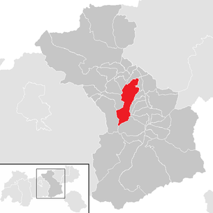
| Location of Fügenberg in the Schwaz district | ||
  |
||
 Fügenberg parish hall |
||
| Source: Municipal data from Statistics Austria | ||

Fügenberg is a municipality with 1,452 inhabitants (as of January 1, 2020) in the Zillertal and belongs to the Schwaz district in Tyrol ( Austria ). The community is located in the judicial district of Zell am Ziller .
geography
location
In terms of area, Fügenberg is one of the larger communities in the Zillertal. It extends above Fügen over wide mountain slopes and narrow valleys of the Tux Prealps. Most of the area is on a hillside. The community is closely intertwined with Fügen in economic and cultural terms.
Community structure
The municipality includes the following two localities (residents as of January 1, 2020):
- Fuegenberg (771)
- Pankrazberg (681)
Two deep into the Tuxer in reaching valleys belong to the community area, the Finsinggrund high altitude with the m to about 1,500 (Klaus bottom) Hoteldorf Hochfuegen and the upper portion of the of Schlitters forth leading Öxltals with the Kaunzalm.
|
structure
|
||||||
|
Legend for the breakdown table
|
Alpine pastures
- Kaunzalm (Niederleger ( 1525 m above sea level ), Mittelleger (~ 1730 m above sea level ), Hochleger (~ 1870 m above sea level ))
- Kohleralm ( 1194 m above sea level )
- Geolsalm ( 1733 m above sea level )
- Gartalm (Niederleger ( 1572 m above sea level ), Hochleger ( 1849 m above sea level ))
- Schellenbergalm ( 1291 m above sea level )
- Lamarkalm (Niederleger ( 1613 m above sea level ), Mittelleger (~ 1905 m above sea level ), Hochleger ( 1985 m above sea level ))
- Pfundsalm (Niederleger ( 1640 m above sea level ), Mittelleger ( 1832 m above sea level ))
- Viertelalm (Niederleger (~ 1765 m above sea level ), Hochleger ( 2022 m above sea level ))
- Holzalm (Niederleger (~ 1630 m above sea level ), Hochleger ( 1896 m above sea level ))
- Keglalm (Niederleger (~ 1405 m above sea level ), Mittelleger ( 1706 m above sea level ), Hochleger (~ 1955 m above sea level ))
- Winkelalm (~ 1387 m above sea level )
- Lumpereralm ( 1392 m above sea level )
- Hölderalm (~ 1488 m above sea level )
- Schlagalm ( 1476 m above sea level )
- Gartalm in Schlagwald (~ 1125 m above sea level )
Special case:
- Maschentalalm (Niederleger (~ 1530 m above sea level ), Hochleger (~ 1720 m above sea level )); belongs to the Piller municipality (Hochpillberg).
The Maschentalalmen are colloquially referred to as "Lamaschalmen".
Neighboring communities
history
The mountain settlements of the Zillertal, including Fügenberg, go back to agricultural colonization in the Middle Ages, when the valley floor was no longer sufficient for cultivation. Fügenberg was first mentioned in a document as Fügerberg in 1315. When, after the Napoleonic Wars in 1816, the Tyrolean municipal constitution came into force in the whole of Zillertal, Fügenberg and Pankrazberg were merged to form today's municipality of Fügenberg.
Since the Middle Ages, mineral resources have been sought in the municipality for several centuries, including gold and iron ore. The iron ore deposits in the Zillertal had become important due to the increased iron requirements of the large silver and copper mines in Schwaz and Kitzbühel .
Between 1562 and 1760 there were nine tunnels on the southeast flank of the Grätzenkopf and Samjoch ridge in the Öxltal as well as on the Schwaz side. After being crushed in leather sacks weighing 60 to 80 kg, they were transported to the ironworks in Kleinboden by pack horses and carts . The empty sacks were carried up again by large dogs. The annual production of iron ore was between 200 and 5000 tons, up to 500 men were employed in smelting and mining. The miners built several chapels and were significantly involved in the construction of the Pankrazkirche.
Culture and sights

Attractions
The Pankrazkirche, built between 1494 and 1497 in the Gothic style, is worth seeing . In September 1999, the show tunnel in the Öxltal was opened to visitors at an altitude of 1783 m.
Sports
The Fügen-Fügenberg region offers two ski areas: the Spieljoch and Hochfügen. In addition to its importance as a winter sports center, Hochfügen is also the starting point for many mountain hikes, for example to the 2506 m high Gilfert or the 2762 m high Rastkogel .
The area between Schwaz, Jenbach, Fügen and Hochfügen has the densest network of official mountain bike routes in Tyrol. In May 2005, a trail between Gamsstein and the Gartalm-Niederleger was released for the first time.
Economy and Infrastructure

economy
Fügenberg is a scattered settlement that a few decades ago was almost exclusively populated by farmers. With the upturn in winter tourism, the situation has changed, farms have declined or are largely run as part-time jobs.
traffic
From the center of Fügen, the Hochfügen-Straße leads to Fügenberg and from there on to the Hochfügen hotel complex.
literature
- Hans Mair: History of the houses and farms of Fügen and Fügenberg (Schlern writings 260). Wagner: Innsbruck 1971.
Web links
- History-Tyrol: Fügen / Fügenberg
- 70910 - Fügenberg. Community data, Statistics Austria .
Individual evidence
- ↑ Statistics Austria: Population on January 1st, 2020 by locality (area status on January 1st, 2020) , ( CSV )
Achenkirch | Aschau im Zillertal | Brandberg | Bruck am Ziller | Book in Tyrol | At the Achensee | Finkenberg | Joining | Fügenberg | Gallzein | Gerlos | Gerlosberg | Hainzenberg | Hart in the Zillertal | Hippach | Jenbach | Kaltenbach | Mayrhofen | Pill | Ramsau im Zillertal | Ried im Zillertal | Rohrberg | Schlitters | Schwaz | Schwendau | Stans | Steinberg am Rofan | Strass im Zillertal | Mute | Stummerberg | Terfens | Tux | Uderns | Vomp | Weer | Weerberg | Wiesing | Zell am Ziller | Zellberg