
Hainzenberg
|
Hainzenberg
|
||
|---|---|---|
| coat of arms | Austria map | |
 |
|
|
| Basic data | ||
| Country: | Austria | |
| State : | Tyrol | |
| Political District : | black | |
| License plate : | SZ | |
| Surface: | 21.47 km² | |
| Coordinates : | 47 ° 13 ' N , 11 ° 54' E | |
| Height : | 910 m above sea level A. | |
| Residents : | 713 (January 1, 2020) | |
| Population density : | 33 inhabitants per km² | |
| Postal code : | 6278 | |
| Area code : | 05282 | |
| Community code : | 7 09 14 | |
| NUTS region | AT335 | |
| Address of the municipal administration: |
Dörfl 360 6278 Hainzenberg |
|
| Website: | ||
| politics | ||
| Mayor : | Georg Wartelsteiner ( General list of names Hainzenberg ) | |
|
Municipal Council : (2016) (11 members) |
||
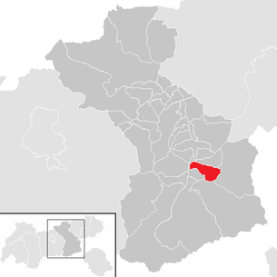
| Location of Hainzenberg in the Schwaz district | ||
  |
||
| Source: Municipal data from Statistics Austria | ||

Hainzenberg is a municipality with 713 inhabitants (as of January 1, 2020) in the Zillertal and belongs to the Schwaz district in Tyrol ( Austria ). The community is located in the judicial district of Zell am Ziller .
geography
Hainzenberg is located southeast of Zell am Ziller at the beginning of the Gerlos valley , on a slope. The Gerlosbach and the Weißbachl , flowing from the mountain slopes of the Torhelm, form the boundaries of the municipality in the north and east, which extends in the Zillertal to just before Ramsau .
The municipality includes the districts of Talstraße , Schweiberweg , Unterberg , Bichl , Dörfl , Innerberg , Gerlosstein , Lindenhöhe , Penzing , Eggeweg and Enterberg . Dörfl, about two kilometers southeast of Zell, forms the center of the community with the municipal office, the elementary school and the valley station of the Gerlossteinbahn . Most of the original townscape has been preserved here.
history
Hainzenberg is first mentioned in 1303 and 1309 as "Haitzenperch". The origin of the place name is unclear. The tax cadastre from 1779 lists Hainzenberg as the main team of the Zell nursing court , from which today's political community developed in the 19th century.
The location on the shortest connection from Zell through the Gerlostal to the ore monastery of Salzburg, to which a large part of the Zillertal belonged, was important for Hainzenberg.
In 1506 a gold mine was first mentioned on the Hainzenberg. When the mines were generating more and more income at the beginning of the 17th century, a dispute broke out between Salzburg and Tyrol, who had already agreed to share gold and silver ores in the Zillertal in 1427. In 1630 this almost led to the outbreak of war. Finally it was possible to agree on the joint exploitation of the gold deposit. In 1803 the mine, like the entire Zillertal, became the property of the Tyrolean sovereigns. In 1870 the work was stopped because of the low yield, after which various companies tried in vain to make production profitable. Around 1930 the work was finally stopped.
In 1996 the old mine was taken over by the Zell am Ziller Tourist Association and expanded into a gold mine.
Culture and sights

economy
In addition to tourism (mainly in the winter season) with the Gerlosstein ski area and agriculture, Hainzenberg is now mainly a community of commuters.
traffic
Hainzenberg can be reached from the Zillertal via Gerlos Straße B 165.
Web links
- History Tyrol: Hainzenberg
- 70914 - Hainzenberg. Community data, Statistics Austria .
Achenkirch | Aschau im Zillertal | Brandberg | Bruck am Ziller | Book in Tyrol | At the Achensee | Finkenberg | Joining | Fügenberg | Gallzein | Gerlos | Gerlosberg | Hainzenberg | Hart in the Zillertal | Hippach | Jenbach | Kaltenbach | Mayrhofen | Pill | Ramsau im Zillertal | Ried im Zillertal | Rohrberg | Schlitters | Schwaz | Schwendau | Stans | Steinberg am Rofan | Strass im Zillertal | Mute | Stummerberg | Terfens | Tux | Uderns | Vomp | Weer | Weerberg | Wiesing | Zell am Ziller | Zellberg