
Wiesing
|
Wiesing
|
||
|---|---|---|
| coat of arms | Austria map | |
 |
|
|
| Basic data | ||
| Country: | Austria | |
| State : | Tyrol | |
| Political District : | black | |
| License plate : | SZ | |
| Surface: | 10.37 km² | |
| Coordinates : | 47 ° 24 ' N , 11 ° 48' E | |
| Height : | 566 m above sea level A. | |
| Residents : | 2,144 (January 1, 2020) | |
| Population density : | 207 inhabitants per km² | |
| Postal code : | 6210 | |
| Area code : | 05244 | |
| Community code : | 7 09 39 | |
| NUTS region | AT335 | |
| UN / LOCODE | AT WSG | |
| Address of the municipal administration: |
Dorf 19 6210 Wiesing |
|
| Website: | ||
| politics | ||
| Mayor : | Alois Aschberger (Independent Wiesinger List) | |
|
Municipal Council : (2010) (13 members) |
||
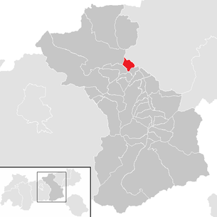
| Location of Wiesing in the Schwaz district | ||
  |
||
 Wiesing in front of the Rofan Mountains |
||
| Source: Municipal data from Statistics Austria | ||

Wiesing is a municipality with 2144 inhabitants (as of January 1, 2020) in the district of Schwaz , Tyrol ( Austria ). The community is located in the judicial district of Schwaz .
geography
Wiesing is located in the central Lower Inn Valley north of the Inn, at the entrance to the Zillertal , at the southern foot of the Rofan Mountains . In addition to the village of Wiesing, the Rotten Bradl and Dikat , the village of Erlach and the Rofan settlement also belong to the community.
Community structure
The municipality includes the following eight localities (residents as of January 1, 2020):
- Astenberg (35)
- Bradl (78)
- Dicate (100)
- Honor stable (3)
- Erlach (253)
- Rofan settlement (701)
- Zoo (7)
- Wiesing (967)
|
structure
|
||||||
|
Legend for the breakdown table
|
Neighboring communities
Neighboring communities are Buch in Tyrol , Eben am Achensee , Jenbach and Strass in the Zillertal in the Schwaz district. To the east, the municipality of Münster is followed by the Kufstein district.
Culture and sights
Celtic fortifications on the Buchberg
From 1981 onwards, on the Inselberg Buchberg near Wiesing, north of the Inn, an area exposed by the construction of a quarry was examined. The area has been destroyed by the expansion of the quarry since 1984.
On the top of the hill at the western end, two wall squares were excavated. The finds showed a settlement from the 2nd century BC. The ceramics point to the late Hallstatt to early La Tène period. The massive palisade , which was erected on a limestone plinth and apparently burned in a warlike incident, enclosed a 25 × 25 m square. Due to the position of the pillars, the facility was not roofed; there was an access on the east side. This is also where most of the artifacts, mainly pottery shards, have been found. An interpretation as a cult area is questionable, rather a fortification is assumed. The lack of places for burnt victims, the small number of pottery finds, but above all 13 arrowheads and one lance tip on the east wall reinforce this assumption. After the masonry had apparently been destroyed by enemy conquest, a limestone wall was erected in front of the east wall with a system of three trenches in front of it. Another protective wall in front of it confirms its function as a weir system.
First mention
Wiesing is first mentioned in a document in the years 930/31 as "Vuisinga" on the occasion of a transfer of ownership to the Archbishopric of Salzburg , when a certain Himiltrud handed over her property there as well as other goods in Bozen , Mils , Vomp and Schwaz to Archbishop Odalbert .
Economy and Infrastructure
In terms of transport, Wiesing benefits from its location with several small and medium-sized businesses, and there are also many commuters.
From the A 12 Inntal motorway , the B 169 lead to the Zillertal and the B 181 to the Achensee . The Kanzelkehre on Achenseestraße offers a view of the Inn Valley and the entrance to the Zillertal. There is a connection to the S-Bahn via the Westbahn with the Münster-Wiesing stop .

Partner communities
Harsum in Lower Saxony , Germany , is Wiesing's partner municipality.
Web links
- 70939 - Wiesing. Community data, Statistics Austria .
Individual evidence
- ↑ Statistics Austria: Population on January 1st, 2020 by locality (area status on January 1st, 2020) , ( CSV )
- ^ Susanne Sievers / Otto Helmut Urban / Peter C. Ramsl: Lexicon for Celtic Archeology. A – K and L – Z (communications from the prehistoric commission published by the Austrian Academy of Sciences ), Vienna 2012, ISBN 978-3-7001-6765-5 , p. 274.
- ↑ Martin Bitschnau , Hannes Obermair : Tiroler Urkundenbuch, II. Department: The documents on the history of the Inn, Eisack and Pustertal valleys. Vol. 1: Up to the year 1140 . Universitätsverlag Wagner, Innsbruck 2009, ISBN 978-3-7030-0469-8 , p. 104-105, No. 138 .
- ↑ Entry about the partner communities on the homepage of the community of Harsum.Retrieved on April 26, 2019, 1:40 am
Achenkirch | Aschau im Zillertal | Brandberg | Bruck am Ziller | Book in Tyrol | At the Achensee | Finkenberg | Joining | Fügenberg | Gallzein | Gerlos | Gerlosberg | Hainzenberg | Hart in the Zillertal | Hippach | Jenbach | Kaltenbach | Mayrhofen | Pill | Ramsau im Zillertal | Ried im Zillertal | Rohrberg | Schlitters | Schwaz | Schwendau | Stans | Steinberg am Rofan | Strass im Zillertal | Mute | Stummerberg | Terfens | Tux | Uderns | Vomp | Weer | Weerberg | Wiesing | Zell am Ziller | Zellberg