Ried in the Zillertal
|
Ried in the Zillertal
|
||
|---|---|---|
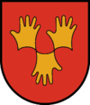
| coat of arms | Austria map | |
|
|
||
| Basic data | ||
| Country: | Austria | |
| State : | Tyrol | |
| Political District : | black | |
| License plate : | SZ | |
| Surface: | 9.47 km² | |
| Coordinates : | 47 ° 18 ' N , 11 ° 52' E | |
| Height : | 573 m above sea level A. | |
| Residents : | 1,281 (January 1, 2020) | |
| Population density : | 135 inhabitants per km² | |
| Postal code : | 6273 | |
| Area code : | 05283 | |
| Community code : | 7 09 23 | |
| NUTS region | AT335 | |
| Address of the municipal administration: |
Großriedstrasse 4 6273 Ried im Zillertal |
|
| Website: | ||
| politics | ||
| Mayor : | Hansjörg Jäger ( ÖVP ) | |
|
Municipal Council : (2016) (13 members) |
||
| Location of Ried im Zillertal in the Schwaz district | ||
 View of Ried from the south |
||
| Source: Municipal data from Statistics Austria | ||
Ried im Zillertal is a municipality with 1281 inhabitants (as of January 1, 2020) in the Zillertal and belongs to the Schwaz district in Tyrol ( Austria ). The community is located in the judicial district of Zell am Ziller .
geography
Ried is located in the middle of the Zillertal, on the left bank of the Ziller . The community consists of Kleinried , Großried and Taxach on the rubble cone of the Riedbach and the Riedberg on the mountain slope, which is characterized by farms .
Neighboring communities
Fügenberg , Kaltenbach , Stumm , Uderns , Zellberg
history
The place name from the time of the Bavarian conquest is related to "clearing". Ried probably originated in the 10th century and was first mentioned in a document in 1150. With Uderns it belonged to the Tyrolean part of the Zillertal, while the other communities belonged to Salzburg .
In 1805 Ried was assigned to the Rattenberg district court , in 1817 to the Fügen district court and, since 1923, to the Zell am Ziller district court.
Mudslides from the Riedbach were a constant threat to the place .
Culture and sights
- The parish church of St. John the Baptist dates back to 1779 and is built in the late baroque style.
economy
While the district of Riedberg is characterized by agriculture, there is a wide range of commercial, trading and service companies in the main town of Ried. In addition, Ried is a two-season tourist community.
traffic
Ried is on the Zillertalstrasse B 169 and on the Zillertalbahn with one stop. The northernmost access road to the apex of the Zillertaler Höhenstraße begins in Ried .
Personalities
- Peter Prosch (1744–1804), farmer's son, who traveled to German royal houses and wrote an autobiography about it.
- Marc Pircher (* 1978), folk musician
Web links
- 70923 - Ried im Zillertal. Community data, Statistics Austria .


