Gmina Brusy
| Gmina Brusy | ||
|---|---|---|

|
|
|
| Basic data | ||
| State : | Poland | |
| Voivodeship : | Pomerania | |
| Powiat : | Chojnicki | |
| Geographic location : | 53 ° 53 ' N , 17 ° 44' E | |
| Residents : | s. Gmina | |
| Postal code : | 89-632 | |
| Telephone code : | (+48) 52 | |
| License plate : | GCH | |
| Economy and Transport | ||
| Street : | Ext. 235 : Chojnice - Kościerzyna | |
| Ext. 236 : Konarzynki – Brusy | ||
| Rail route : | PKP line 211: Chojnice - Kościerzyna | |
| Next international airport : | Danzig | |
| Gmina | ||
| Gminatype: | Urban-and-rural parish | |
| Gmina structure: | 25 school offices | |
| Surface: | 400.74 km² | |
| Residents: | 14,572 (Jun. 30, 2019) |
|
| Population density : | 36 inhabitants / km² | |
| Community number ( GUS ): | 2202023 | |
| Administration (as of 2013) | ||
| Mayor : | Witold Ossowski | |
| Address: | ul. Na Zaborach 1 89-632 Brusy |
|
| Website : | www.brusy.pl | |
The Gmina Brusy [ 'brusɨ ] a town-and-country municipality in the powiat Chojnicki in the Pomeranian Voivodeship in Poland . Its seat is the city of Brusy ( German : Bruß ).
geography

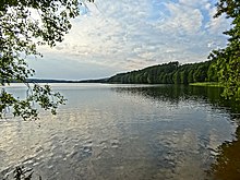
The municipality is located in Kashubia , in the Bory Tucholskie (Tucheler Heide) .
history
From 1920 to 1939 the area of the municipality was part of the Polish corridor .
From 1975 to 1998 the municipality belonged to the Bydgoszcz Voivodeship .
coat of arms
On September 9, 1999, the municipality's coat of arms was changed. As before, the upper half shows half a red griffin on a white background holding a B. However, the crown was taken from the griffin. The lower part of the coat of arms is blue as before and shows three spruce trees . These were green until 1999, since then they have been gold in color.
structure
The urban-and-rural municipality Brusy consists of the following localities:
| Polish name | Kashubian name | German name (until 1920 and 1939–45) |
|---|---|---|
| Antoniewo | Antoniéwò | Antonin (1942–45 Antonsfeld ) |
| Asmus | Asmës | Asmus |
| Broda | Brodda | |
| Brusy | Brusë | Bruß |
| Brusy-Jaglie | ||
| Brusy Wybudowanie | ||
| Chłopowy | Chłòpòwë | Kloppowo (1942–45 Klopphof ) |
| Czapiewice | Czôpiéwice | Czapiewitz (1942–45 pure water ) |
| Czapiewice Wybudowanie | ||
| Czarniż | Czôrniéż | Czarniss (1942–45 Moorbach ) |
| Czarnowo | Côrnowò | Czarnowo (1942–45 Schwarzhöfe ) |
| Czernica | Czernitza (1942–45 Schernitz ) | |
| Czyczkowy | Czëczkòwò | Czyczkowo (1942–45 Langenlinden ) |
| Czyczkowy Wybudowanie | ||
| Dąbrówka | Dăbrowka | Dombrowo (1942–45 Eichenfier ) |
| Gacnik | ||
| Gapowo | Gapowo | |
| Giełdon | Giéłdón | Gildon (1942-45 guilds ) |
| Główczewice | Głowczéwice | Glowczewitz (1942–45 listening ) |
| Huta | Hëta | Hutta (1942-45 Heath Cottage ) |
| Kaszuba | Kaszuba | Kaszuba (1942–45 Spritzmühl ) |
| Kinice | Kënice | Friedrichsbruch |
| Kosobody | Kòsòbùdë | Kossabude |
| Krównia | ||
| Kruszyn | Kruszëno | Kruschin (1942–45 Kruschen ) |
| Lamk | Lamk | Lamk (1942–45 Lemkenmühl ) |
| Laska | Lôska | Laska (1942–45 Waldsee ) |
| Lendy | Loin | Lendy (1942-45 loins ) |
| Leśno | Lésno | Lesno (1942–45 last ) |
| Lubnia | Lubniô | Lubnia (1942–45 Lübbenberg ) |
| Małe Chełmy | Małé Chełmë | Klein Chelm (1942–45 Kelm ) |
| Małe Gliśno | Małé Glësno | Klein Glisno (1942-45 Glissenbruch ) |
| Męcikał | Mãcëkôł | Menczikal (1900–42 Mentschikal , 1942–45 Menzig ) |
| Młynek | ||
| Okręglik | Òkrenglik | Okrenglik (1873–1945 Elisenbruch ) |
| Orlik | Òrlik | Orlik (1942–45 Arnsnest ) |
| Parova | Pôrowa | Parova |
| Parzyn | Pôrzën | Parszin |
| Peplin | Peplën | Peplin (1942-45 Plinne ) |
| Pokrzywno | Pòkrzëwno | Pokrzywno |
| Przymuszewo | Przëmùszéwò | Forced break |
| Rolbik | Rolbiék | Rolbick (1942–45 Rollbeck ) |
| Rudziny | Rudzënnë | Rudzini (1942–45 Rautenbruch ) |
| Skoszewo | Skòszéwò | Skoszewo (1942-45 Locked ) |
| Spierwia | Spiérwia | Spirwia |
| Struga | Strëga | Struga (1942–45 Fließbrück ) |
| Turowiec | Turowiéc | Turowitz (1942–45 Auerhöh ) |
| Wawrzyn | ||
| Widno | Widno | Widno (1942–45 splash bridge ) |
| Wielkie Chełmy | Dużé Chełmë | Groß Chelm (1942–45 Gut Kelm ) |
| Windorp | Windorp | Windorp (1942-45 Windorf ) |
| Wysoka Zaborska | Wësokô | Wissokasaborska (1942–45 Hohensaborn ) |
| Żabno | Żôbno | Zabno (1942–45 Heidewiese ) |
| Zalesie | Zôlésé | Zalesie (1942–45 Saalesch ) |
traffic
Wojewodschaftsstrasse 235 ( droga wojewódzka 235 ) runs through town and municipality . In the south this ends in Chojnice , in the north it joins the national road 20 ( droga krajowa 20 ) about six kilometers west of Kościerzyna . The nearest international airport is Lech Wałęsa Airport, Gdansk, north-east of Brusy, about 90 kilometers away .
Personalities
- Konstantyn Krefft , pastor, born in Lubnia in 1867, died in 1940 in the Stutthof concentration camp .
Web links
Footnotes
- ↑ population. Size and Structure by Territorial Division. As of June 30, 2019. Główny Urząd Statystyczny (GUS) (PDF files; 0.99 MiB), accessed December 24, 2019 .
- ↑ brusy.pl


