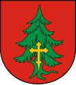
Gmina Ochotnica Dolna
| Gmina Ochotnica Dolna | ||
|---|---|---|

|
|
|
| Basic data | ||
| State : | Poland | |
| Voivodeship : | Lesser Poland | |
| Powiat : | Nowotarski | |
| Geographic location : | 49 ° 32 ' N , 20 ° 19' E | |
| Residents : | see Gmina | |
| Postal code : | 34-452 | |
| Telephone code : | (+48) 18 | |
| License plate : | KNT | |
| Gmina | ||
| Gminatype: | Rural community | |
| Gmina structure: | 3 localities | |
| 4 school offices | ||
| Surface: | 141.03 km² | |
| Residents: | 8544 (Jun. 30, 2019) |
|
| Population density : | 61 inhabitants / km² | |
| Community number ( GUS ): | 1211102 | |
| Administration (as of 2014) | ||
| Mayor : | Stanislaw Jurkowski | |
| Address: | os. Dłubacze 160 34-452 Ochotnica Dolna |
|
| Website : | www.ochotnica.pl | |
The Gmina Ochotnica Dolna is a rural community in the powiat Nowotarski of the Lesser Poland Voivodeship in Poland . Its seat is the village of the same name with around 2100 inhabitants.
geography
The municipality is located in the Gorcen and extends over a length of 38 km along the Ochotnica stream.
history
From 1975 to 1998 the municipality belonged to the Nowy Sącz Voivodeship .
structure
The rural community (gmina wiejska) Ochotnica Dolna includes three villages with four school boards :
Ochotnica Dolna and Ochotnica Dolna – Młynne, Ochotnica Górna and Tylmanowa .
Web links
Commons : Gmina Ochotnica Dolna - collection of pictures, videos and audio files
Individual evidence
- ↑ population. Size and Structure by Territorial Division. As of June 30, 2019. Główny Urząd Statystyczny (GUS) (PDF files; 0.99 MiB), accessed December 24, 2019 .
- ^ Joint work: Gorce. Przewodnik dla prawdziwego turysty . Oficyna Wydawnicza "Rewasz", Pruszków 2004, ISBN 83-8918819-8 , p. 303-306 (Polish).
- ↑ Dz.U. 1975 no 17 poz. 92 (Polish) (PDF file; 783 kB)

