Gosnold (Massachusetts)
| Gosnold | ||
|---|---|---|
|
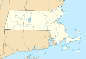
Location in Massachusetts
|
||
| Basic data | ||
| Foundation : | 1864 | |
| State : | United States | |
| State : | Massachusetts | |
| County : | Dukes County | |
| Coordinates : | 41 ° 27 ′ N , 70 ° 49 ′ W | |
| Time zone : | Eastern ( UTC − 5 / −4 ) | |
| Residents : | 75 (as of 2010) | |
| Population density : | 2.2 inhabitants per km 2 | |
| Area : | 363.0 km 2 (approx. 140 mi 2 ) of which 34.2 km 2 (approx. 13 mi 2 ) is land |
|
| Height : | 26 m | |
| FIPS : | 25-26325 | |
| GNIS ID : | 0618290 | |
Gosnold is a parish in Dukes County, which includes the Elizabeth Islands , in the US state of Massachusetts. At the United States Census 2010 , 75 people lived in Gosnold.
history

The first settlers to colonize the Elizabeth Islands were the Wampanoag . During the summer they hunted and fishing in the Elizabeth Islands . The names of the individual islands of the Elizabeth Islands come from the language of the Wampanoag .
Bartholomew Gosnold , after whom the community was later named, was one of the first Europeans to learn about the Elizabeth Islands in 1602. Gosnold and his crew tried to set up the first trading post on Cuttyhunk to trade with the natives. The trading post was given up after a few weeks and Gosnold decided to return to Great Britain with his team . It was not until 1641 that Gosnold and the Elizabeth Islands were repopulated by the British Thomas Mayhew (1593-1682) and then acquired by Mayhew. The Wampanoag claimed the islands and Gosnold for themselves until 1658. In 1683 the Elizabeth Islands, Martha's Vineyard and Nantucket were transferred to the Province of Massachusetts Bay . Gosnold was founded as a separate community in 1864. Gosnold used to be part of the Chilmark Parish on Martha's Vineyard.
geography
According to the United States Census Bureau , the community has a total area of 363.0 km², of which 90.95% falls, or 328.9 km² on water and 9.05%, 34.2 km² on land. Gosnold includes the islands of Nonamesset Island , Uncatena Island , Naushon Island , Pasque Island , Nashawena Island and Cuttyhunk. The community stretches about 14 km from southwest on Cuttyhunk to northeast on Nonamesset Island. More than half of the population lives on Cuttyhunk, a quarter lives on Naushon Island and the rest is spread across the other islands.
Demographics
| Population development | |||
|---|---|---|---|
| Census | Residents | ± in% | |
| 1870 | 99 | - | |
| 1880 | 152 | 53.5% | |
| 1890 | 135 | -11.2% | |
| 1900 | 164 | 21.5% | |
| 1910 | 152 | -7.3% | |
| 1920 | 181 | 19.1% | |
| 1930 | 120 | -33.7% | |
| 1940 | 136 | 13.3% | |
| 1950 | 56 | -58.8% | |
| 1960 | 66 | 17.9% | |
| 1970 | 83 | 25.8% | |
| 1980 | 63 | -24.1% | |
| 1990 | 98 | 55.6% | |
| 2000 | 86 | -12.2% | |
| 2010 | 75 | -12.8% | |
At the United States Census 2000 there were 68 residents in 46 households and 21 families in the entire parish of Gosnold. The population density was 2.5 inhabitants per km². There were 215 housing units at an average density of 16.1 per km². 95.3% were white and 4.7% were two or more turf. The age structure in 2000 was distributed to 17.4% young people up to 18 years of age, 5.8% were between 18 and 24 years old, 32.6% were between 25 and 44 years of age, 31.4% stated an age between 45 and 64 and 12.8% were 64 or older. The mean age of the population was 42 years. For every 100 women there are 138.9 men. The median income in 2000 averaged $ 22,344 . One family had a median income of $ 27,500. Males had a median income of $ 21,875 and females a median income of $ 30,625. 23.5% of the population lived below the poverty line, including 40.0% young people up to 18 years of age and 22.2% of those over 64 years of age.
