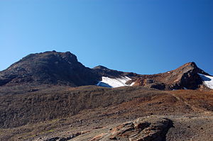
Guslar tips
| Guslar tips | ||
|---|---|---|
|
Front, middle and rear Guslarspitze |
||
| height | 3147 m above sea level A. | |
| location | Tyrol , Austria | |
| Mountains | Ötztal Alps | |
| Dominance | 0.68 km → on the ridge to the Kesselwandspitze | |
| Notch height | 75 m ↓ notch to the top of the boiler wall | |
| Coordinates | 46 ° 50 '15 " N , 10 ° 49' 5" E | |
|
|
||
| rock | Mica schist, granite gneiss and paragneiss | |
| First ascent | Schlagintweit brothers in 1848 | |
| Normal way | From the Hochjochhospiz | |
The Guslar peaks are three peaks in the Ötztal Alps in Tyrol . They are located in the Weißkamm above the Rofental, a source valley of the Venter Valley .
The Vordere Guslarspitze to the east has a height of 3118 meters, the Middle Peak is 3128 meters high and the western Hintere Guslarspitze is the highest peak at 3147 meters. The Guslar peaks were first climbed by the Schlagintweit brothers between August 27 and September 8, 1848.
Location and surroundings
The three peaks are in the Weißkamm, a mountain range that runs from the Weißkugel in the southwest over the Wildspitze to Sölden in the northeast. On the northwest side of the Guslar peaks, the Guslarferner glacier extends up to a height of 3100 meters. The southeast flank of the peaks, however, is covered with rubble and debris. Neighboring mountains are in the west, separated by the lower Kesselwandferner , the 3257 meter high Mutspitze , in the northwest, separated by the Brandenburger Jöchl (3246 m), the Kesselwandspitze with 3414 meters. The deeply cut Rofental runs in the southeast. The next significant place is the Sölden district of Vent , about 7 kilometers as the crow flies in an east-northeast direction.
Ascent
The Guslar peaks can be reached both from the Vernagthütte (2755 m) to the north and from the Hochjochhospiz to the south at an altitude of 2412 meters . The normal route from the Hochjochhospiz leads first over the Deloretteweg in a north-westerly direction, then at an altitude of 2900 meters east to the summit cross of the Mittlerer Guslarspitze in about two hours of walking. From here, the other peaks can be reached quickly with easy climbing of the UIAA I level of difficulty . The north ascent from the Vernagthütte requires 1.5 hours of walking.
Literature and map
- Heinrich Hess in Eduard Richter : The Development of the Eastern Alps , Volume II, published by the German and Austrian Alpine Association, Berlin 1894
- Walter Klier and Henriette Klier: Alpine Club Guide Ötztaler Alpen , Bergverlag Rother , Munich 2006, ISBN 3-7633-1123-8
- Alpine Club map 1: 25,000, sheet 30/2 Weißkugel (with height information that differs from the BEV )
- Austrian Map online


