Gydan Peninsula
| Gydan Peninsula | ||
 Location of the Gydan Peninsula |
||
| Geographical location | ||
|
|
||
| Coordinates | 70 ° 0 ′ N , 79 ° 0 ′ E | |
| Waters 1 | Obbos | |
| Waters 2 | Yenisei estuary | |
| length | 400 km | |
| width | 400 km | |
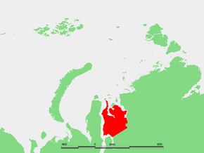
The Gydan Peninsula ( Russian Гыданский полуостров , Gydanski poluostrow ) is a peninsula in northern Western Siberia in the Asian part of Russia .
Geography and natural conditions
The more than 100,000 km² peninsula is located in the northern part of the West Siberian lowlands on the coast of the Kara Sea , a marginal sea of the Arctic Ocean . In the west it is bounded by the Obbusen and the Tasbusen flowing into it from the east , and in the east by the confluence of the Yenisei (Jenisseibusen). The northern part of the peninsula is divided into two parts by the Gydanbusen . The peninsula extends in north-south as well as in west-east direction over about 400 kilometers.
The surface represents a hilly plain, which is characterized by quaternary marine and glacial sediments . In the Juribei range of hills (Juribeiskaja grjada) running along the western side of the peninsula and the Gydan range of hills (Gydanskaja grjada), which cuts through the peninsula from southwest to northeast , heights of a good 150 meters above sea level are reached. The flatter parts of the peninsula, especially around the Gydan Bay, are heavily swampy and rich in lakes; the largest lakes are Jambuto, Periptaweto, Chassato, Chutscheto and Jarato. To the south, the peninsula is bounded by the approximately 200 meter high Tanama ridge (Tanamskaja voswyschennost) .
The most important rivers are the 479 km long Juribei, which flows into the Gydan Bay, and the 521 km long Tanama, which flows into the Yenisei lower course .
The climate is harsh; the mean January temperature is −26 ° C to −30 ° C, the mean July temperature +4 ° C to +11.5 ° C. The mean amount of precipitation is relatively low at 200 to 300 mm. The tundra landscape predominates , which merges into light forest tundra in the southern part of the peninsula .
Population and economy
Administratively, the territory belongs mainly to the Yamal-Nenets Autonomous Okrug ( Tasovsky district ), only the extreme east to the Krasnoyarsk region ( Taimyr district , formerly the autonomous district).
The Gydan Peninsula is only very sparsely populated; about 7000 people live there. Today there are only two permanently inhabited villages, Antipajuta on the Tasbusen and Gyda on the Gydanbusen. The polar station Leskino, founded in 1934, is located in the far northeast on the banks of the Yeniseii . There are no year-round traffic routes.
A large part of the population are members of the Nenets indigenous people who are nomadic or semi-nomadic reindeer herding , hunting and fishing. In the western part of the peninsula in particular, a number of natural gas reservoirs have been discovered but have not yet been developed.
The northern part of the peninsula and some offshore islands, including Oleni , were placed under nature protection in 1996 as Sapowednik Gydanski . The five sub-areas of the area together cover 878,174 hectares .
Web links
- Article Gydan Peninsula in the Great Soviet Encyclopedia (BSE) , 3rd edition 1969–1978 (Russian)
Individual evidence
- ^ Official website of Tazovsky Raion (Russian)
- ↑ Gydan-Sapowednik in the information and information system Specially Protected Natural Areas of Russia of the Center for Nature Conservation (Russian)
