Hasselbach (Werre)
| Hasselbach | ||
|
Confluence of the Hasselbach (left) with one of its small tributaries |
||
| Data | ||
| Water code | EN : 4614 | |
| location | North Rhine-Westphalia , Germany | |
| River system | Weser | |
| Drain over | Werre → Weser → North Sea | |
| source | Detmold- Hiddesen | |
| Source height | approx. 180 m above sea level NN | |
| muzzle | Detmold- Pivitsheide VH Coordinates: 51 ° 57 '30 " N , 8 ° 48' 59" E 51 ° 57 '30 " N , 8 ° 48' 59" E |
|
| Mouth height | approx. 112 m above sea level NN | |
| Height difference | approx. 68 m | |
| Bottom slope | approx. 10 ‰ | |
| length | 6.5 km | |
| Catchment area | 9.311 km² | |
| Left tributaries | Hebbelbach, Moorbach, Blue Bach | |
| Reservoirs flowed through | Krebsteich, Donoperteich, Hasselbachstausee | |
The Hasselbach is a left tributary of the Werre in Ostwestfalen-Lippe with a length of 6.5 km. The name Hasselbach refers to the dairymen's horses bred in the Hasselbachtal at that time , because "Hassel" means "foal" in Low German.
course
The Hasselbach rises on the western edge of Hiddesen in the Donoperteich nature reserve - Hiddeser Bent at the foot of the 340 m high Kahler Ehberg as a moor brook and initially flows parallel to the L 938 in a westerly direction. After approx. 1 km the brook flows through the first reservoir, the crab pond. As it continues, the stream gradually turns north. After a further 100 meters, the brook is dammed a second time and feeds the Donoperteich. After flowing through the pond, the Hasselbach continues curvy in its deeply incised brook bed to the north, parallel to the L 944 and is dammed a third time to the Hasselbach reservoir. For the last 3.5 km of its course, the stream continues to flow in a northerly direction around the Detmold district of Pivitsheide VH - northeast of the Meschesee - at a height of approx. 112 m above sea level. NN to flow into the Werre.
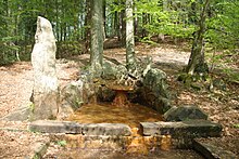
An iron-containing spring from the Hasselbach springs was set in the form of a stone vase at the beginning of the 17th century and developed into a health fountain. However, this was forgotten in the course of time. The spring near the Donoper pond can still be visited today. In addition to this, there are other very lime-rich springs in the Hasselbachtal that are used to supply Detmold with drinking water.
Reservoir oak
Crab pond
The crab pond, located below the Hiddeser Bents, was used for crab breeding because of its nutrient-poor water.
Donoperteich
→ Main article: Donoperteich
The Donoperteich is part of the Residenzweg and is located in the Hasselbachtal. It was dammed for fish farming around 1625 at the behest of Simon VII and named after the Chamberlain von Donop. It was initially stocked with trout and carp . In 1950 it was declared a nature reserve. There are several Bronze Age burial mounds nearby .
Hasselbach reservoir
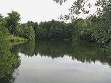
The water of the Hasselbach was used industrially at the site of today's Hasselbach reservoir early on. The first industrial development goes back to the year 1565 when a flour mill was built. Later, various other mills, furniture and sawmills and a system for generating electricity were built in the entire Hasselbachtal, which was in operation until 1928. Where the Hasselbach reservoir is today, a paper mill was built in 1674, which later became a furniture factory and, after being expanded several times, produced it until 1965. After the factory was leveled in 1981, the Hasselbach reservoir was created in its current form and opened to the public on May 2nd, 1982. The reservoir has a water surface of 1.3 hectares with a volume of 13,000 m³.
tourism
In the Hasselbachtal there are many signposted hiking trails, including the Residenzweg Detmold , which in turn is part of the Hermannsweg .
Water coloring
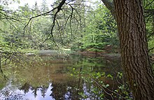
The Hasselbach has a strong red-brown color in the upper course, as is characteristic of bog brooks, but it gradually disappears the further you get away from the source, as the brook absorbs clear water from small tributaries that arise in karst springs. The red-brownish water is very poor in nutrients and comes from the Hiddeser Bent , a raised bog .
environment
Water quality
The Hasselbach is classified in water quality class II along its entire length , which means that it is moderately polluted.
Nature reserves
The Hasselbach is part of two nature reserves: The upper course of the brook has been part of the 119.00 hectare nature reserve Donoper Teich and Hiddeser Bent since 2005 . In addition, other parts of the creek are located in the 61 hectare nature reserve Hasselbach / Schwarzenbrink / Heidemoor am Kupferberg .
Tributaries
The tributaries of the Hasselbach include the 1.9 km long Hebbelbach, the 0.5 km long Moorbach and the almost 1 km long Blue Bach. In addition, some unnamed tributaries flow to the Hasselbach in the upper and middle reaches, which arise in karst springs and have strongly fluctuating outflows.
See also
- Hiddeser Bent
- List of bodies of water in Ostwestfalen-Lippe
- List of nature reserves in Ostwestfalen-Lippe
Footnotes
- ↑ a b Topographic map 1: 25,000
- ↑ a b Topographical Information Management, Cologne District Government, Department GEObasis NRW
- ↑ Pivitsheide website: Hasselbach and Donoperteich
- ↑ Donoper Ponds, section Water in Abundance. ruengener.eu, accessed on May 19, 2017 .
- ↑ Website of the Southern Teutoburg Forest and Eggegebirge Nature Park ( Memento of the original from January 23, 2016 in the Internet Archive ) Info: The archive link has been inserted automatically and has not yet been checked. Please check the original and archive link according to the instructions and then remove this notice.
- ↑ Water quality map district Lippe 2008
- ↑ Detmold district government


