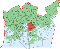
Herttoniemi
|
Herttoniemi (Hertonäs) District No. 43 of Helsinki |
|
|---|---|
| Coordinates | 60 ° 12 ′ 0 ″ N , 25 ° 3 ′ 0 ″ E |
| surface | 6.06 km² |
| Residents | 23,975 (Jan. 1, 2006) |
| Population density | 3956 inhabitants / km² |
| Jobs | 10,097 (Dec. 31, 2004) |
| structure | |
| Sub-areas |
Länsi-Herttoniemi (43.1) |
| Source: Helsinki City Statistics Office: Helsinki alueittain 2006 (PDF, 12 MB, Finnish) | |
Herttoniemi ( Swedish Hertonäs ) is the 43rd district ( Finnish kaupunginosa , Schw. Stadsdel ) of the Finnish capital Helsinki . It comprises the sub-areas ( osa-alue ) Länsi-Herttoniemi (West-Herttoniemi), Roihuvuori, Herttoniemen teollisuusalue (Herttoniemi industrial area) and Herttoniemenranta. Herttoniemi is also the name of a district (Fi. Peruspiiri , Schw. District ), which also includes the sub-area of Tammisalo .
Web links
Commons : Herttoniemi - collection of images, videos and audio files
