
Hiddingen
|
Hiddingen
City of Visselhövede
Coordinates: 53 ° 0 ′ 23 " N , 9 ° 37 ′ 4" E
|
||
|---|---|---|
| Height : | 58 m above sea level NHN | |
| Residents : | 498 | |
| Incorporation : | March 1, 1974 | |
| Postal code : | 27374 | |
| Area code : | 04262 | |
Location of Hiddingen in Lower Saxony |
||

Hiddingen is a district of the town of Visselhövede in the Rotenburg (Wümme) district in Lower Saxony . About 560 people live in the village.
geography
Hiddingen is located in the northeastern area of the city of Visselhövede, 3 km northeast of the core town of Visselhövede. Battenbrock and Jürshof also belong to Hiddingen.
Neighboring towns are - clockwise from the north - Rosebruch , Drögenbostel , Ottingen , Visselhövede (core town), Schwitschen and Buchholz .
The Rodau , a left tributary of the Wümme, has its source near Hiddingen .
history
Since the regional reform that came into force on March 1, 1974, the previously independent municipality of Hiddingen has been one of 15 localities in the city of Visselhövede.
politics
The local mayor is Holger Eimer.
Economy and Infrastructure
Hiddingen is far from the main traffic. The federal highway 27 runs 17 km away to the southwest. Of Bomlitz via Visselhövede to Rotenburg (Wümme) leading national highway 440 runs southwest, 3 km away. The federal highway 71 from Soltau via Neuenkirchen to Rotenburg (Wümme) runs 6 km to the northeast.
In Hiddingen - in contrast to some of the smaller districts of Visselhövede - there are street names and not just house numbers , so that residents, postmen, suppliers and visitors can find their way around.

Town view

Calves in May
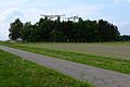
Radar system in Hiddingen
_-_Dorfansicht.jpg)
_-_Dorfansicht_mit_K%C3%A4lbern.jpg)
_-_Radaranlage.jpg)
Personalities
- Marlene Crüsemann (born November 7, 1953; née Cohrs), New Testament scholar
Web links
Individual evidence
- ^ Federal Statistical Office (ed.): Historical municipality directory for the Federal Republic of Germany. Name, border and key number changes in municipalities, counties and administrative districts from May 27, 1970 to December 31, 1982 . W. Kohlhammer GmbH, Stuttgart / Mainz 1983, ISBN 3-17-003263-1 , p. 245 .

Bleckwedel | Buchholz | Dreeßel | Drögenbostel | Hiddingen | Jeddingen | Chain Castle | Lüdingen | Nindorf | Ottingen | Rose break | Schwitschen | Visselhövede | Wehnsen | Wittorf