Rechberg (Schwäbisch Gmünd)
|
Rechberg
City of Schwäbisch Gmünd
|
|
|---|---|
| Coordinates: 48 ° 45 ′ 9 ″ N , 9 ° 47 ′ 40 ″ E | |
| Height : | 580 (410-707) m |
| Area : | 7.08 km² |
| Residents : | 1324 (2012) |
| Population density : | 187 inhabitants / km² |
| Incorporation : | 1st January 1975 |
| Postal code : | 73529 |
| Area code : | 07171 |
|
Location of Rechberg in Schwäbisch Gmünd
|
|
Rechberg is the youngest district of Schwäbisch Gmünd in the Ostalb district in Baden-Württemberg .
geography
Geographical location
The Rechberg district is around five kilometers south of the city of Schwäbisch Gmünd at the foot of the Rechberg mountain of the same name , one of the Three Kaiser Mountains .
geology
The rock layers of the Rechberg district were deposited in the Jurassic period by the initially expanding Jurassic Sea. The predominant rock layers in the district belong mainly to the Central Jurassic . The only witness of the Upper Jurassic layers above is the Rechberg . The mountain is a so-called witness mountain , consists of Upper Jurassic rocks. The rocks of the Rechberg were better protected from erosion in a tectonic trench structure . than the surrounding rocks, so that the Rechberg was shaped as a characteristic mountain top by the weathering today.
landscape
Sheep and goat pastures still dominated the landscape in the middle of the 19th century. From 1870 the mountain slopes were partially reforested with beech forests. Today the mountain slopes are forested, the lower slopes are used as intensive meadows, orchards and mixed forests. Since 1955, the entire Rechberg area, with the exception of the settlement areas, has been a landscape protection area.
structure
The place consists of the suburbs of Vorderweiler, Hinterweiler and several farms . The mountain Rechberg with the two peaks Schloßberg and Kirchberg lies on the boundary of the village.
climate
Measurements in the period from 1939 to 1961 showed an average annual precipitation of approx. 1000 mm per m² and year and an average annual temperature of 7.3 ° C. In the period from 1961 to 1990 there was an average annual precipitation of approx. 1015 mm per m² and year and an average annual temperature of 7.8 ° C. The climate is therefore classified as temperate-montane. The measurements took place at climate stations in Schwäbisch Gmünd and Geislingen / Stötten.
history
Local history
First documentary mention in a document from Emperor Frederick I (Barbarossa) in 1179. Ulrich von Rechberg signed this as “Ulricus de Rehperg” as a witness. Vorderweiler was first mentioned in 1355 as "by Rechberg w (e) yer". Hinterweiler was probably created in the 15th century from a building or castle courtyard below the castle. At a citizens' hearing on January 20, 1974, with a turnout of 91%, only 63 citizens voted for incorporation into Schwäbisch Gmünd. 638 citizens voted for the community to retain its independence. On January 1, 1975, the community was incorporated into the city of Schwäbisch Gmünd against their will, which was confirmed by the State Court in a judgment of November 6, 1975. Rechberg has been a state-approved resort since July 15, 1979.
Population development
The population figures are estimates, census results (¹) or official updates from the respective statistical offices ( main residences only ).
|
|
¹ census result
politics
Mayor and Mayor
since 1946:
|
|
coat of arms
| Blazon : "In gold (yellow) on a green mountain a striding red roebuck." | |
| Reasons for the coat of arms: The coat of arms was awarded in 1919. The red roebuck comes from the coat of arms of the Counts of Rechberg-Rothenlöwen and, in connection with the green mountain, is a talking coat of arms . Red and gold are the colors of the Rechberg house. |
banner
Description of the banner: "The banner is red and yellow striped lengthways with the coat of arms above the middle."
Culture and sights
Buildings
- Pilgrimage Church of St. Maria Hohenrechberg . The baroque church was built by the builder Valerian Brenner from 1686 to 1688. The centerpiece of the altar in the church is a figure of Mary from the early 14th century.
- Hohenrechberg ruins . The Hohenstaufen castle was mentioned for the first time in 1179. For a long time it was ancestral seat of the Counts von Rechberg . A fire caused by lightning struck the castle in ruins in 1865.
Paths and ways
- Geological path. The hiking trail leads from the Hölltal (Schwäbisch Gmünd) to the Kirchberg of the Rechberg mountain. It overcomes 392 meters in altitude at around 5 kilometers. The rock strata crossed in the process are explained on 24 information boards.
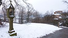
- Way of the Cross. Since 1891 the route from the Hohenrechberg ruins to the pilgrimage church has been flanked by a way of the cross.
Economy and Infrastructure
education
There is a kindergarten with two groups in the village. Four primary school classes are taught in the Scherr primary school (as of 2010).
Personalities
Sons and daughters of the church
- Ignaz Thomas Scherr (1801–1870), school reformer
- Johannes Scherr (1817–1886), cultural historian and writer
- Konrad Kümmel (1848–1936), writer and papal house prelate
Personalities who have worked on site
- Franz Reinisch (1903–1942), resistance fighter against National Socialism, brief pastor in Rechberg
Say
The legend of Klopferle vom Rechberg is about the death of Count Ulrich II († 1496). He and his wife Anna used his dog to send each other messages. The dog is said to have transported these messages from castle to castle in a bag on its collar during the wedding period. One day when the count was away, his wife prayed in the palace chapel for her husband's happy return. During the prayer she was disturbed by loud knocking. When she opened the door after the third knock, she found her husband's dog in front of the door. She opened the leather pouch on the dog's collar. Since the bag was empty, she suspected that something had happened. A little later she received the news of her husband's death. Since then, so the legend goes, you can hear a knock every time one of the Rechberg family is dying. The representation of the loyal dog in connection with the Rechberg noble family appears again and again in various places. Some of the representations can be found up to the 18th century.
literature
- Rechberg - A home book: Ortschronik Rechberg, district of Schwäbisch Gmünd . Einhorn-Verlag, Schwäbisch Gmünd 2004, ISBN 3-936373-16-7 .
Individual evidence
- ^ " Timeline of the most important Gmünd events from November 1973 to October 1974 " in einhorn yearbook 1974 , Einhorn-Verlag Eduard Dietenberger KG, Schwäbisch Gmünd 1974.
- ^ Federal Statistical Office (ed.): Historical municipality directory for the Federal Republic of Germany. Name, border and key number changes in municipalities, counties and administrative districts from May 27, 1970 to December 31, 1982 . W. Kohlhammer, Stuttgart / Mainz 1983, ISBN 3-17-003263-1 , p. 471 .
- ↑ Timeline of the most important Gmünd events from November 1974 to October 1975. In: Einhorn Jahrbuch Schwäbisch Gmünd 1975. Einhorn-Verlag Eduard Dietenberger, Schwäbisch Gmünd 1975.
- ↑ The GT comes to Rechberg. In: Gmünder Tagespost . November 11, 2009.
- ↑ Bulletin Schwabisch Gmund - Rechenberg, Straßdorf, Metlangen, riding Precht
- ^ Website about Rechberg
- ^ Flags of the districts of Schwäbisch Gmünd
- ↑ Schwäbisch Gmünd - Geological Path
- ^ Rechberg - A home book. ISBN 3-936373-16-7 , pp. 48, 458, 459.
- ↑ From the Chronicle of Straßdorf. Anton Schurr 1951, p. 18.
- ^ Rechberg - A home book. 2004, ISBN 3-936373-16-7 , p. 54.


