Hnilec
|
Hnilec Gölnic |
||
| Data | ||
| location | Slovakia | |
| River system | Danube | |
| Drain over | Hornád → Sajó → Tisza → Danube → Black Sea | |
| source |
Kráľova hoľa 48 ° 53 ′ 4 ″ N , 20 ° 8 ′ 46 ″ E |
|
| Source height | approx. 1800 m | |
| muzzle | in the Hornád ( Ružín reservoir) near Margecany Coordinates: 48 ° 52 ′ 48 ″ N , 20 ° 59 ′ 56 ″ E 48 ° 52 ′ 48 ″ N , 20 ° 59 ′ 56 ″ E
|
|
| length | 88.9 km | |
| Catchment area | 654 km² | |
| Drain |
MQ |
8.1 m³ / s |
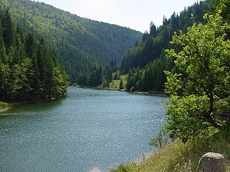
| Reservoirs flowed through | Palcmanská Maša reservoir | |
| Medium-sized cities | Gelnica | |
| Communities | Stratená , Hnilec | |
|
Palcmanská Maša reservoir |
||
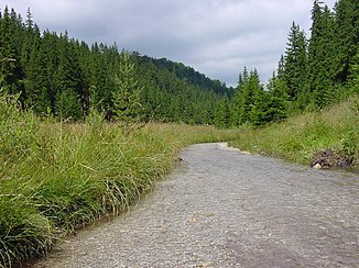
The Hnilec (in Slovak older also "Gelnický potok"; German Göllnitz ; Hungarian Gölnic ) is an approximately 90 km long river in eastern Slovakia and the name of a place on its course. The east-facing Hnilec is a tributary of the Hornád - but almost as long as it - and also rises on the eastern flank of the Low Tatras (Slovak Nízke Tatry ), towards the foothills of the Slovak Ore Mountains ( Slovenské rudohorie ).
Its upper course , which only touches the “ Slovak Paradise ” (Slovenský raj), is as varied as that of the main river. In the mountains flanking the valley, various ore deposits (gold, silver, copper and mercury) were exploited from the Middle Ages to the end of the 20th century , which earlier helped eastern Slovakia to achieve a certain level of prosperity (see the works of art in the Carpathian-German Spis region).
The Hnilec runs almost parallel to the Hornád, between them an approximately 1500 m high mountain range, and flows into this at Margecany in the form of the approximately 20 km long Ružín reservoir . Then the combined river from the Ore Mountains enters a wide plain near the east Slovak city of Košice and crosses the northern part of the Great Hungarian Plain towards the wide Tisza .
See also
- Western Carpathians , Eastern Slovakia Lowlands
- Regional Association: Košický kraj , Slovak Paradise
- Districts: Spišská Nová Ves (Spiš), Gelnica
- List of rivers in Slovakia
literature
- Great world atlas . Istituto Geografico de Agostini, Munich / Novara 1985

