Hohenwarsleben
|
Hohenwarsleben
Municipality Hohe Börde
|
|
|---|---|
| Coordinates: 52 ° 10 ′ 41 ″ N , 11 ° 29 ′ 54 ″ E | |
| Height : | 133 m above sea level NHN |
| Area : | 8.12 km² |
| Residents : | 1617 (Dec. 31, 2008) |
| Population density : | 199 inhabitants / km² |
| Incorporation : | January 1, 2010 |
| Postal code : | 39326 |
| Area code : | 039204 |
|
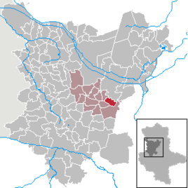
Location of Hohenwarsleben in the Börde district
|
|
Hohenwarsleben is a district of the municipality of Hohe Börde in the Börde district in Saxony-Anhalt .
geography
Hohenwarsleben is about 2 km northeast of Irxleben .
The following were identified as living spaces in the former municipality:
- Rest area
- Hohe Börde residential park (since 1994), around 900 residents now live there
history
Hohenwarsleben was first mentioned in a document in 1144.
On January 1, 2010, the previously independent communities of Hohenwarsleben, Ackendorf , Bebertal , Eichenbarleben , Groß Santersleben , Hermsdorf , Irxleben , Niederndodeleben , Nordgermersleben , Ochtmersleben , Schackensleben and Wellen merged to form the new community of Hohe Börde.
politics
A local constitution was introduced for the Hohenwarsleben district. The Hohenwarsleben local council consists of 7 members.
mayor
The last mayor of the Hohenwarsleben community was Wolf Graf von Westarp.
coat of arms
The coat of arms was approved on January 7, 1997 by the Magdeburg Regional Council.
Blazon : "In silver, a Benedictine monk in a black robe with a gold halo , in his right hand a gold-decorated red book, in the left holding a red crook with gold crooks."
The Benedictine monk stands for the power of the monasteries and their culture, even in feudal times. The landscape in the Börde was influenced by monasteries. Hohenwarsleben had a Benedictine church.
The colors of Hohenwarsleben are black and white.
The coat of arms was designed by Günther Gembalski .
Culture and sights
Buildings
- The St. Benedict Church is also used as a Protestant motorway church.
- The oldest house is a baroque half-timbered building from 1665 and is now a listed building as a former parsonage.
- The spontaneous wealth of the farmers in the 19th century created a number of so-called beet palaces in Hohenwarsleben . One of the best-renovated is the Im Winkel 1 building .
- Also noteworthy are the farms on Dahlenwarsleber Strasse with the fish ponds and in Karl-Marx-Strasse with the pigeon tower.
- The sunshine daycare center , which was built in 1999 and is run by the community, can accommodate around 120 children from Hohenwarsleben and the surrounding communities.
Economy and Infrastructure
economy
After the turnaround , Hohenwarsleben was able to successfully convert from agriculture to trade and commerce . Today there are an estimated 400 to 500 jobs in Hohenwarsleben. Hohenwarsleben has a generously developed industrial park at the gates of the Elbe Park . Numerous companies from the trades and services have settled here.
traffic
The place is crossed by the federal motorway 2 (west-east axis), the state road L47 (south-west-north-east axis) and the district road K115 (north-south axis). The federal motorway 2 (junction Irxleben / Hohenwarsleben) is at the end of the village. To the federal highway 1 , which connects Braunschweig with Magdeburg , it is approx. 3 km to the south. Hohenwarsleben is thus optimally connected to the road network.
Personalities
- Samuel Gottlieb Heine (1683–1746), Protestant pastor and chronicler
- Max Bösche , local poet, who has preserved traditional and contemporary aspects of village life for posterity with a wide range of imaginative stories in text, sketches and photographs
- Marcel Maltritz (* 1978), soccer player for the second division VfL Bochum


