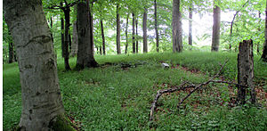
Hopfenberg (Rhoen)
| Hops mountain | ||
|---|---|---|
|
Höhenstein on the Hopfenberg summit |
||
| height | 491.5 m above sea level NHN | |
| location | near Schwarzenfels ; Main-Kinzig-Kreis , Hessen ( Germany ) | |
| Mountains | Rhön | |
| Coordinates | 50 ° 18 '7 " N , 9 ° 40' 32" E | |
|
|
||
| rock | Dolerite - basalt | |
The Hopfenberg near Schwarzenfels in the Hessian Main-Kinzig district is 491.5 m above sea level. NHN high and wooded mountain of the Rhön .
geography
location
The Hopfenberg is located in the Hessian Spessart Nature Park . The Sinn tributary, the Schmale Sinn , flows past to the west, roughly in a north-south direction , the upper valley of which at Mottgers separates the Rhön and Spessart low mountain ranges . The village of Schwarzenfels stretches from the south and south-west flanks of the mountain to the south in the direction of Güntershöfe , and to the north its landscape slopes down to Weichersbach . All of the named localities are districts of the Sinntal community . The neighboring mountain to the northeast is the Stiftes ( 567.7 m ) and the Escheberg ( 516.3 m ) to the southeast .
Natural allocation
The Hopfenberg belongs to the natural spatial main unit group Osthessisches Bergland (No. 35), in the main unit Vorder- und Kuppenrhön (353) and in the subunit Kuppenrhön (353.2) to the natural area Brückenauer Kuppenrhön (353.20), whereby in the west beyond the Schmalen Sinn the to the main unit group Odenwald, Spessart and Südrhön (14) and to the main unit Sandsteinspessart (141) belonging subunit Schlüchtern basin (141.6).
Schwarzenfels Castle
Schwarzenfels Castle, first mentioned in 1280 (approx. 427 m ) , sits enthroned on the southwest spur of Hopfenberg above the village of Schwarzenfels . Your core castle is in ruins, the stables and the clock tower at the entrance to the courtyard have been preserved.
Traffic and walking
State road 3180 runs south to south-east past the Hopfenberg and connects Mottgers in the west- south- west through Schwarzenfels with Züntersbach in the east-north-east. For example, starting on this street or on its side streets in Schwarzenfels, the mountain can be hiked on forest paths and paths. In the lower part of its western flank, the high-speed line Hanover – Würzburg runs above the Schmaler Sinn with the northern entry and exit of the 2.12 km long Schwarzenfelstunnel between Mottgers and Weichersbach .
Individual evidence
- ↑ a b Map services of the Federal Agency for Nature Conservation ( information )
- ↑ Brigitte Schwenzer: Geographical land survey: The natural space units on sheet 140 Schweinfurt. Federal Institute for Regional Studies, Bad Godesberg 1968. → Online map (PDF; 4.3 MB)

