Hundsheimer Mountains
| Hundsheimer Mountains | ||
|---|---|---|
|
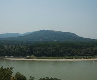
Hundsheimer Mountains from the northeast |
||
| Highest peak | Hundsheimer Berg ( 480 m above sea level ) | |
| location | Lower Austria , Burgenland | |
| part of | Carpathians or Eastern Alps (2921 to Trimmel ) | |
|
|
||
| Coordinates | 48 ° 8 ' N , 16 ° 56' E | |
| surface | 100 km² | |
The Hundsheimer Berge (also Hainburger Berge ) are a small group of mountains in the Pannonian Plain in Austria , on the Danube near Bratislava . The highest point is the Hundsheimer Berg with a height of 480 m above sea level. A.
Location and landscape
The mountains are in the east of Lower Austria . Geologically, they already belong to the Little Carpathians , from which they are separated by the Danube . This short breakthrough valley from the Marchfeld to the Hungarian lowlands is called the Hungarian , Theben or Hainburger gate . Orographically , they are therefore often placed facing the Alps after the significant valley line. The mountain range separates the Vienna Basin in the west and the Little Hungarian Plain (Kisalföld in Hungarian) in the east and connects to the foothills of the Eastern Alps via the Leithagebirge and the Rosaliengebirge . A small proportion of it extends as far as northern Burgenland .
The town of Hainburg and the communities of Hundsheim , Edelstal and Berg lie at the foot of the mountains, which cover almost 100 km² . The latter already borders on Slovakia with the Berg customs office ; it is only separated from Bratislava by the Danube.
The massif consists of crystalline and Permian-Mesozoic limestone and is therefore - provided it is part of the Alps - placed in the group of the Central Alps . It was separated from the original Danube by the Brucker breakthrough from the Leithagebirge and by the Hainburg breakthrough from the Western Carpathians, probably in several stages of switching back and forth, Bratislava is about 40 meters lower than the Parndorfer Platte , which is the cut in the former but today 300 meters deep.
The Hundsheimer Mountains form a wavy high plateau in the flatter eastern part, which is only overgrown with bushes or bare, while the Hundsheimer Berg is half wooded (Hainburg Forest). Limestone quarries lie on the edge of the mountain - above all the large Roman quarry on Pfaffenberg (which is partly controversial today for environmental reasons) , whose 120 m high limestone walls shape the view from the west and stand out from the dark Carpathians . The ridges of the mountains are partly made of mica slate and granite gneiss .
The southern end of the plateau is formed by the elongated Spitzerberg , the broad side of which appears like a table mountain and where there is almost always a updraft . The sports and glider airfield of the Spitzerberg flight school is located at its foot . It turns into the Blauenstein and the Steinberg .
The Braunsberg (346 m) and the Königswarte (344 m) rise to the east .
The plateaus of the mountains have a Pannonian flora , especially steppe and dry grasslands . Further west, similar species can be found again in the nature reserve of the Laaerberg near Vienna. Areas with an area of 193 hectares in the two communities of Hainburg and Hundsheim therefore belong to the Braunsberg-Hundsheimerberg nature reserve ( Lage ), as does the “ Spitzerberg ” nature reserve with 227 hectares. Parts of this are also Natura 2000 areas (see Natura 2000- Hundsheimer Berge area ).
literature
- G. Wessely: Geology of the Hainburger Mountains. In: Jahrbuch der Geologische Bundesanstalt , Vol. 104, 1961, pp. 273–349 ( full article , pdf, geologie.ac.at).
Web links
- LIFE project "Pannonian steppe and dry grasslands"
- The Hundsheimer Berge on Carpathian hikers
- The flora of the Hundsheimer / Hainburg mountains
Individual evidence
- ^ FFH area Hundsheimer Berge on the website of the Lower Austrian state government, accessed on February 12, 2017.

