Huveaune
| Huveaune | ||
|
The river at the old bridge of Saint Marcel (Marseille) |
||
| Data | ||
| Water code | FR : Y44-0400 | |
| location | France , Provence-Alpes-Cote d'Azur region | |
| River system | Huveaune | |
| River basin district | FRD Rhône | |
| source | in the municipality of Nans-les-Pins 43 ° 20 ′ 39 ″ N , 5 ° 45 ′ 29 ″ E |
|
| Source height | approx. 590 m | |
| muzzle | in the urban area of Marseille in the Mediterranean Coordinates: 43 ° 15 ′ 34 " N , 5 ° 22 ′ 24" E 43 ° 15 ′ 34 " N , 5 ° 22 ′ 24" E |
|
| Mouth height | 0 m | |
| Height difference | approx. 590 m | |
| Bottom slope | approx. 12 ‰ | |
| length | 48 km | |
| Right tributaries | Jarret | |
| Big cities | Marseille | |
| Medium-sized cities | Aubagne | |
| Small towns | Auriol , Roquevaire , La Penne-sur-Huveaune | |
|
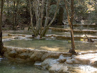
Sinter basin at the source of the river |
||
The Huveaune is a coastal river in France that runs in the Provence-Alpes-Côte d'Azur region . It rises on the north side of the Massif de la Sainte-Baume mountain range , in the municipality of Nans-les-Pins . The source is in the Grotte de Castelette rock cave , from which the water flows out through several sintering basins . The river initially drains in a north-westerly direction, but then turns south-west to west, reaches the heavily populated area in the greater Marseille area near Auriol , is accompanied from here by the A52 and A50 motorways , crosses the urban area of Marseille in the northeast and reaches overall 48 kilometers south of the city center, in the Saint-Giniez district , right by Parc Borély , the Mediterranean, where the beach at the mouth is named Plage de l'Huveaune after him . On its way, the Huveaune crosses the Var and Bouches-du-Rhône departments .
Places on the river
Hydrology
Since the water quality deteriorated due to the heavy settlement and industrialization on the river and the beach at the river mouth was polluted, a large part of the water flow has been diverted into the sewage treatment plant in the city of Marseille since 1986 and after treatment the water is discharged into the sea at Calanque Cortiou .
Attractions
- Source in the Grotte de Castelette
- Medieval bridge Pont-Peyrène , in the municipality of Roquevaire
See also
- List of French Mediterranean tributaries and their tributaries, from 36 km in length, sorted geographically

