Nans-les-Pins
| Nans-les-Pins | ||
|---|---|---|

|
|
|
| region | Provence-Alpes-Cote d'Azur | |
| Department | Var | |
| Arrondissement | Brignoles | |
| Canton | Saint-Cyr-sur-Mer | |
| Community association | Communauté de communes Sainte Baume-Mont Aurélien | |
| Coordinates | 43 ° 22 ' N , 5 ° 47' E | |
| height | 308-772 m | |
| surface | 47.99 km 2 | |
| Residents | 4,627 (January 1, 2017) | |
| Population density | 96 inhabitants / km 2 | |
| Post Code | 83860 | |
| INSEE code | 83087 | |
| Website | mairie-nanslespins.fr | |

Nans-les-Pins is a French municipality with 4627 inhabitants (at January 1, 2017) in the Var department in the region of Provence-Alpes-Cote d'Azur .
geography
The territory of the municipality includes two mountain formations: the Massif de la Sainte-Baume and the Mont Aurélien. The place lies in the middle of a triangle formed by the most important centers in the region: Aix-en-Provence is 45 kilometers to the northwest, Marseille 45 kilometers to the southwest and Toulon 65 kilometers to the south-southeast.
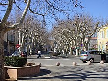
On the edge of the old town center there is a traditional Provencal square with a market every Sunday.
history
Dolmens , barrows and other Neolithic finds prove that the area was permanently inhabited from prehistoric times to around 650 BC. The Iron Age remnants of the oppidum of Sainte-Croix, which suggest a further 2 centuries of settlement from around 200 BC, do not follow seamlessly . Can prove at. The original name Nans comes from this time and goes back to the Celtic word for valley . ( Nans-les-Pins was first mentioned in 1920).
economy
tourism
Since 1932 Nans-les-Pins has been classified as an official station touristique . The place offers visitors a well-developed tourist infrastructure with a golf course, horse riding facilities and many hiking trails. A campsite with a holiday village as well as hotels and guest rooms are available for overnight stays.
Para-hospitalier
In the 1920s, pulmonologist Lucien Parrel set up a rehabilitation center for respiratory diseases in Nans-les-Pins. Originally the clinic was used to treat miners in the area who suffered from silicosis . Today she is visited by patients from all over France. The facility was supplemented by a senior citizens' home and centers for long-term therapy.
Agriculture
Agriculture has become much less important. There was significant rose production up until the beginning of the 20th century. Today there is essentially only viticulture and some vegetable growing.
Attractions
- The Miette wayside shrine , built in 1516, has been classified as a monument historique since 1938 . It is located on the Chemin des Roys towards the Massif de la Sainte-Baume.
- The fortified church of Chapelle Notre-Dame-de-la-Miséricorde was built in 1623.
- The Ligurian oppidum on the Roche de Sainte-Croix
- The wine cooperative Les Vignerons de Nans-les-Pins , built in 1913, is another monument historique.
- The bronze bell of the Saint-Sébastien-Saint-Laurent church is barely visible, but easy to hear . In 1992, the municipality also registered it as a Monument historique.
Town twinning
- Rabenau in Hesse


