
Jarret
|
Jarret Iarret |
||
|---|---|---|
.svg)
|
|
|
| region | Occitania | |
| Department | Hautes-Pyrénées | |
| Arrondissement | Argelès-Gazost | |
| Canton | Lourdes-2 | |
| Community association | Tarbes-Lourdes-Pyrénées | |
| Coordinates | 43 ° 5 ′ N , 0 ° 1 ′ W | |
| height | 439-855 m | |
| surface | 4.44 km 2 | |
| Residents | 320 (January 1, 2017) | |
| Population density | 72 inhabitants / km 2 | |
| Post Code | 65100 | |
| INSEE code | 65233 | |
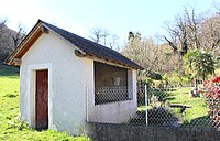
_1.jpg) Mairie Jarret |
||

Jarret ( Occitan : Iarret ) is a French commune with 320 inhabitants (as of January 1, 2017) in the Hautes-Pyrénées department in the Occitanie region (until 2015 Midi-Pyrénées ). The municipality belongs to the Arrondissement of Bagnères-de-Bigorre and the Tarbes-Lourdes-Pyrénées municipal association, founded in 2016 . The inhabitants are called Jarretois .
geography
_2.jpg)
The municipality of Jarret is located in Lavedan within the Bigorre landscape in the foothills of the Pyrenees , about 23 kilometers southwest of the city of Tarbes and four kilometers southeast of the pilgrimage site of Lourdes . The 4.44 km² municipal area of Jarret includes the high valleys of the Ruisseau de Lousourm and the Ruisseau d'Ayné , which unite in the village of Jarret to form the Rieutort river , which flows a few kilometers further into the Gave de Pau and those in the south of the municipality Summit of the foothills of the Pyrenees.
The highest peaks in the municipality of Jarret:
- Soum de Basta 855 m
- Soum de Caubi 829 m
- Le Coustala 811 m
- Pré Conques 705 m
- Montagne du Castet 651 m
About a third of the community area is forested. The municipality of Jarret includes the villages Jarret ( 460 m ), Lousourm ( 585 m , Occitan: Losorm ) and Ayné ( 595 m , Occitan: Ainèr ) as well as the hamlets of Carrères ( 430 m ), Lasbats ( 600 m ), Plaou ( 520 m ) and Léret ( 650 m ).
Jarret is surrounded by the neighboring communities of Lézignan in the north (point of contact), Les Angles in the northeast, Artigues in the east, Saint-Créac in the south and Lourdes in the west.
Place name
The place name A Ierret appeared for the first time in the Bigorre ( cartulaire de Bigorre ) published between 1200 and 1230 . This was followed by the spellings de Gereta (Latvian, 1342), Gerret (1429), Jerret (1736) and again Gerret (1738) and for the first time Jarret (1755 in a parish register), before finally with the appearance of the Cassini cards at the end of the 18th century. Century the still valid name Jarret prevailed. Probably the name comes from the distinctive 951 m high mountain Pic du Jer return of between Jarret and Lourdes and the summit of Lourdes with a funicular ( funiculaire is developed).
The name of the village Ayné first appeared in Latin as de Aynerio in 1342 and changed from Ayner (1429) to Ainé (1760) to Ayné (on the Cassini maps between 1770 and 1810).
Like Jarret, the name of the village Louzourm appeared for the first time in the Bigorre index (between 1200 and 1220) as A Lozorn . This name developed over de Lozornio (Latin, 1319), Lo Sorn and en loc deu Sorn (1429) and Lousour or Louzour (1737, 1788) to the Louzourm in use today .
Population development
| year | 1962 | 1968 | 1975 | 1982 | 1990 | 1999 | 2007 | 2016 |
|---|---|---|---|---|---|---|---|---|
| Residents | 132 | 121 | 132 | 184 | 225 | 219 | 300 | 312 |
Sources: Cassini and INSEE
Attractions
_1.jpg)
- Saint Martin Church in Jarret
- Saint-Roch church in Ayné
- Saint-Jean-Baptiste church in Louzourm
- three washing bays / wash houses ( lavoirs )
- two watermills
- Fallen memorial
- several hall and way crosses
- difficult to access grotto on Le Coustala mountain in the southwest of the municipality
- Churches in Jarret

Saint Martin Church

Saint-Roch church

Saint-Jean-Baptiste church
_1.jpg)
_1.jpg)
_1.jpg)
- Wash houses in Jarret


_1.jpg)
_3.jpg)
_4.jpg)
- Water mills in Jarret


_1.jpg)
_2.jpg)
Economy and Infrastructure
Agriculture dominates in Jarret. There are 13 farms in the community (cereal cultivation, horse, cattle, sheep, goat and poultry breeding). In addition, holiday homes and guest houses offer accommodation for the pilgrims of the nearby pilgrimage site of Lourdes .
The city of Lourdes, four kilometers away, is a local transport hub on the northern edge of the Pyrenees.
supporting documents
- ↑ Michel Grosclaude , Jean-Francois Le Nail : Dictionnaire toponymique des communes des Hautes-Pyrénées, Tarbes, Conseil Général des Hautes-Pyrénées. 2000, ISBN 2-9514810-1-2 ( Toponymic Dictionary of the Communes of the Hautes-Pyrénées ).
- ↑ Jarret on cassini.ehess.fr
- ↑ Jarret on insee.fr
- ↑ farms on annuaire-mairie.fr (French).
Web links
- Community homepage (French)
- Jarret at the presentation of the community association (French)
- Population statistics