Inja (whether)
|
Inja Иня |
||
|
The Inja the village Sarapulka (Rajon Moschkowo , near Gorny ) |
||
| Data | ||
| Water code | RU : 13010200612115200005288 | |
| location | Kemerovo Oblast , Novosibirsk Oblast (Russia) | |
| River system | If | |
| Drain over | Whether → Arctic Ocean | |
| source |
Kuznetsk Basin 54 ° 40 ′ 24 ″ N , 86 ° 46 ′ 10 ″ E |
|
| Source height | 300 m | |
| muzzle | in the south of Novosibirsk in the Ob Coordinates: 54 ° 59 ′ 39 ″ N , 82 ° 57 ′ 16 ″ E 54 ° 59 ′ 39 ″ N , 82 ° 57 ′ 16 ″ E |
|
| Mouth height | 93 m | |
| Height difference | 207 m | |
| Bottom slope | 0.31 ‰ | |
| length | 663 km | |
| Catchment area | 17,600 km² | |
| Discharge at the Berjosowka A Eo gauge : 17,300 km² Location: 35 km above the mouth |
MQ 1959/2000 Mq 1959/2000 |
47 m³ / s 2.7 l / (s km²) |
| Left tributaries | Kasma , Ur , Batschat | |
| Big cities | Leninsk-Kuznetsky , Novosibirsk | |
| Small towns | Polyssayevo , Toguchin , Promyshlennaya | |
|
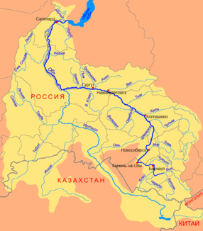
Course of the Inja (Иня) as the right tributary of the Ob in Novosibirsk (Новосибирск) |
||
The 663 km long Inja ( Russian Иня ) is a right tributary of the Ob in Siberia ( Russia , Asia ).
The Inja rises on a ridge in the central part of the Kuznetsk Basin at 300 m above sea level. NN , initially flows through the Kemerovo Oblast in mainly western directions, later the Novosibirsk Oblast , and finally flows into the Ob in the south of the city of Novosibirsk near the settlement Inskaja (at 93 m above sea level ).
The catchment area of the Inja covers 17,600 km². In the village of Berjosowka, about 30 km from the mouth, the mean water flow is 47.0 m³ / s (minimum in February with 8.6 m³ / s, maximum in May with 195 m³ / s). Near the mouth, the river is about 60 m wide, 1.5 m deep, the flow velocity is 0.2 m / s. The most important tributaries are from the left the Kasma ( Касьма ), Ur ( Ур ) and Batschat ( Бачат ).
The cities of Polyssajewo , Leninsk-Kuznetsky and Toguchin are located on the Inja . The river runs through a relatively densely populated area and is crossed by several railway lines (Novosibirsk - Barnaul , Novosibirsk Freight Bypass of the Trans-Siberian Railway , Jurga - Novokuznetsk ). In the valley of the river there are long stretches of railway line and part of the Novosibirsk - Novokuznetsk road.
The Inja freezes from early November to mid-April. Like the large tributaries, it can be used for logging when the water level is high.
Web links
Individual evidence
- ↑ a b Inja in the State Water Register of the Russian Federation (Russian)
- ↑ a b Article Inja in the Great Soviet Encyclopedia (BSE) , 3rd edition 1969–1978 (Russian)
- ↑ a b Inja at the Berjosowka gauge - hydrographic data at R-ArcticNET

