Isle of Mull
| Isle of Mull Eilean Muile |
|
|---|---|
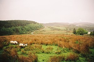
| The typical landscape of Mull in spring | |
| Waters | Atlantic Ocean |
| Archipelago | Inner Hebrides |
| Geographical location | 56 ° 27 ′ N , 6 ° 0 ′ W |
| surface | 875.35 km² |
| Highest elevation |
Ben More 966 m |
| Residents | 2800 (2011) 3.2 inhabitants / km² |
| main place | Tobermory |
| View of the main town Tobermory | |
Isle of Mull ( ) (also Mull for short ; Scottish Gaelic Eilean Muile or ) is an island in the Inner Hebrides off the northwest coast of Scotland , which belongs to the Council Area Argyll and Bute .
geography
The highest point on the island is Ben More, 966 meters high . The center of the island is Tobermory with 954 inhabitants (2011 census). A total of 2800 people lived on the island in 2011.
geology
The entire island is the result of prolonged erosion over the past 30 to 40 million years. It consists mostly of basalt . Especially on the south coast, the basalt forms steep cliffs, and rock gates, the Carsaig Arches , were created on the coast by erosion .
The aluminosilicate mullite , an important raw material in the ceramic industry, was named after the island of Mull, as the mineral was first discovered here in 1924.
history
Microliths show that mull was found around 6000 BC. BC ( Mesolithic ) was settled. During the Stone Age or Bronze Age, the residents built the stone forts Dun Ara and An Sean Dun, stone circles ( Loch Buie stone circle ), stone rows ( Baliscate ) and erected more than a dozen cairns ( Port Donian ) and menhirs ( Glengorm ). Two brochs were created in the Iron Age . Later the castles and palaces Aros Castle , Ardtornish Castle , Calgary Castle , Duart Castle , Glengorm Castle , Moy Castle and Torosay Castle followed .
In the 14th century, Mull became part of the Lordship of the Isles . After the collapse of the Lordship in 1493, rule of the island was taken over by the MacLean clan , who resided in Duart Castle . In 1681 he was replaced by the Campbells clan . During the clearings in the 18th and 19th centuries, the number of residents fell from 10,000 to under 4,000.
Infrastructure
In the meantime, Mull is a well-developed island for tourists and a stopover for many pilgrims who come to Iona via Mull . From the ferry ports in Craignure and Fishnish ride buses across the island. The roads are mostly single-track roads .
Mull is accessible by ferry from Oban , Lochaline and Ardnamurchan . From Mull there are ferries to Iona and excursion boats to the small island of Staffa . From 1983 to 2010 the miniature Isle of Mull Railway was in operation between Craignure and Torosay Castle .
economy
The whiskey distillery Tobermory Distillery , which was founded in 1798, is known nationwide . It has been renamed, closed and reopened several times over the years. In 1983 it was bought by Burn Stewart Distillers Ltd. and has been working continuously ever since. It produces whiskeys under the Tobermory and Ledaig brands . Whiskey brand Ledaig are peated and accordingly have a very smokey flavor, the Tobermory , however, is ungetorft.
Personalities born here
- Lachlan Macquarie , Governor of the British Colony of New South Wales
literature
- Alastair de Watteville: The Isle of Mull. Tranquility & spectacular Beauty in the Inner Hebrides. Romsey Fine Art, Romsey 1994, ISBN 0-9521517-1-5 .
- Argyll: An Inventory of the Monuments Volume 3: Mull, Tiree, Coll & Northern Argyll (excluding the Early Medieval and later monuments of Iona). Royal Commission on the Ancient and Historical Monuments of Scotland [1980], ISBN 0-11-491591-1


