Jerup
| Jerup | ||||
|
||||
| Basic data | ||||
|---|---|---|---|---|
| State : |
|
|||
| Region : | North Jylland | |||
| Region : | North Jylland | |||
|
Municipality (since 2007) : |
Frederikshavn | |||
| Coordinates : | 57 ° 33 ' N , 10 ° 26' E | |||
|
Population : (2020) |
584 | |||
| Postal code : | 9981 Jerup | |||
| Website: | www.jerup.net | |||
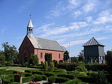
 The Church of Jerup |
||||
Jerup is a village with 584 inhabitants (as of January 1, 2020) about 12 kilometers northwest of Frederikshavn in Denmark . It is located directly on the Kattegat and is surrounded by heathland . Jerup is part of the municipality of Frederikshavn in the Nordjylland region .
The village developed through the construction of the Frederikshavn – Skagen railway line and the neighboring state prison.
The church of Jerup is worth seeing .
Individual evidence
- ↑ a b Statistics Banks -> Befolkning og valg -> BY1: Folketal January 1st efter byområde, alder og køn (Danish)
Web links
- Website of the municipality (Danish)

