
Vărădia Castle
| Vărădia Castle | |
|---|---|
| Alternative name |
a) Arcidava , b) Argidava , c) Arcidaba |
| limes | Dacian Limes |
| section | A / II-III / 9 |
| Dating (occupancy) | traian |
| Type | Cohort fort |
| unit | Cohors I Vindelicorum civium Romanorum milliaria equitata (?) |
| size | rectangular facility with rounded corners, a) 214 × 132 m (?) b) 154 × 172 m (= 2.6 ha) |
| Construction |
a) wood and earth fort, b) stone fort |
| State of preservation | The fence is visible in the area |
| place | Vărădia |
| Geographical location | 45 ° 4 '45.8 " N , 21 ° 33' 4.2" O |
| Previous | Banatska Palanka Castle (southeast) |
| Subsequently | Tibiscum Fort (northwest) |


Findings sketch of the stone fort
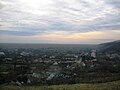
View of the village of Vărădia, photo from 2005


The Vărădia fort was a Roman auxiliary troop camp and part of the fortress chain of the Dacian Limes (limes Daciae / Province Dacia Superior or later Dacia Apulensis ) in the Banat countryside , Vărădia municipality, Caraș-Severin district, Romania .
The garrison of the fort secured the Roman main road Lederata - Tibiscum . Its area has been relatively little explored, investigations were carried out in 1901 by Felix Milleker, 1930 by Grigore Florescu, from 1985 to 1990 under Eugen Iaroslavschi and 1997 to 2002 under Ovidiu Bozu and Eduard Nemeth. The finds from the facilities discussed here are now in the Institutul de Archeology in Bucharest , in the Narodni Muzej of Vršac (Werschetz) and in the Muzeul Judecean Caras Severin in Reșița (Reschitz).
location
The fort is located about 200 m southeast of the village of Vărădia , directly at the confluence of the Vărădia brook into the Caraș river. The site is also known under the field names "Cetate" (= castle) and "Rovină". In the area, the fortification is still clearly visible today as a square elevation.
development
Argidava ( Greek Ἀργίδαυα ) was originally a Dacian fortress town near the Danube, which was founded by the Albocensians . The fort was built in the reign of Trajan (101-102 AD), probably under the name Arcidava . In Ptolemy's it is mentioned as Argidava , in the Tabula Peutingeriana as Arcidaba . Due to its geographical location, the Banat was one of the main entrance gates to the Dacian provinces for the Romans. One of these connections to the Danube Limes was the road to Tibiscum that ran past the fort and started from Lederata in Mösischen . When building this road, the Romans adhered exactly to the topographical conditions and laid the route on the outer edge of the hill country and a plain.
Fort and vicus
During the excavations in the 20th century, a total of two construction phases could be identified:
So far, only its approximate size is known of the wood-earth fort, 214 × 132 m (?), Which largely coincided with the following stone fort. The stone fort was designed by its builders in the classic manner of the early and middle imperial era as a rectangular complex with rounded corners (playing card shape). It covered an area of 154 × 172 m and was surrounded by a 7.50 m wide and 2.50 m deep pointed ditch. The defensive wall was 1.10 m wide and raised using the opus incertum technique. It was broken through by four gates, each of which was flanked by two trapezoidal gate towers protruding slightly outwards. The flank towers of the north gate, the porta praetoria , measured 4.65 × 8.40 m, those of the south gate, the porta decumana , 2.80 × 8.50 m and those of the west gate, the Porta principalis sinistra , 3.15 × 8 , 50 m. The passage through the gates was around 8.80 m wide. Of all the gate structures, only the one on the northern front was equipped with two passages, which were separated by a central pillar (spina) .
Only the remains of the headquarters, the so-called principia , and of two camp streets , the via praetoria (nine meters wide) in the retentura ( pre- camp ) and the via principalis ( nine meters wide) in the retentura could be seen of the interior development. 3.45 m wide) can be observed. The Principia had a rectangular floor plan and measured 32.50 × 37.50 m. They were equipped with an inner courtyard ( atrium , 18.60 × 30 m) and a vestibule ( basilica , 9.50 × 30 m). The flag sanctuary (sacellum) was located at the rear of the building and was flanked on both sides by two smaller chambers.
In the vicinity of the fort, traces of an extensive camp village ( vicus ) were also found .
garrison
It is not known which unit provided the fort's crew; Based on the discovery of a bronze tablet, it is assumed that the Raetian Cohors prima Vindelicorum civium Romanorum milliaria equitata (the first cohort of the Vindelics , with Roman citizenship, 1000 men, partly mounted) was stationed here until 106 or 111/118, before moving to Tibiscum was relocated.
Limes course (road post) between Fort Vărădia and Fort Mehadia
The crews of the forts listed below probably also had priority to monitor the Lederata - Tibiscum road connection .
| Surname | Description / condition | Illustration |
|---|---|---|
| Vrsac Castle | The fort area is located in the area of the city of Vrsac , autonomous province of Vojvodina , in Serbia .
The remains of the fort are located directly under the central park, field names "Cetate" or "Dealul Cetäcii". Scientific excavations have not yet been carried out. Presumably it was a legionary and auxiliary fort, due to some small finds it is assumed that it was founded in the 2nd century AD. Some brick stamps and inscription finds suggest the presence of soldiers from the Legio IIII Flavia Felix , the Legio VII Claudia , the Legio XIII Gemina and two contingents of auxiliary troops: the cohors II Hispanorum and a cavalry unit, the ala I Tungrorum Frontiana . |
|
| Surducul Mare Castle | The fort is located around 1.5 km south of the village of Surducul Mare, on a low terrace east of the Ciornovet stream, Forotic municipality, Caras-Severin district on Romanian territory.
Its area is also known by its field names "Rovinä" and "Progadie". The place is listed in the Tabula Peutingeriana as Centum Putei . The remains of the fence can still be seen as a slight elevation in the terrain. The site has been little explored so far, from 1964 to 1968 Dumitru Protase carried out some investigations. The fort dates from the occupation period in the early 2nd century AD and seems to have been abandoned around 118 AD, as only one construction phase could be determined. It was built using the wood and earth technique and had a square plan measuring 128 × 132 m with rounded corners. The fence consisted of a double wall, each surrounded by one or two pointed trenches.
The camp was probably built by members of the Legio IIII Flavia Felix , as the finds of brick temples of this legion suggest. |
|
| Berzovia Castle | Today the fort is located directly below the center of the village of Berzovia, on a terrace on the banks of the Brzava, protected from floods, in the Caras-Severin district on Romanian territory.
Its area is known by the field name "Jidovin", the fence is still clearly visible. The place is mentioned in the Tabula Peutingeriana as Bersobis . The site was investigated in two excavation campaigns in the 20th century: 1960 to 1964 by Dumitru Protase and Volker Wollmann, 1968 to 1970 by Marius Moga, Flores Medelec and Richard Petrovsky. The single-phase and 410 × 490 m large wood and earth fort dates from the Trajan period and was abandoned after 114. The crew provided the Legio IIII Flavia Felix , which is attested by several brick stamps. In 1783 Johann Georg Hoffinger discovered an ancient building with several rooms that could be heated by hypocausts in the immediate vicinity of the camp. The largest of them had an apse and a step-shaped basin, probably the remains of the fort bath (balineum) . |
|
| Färliug Castle | His remains are north of the village of Färliug, Caras-Severin district, on Romanian territory.
Probably also a wood and earth fort from the early 2nd century AD. In ancient times the place was known as Aizizis . The site is completely unexplored. The remnants of the fence (110 × 30 m) can still be seen as a slight elevation in the terrain and formed an irregular rectangle with north-south long sides, which was roughly aligned with the cardinal points. A gate opening can still be seen on the Siegfried Line. The occupation unit stationed here is not known. |


Monument protection
- Romania: The entire archaeological site and in particular the castle are protected as historical monuments according to Law No. 422/2001 passed in 2001 and are included in the national list of historical monuments ( Lista Monumentelor Istorice with the LMI code CS-IsA-10892 ) entered. Responsible is the Ministry of Culture and National Heritage (Ministerul Culturii şi Patrimoniului Naţional), in particular the General Directorate for National Cultural Heritage, the Department of Fine Arts and the National Commission for Historical Monuments and other institutions subordinate to the Ministry. Unauthorized excavations and the export of ancient objects are prohibited in Romania.
- Serbia: The protection of archaeological objects and zones has top priority and is regulated by the Monument Protection Act (Official Gazette SG RS, 71/94) defined in 1994 with its subsequent amendments and additions as well as by special decrees. The Serbian Monuments Office in Belgrade, which is part of the Ministry of Culture, is responsible. Research and targeted collection of finds are subject to authorization. The damage and destruction of archaeological finds and sites must be reported to the authorities within 24 hours. No antiquities may be taken out of the country without consulting the Serbian Monument Authority. Offenses are punished as criminal acts according to Serbian law. Checks are to be expected when entering the European Union.
See also
literature
- Nicolae Gudea : The Dacian Limes. Materials on its story . In: Yearbook of the Roman-Germanic Central Museum Mainz. 44, 2 (1997), pp. 27-28. PDF .
- Doina Benea: The economic activity in the village branches between Theiss, Marosch and Danube. In: Studia Antiqua et Archaeologica 9 (2003), pp. 299-318 PDF .
further reading
- Nicolae Gudea: Limesul Daciei romanc de la Traianus la Aurelianus. In: Acta Musei Porolissensis 1 (1977), p. 109.
- Nicolae Gudea: The Limes Dakiens and the defense of the Upper Moesian Danube line from Trajan to Aurelian. In: Rise and Fall of the Roman World . Part II, Volume 6. de Gruyter, Berlin / New York 1977, ISBN 3-11-006735-8 , p. 871 (list of military camps) .
- Felix Milleker : Délmagyarország régiségleletei a honfoglalás előtti idökböl. (The archaeological finds of southern Hungary before the time of the conquest.) Temeschburg 1899, p. 245.
- Felix Milleker: History of the royal free city of Werschetz , Volume 1, Budapest 1886, pp. 16-17.
- Vasile Christescu: Istoria militara a Daciei romane. (Military history of Dacia in Roman times), Fundatia Regele Carol I, Bucharest 1937, pp. 137–140.
- Alexandru Borza: Banatul ín timpul Romanilor, Monografii despre raporturile dintre Italieni şi Români , (The Banat in Roman times), Varzi, Timişoara 1943, pp. 63–64.
- Grigore Florescu: Revue roumaine d'archéologie et d'histoire ancienne , Istros I, Bucharest 1934.
- Walter F. Wagner: The dislocation of the Roman auxiliary formations in the provinces of Noricum, Pannonia, Moesia and Dacia from Augustus to Gallienus. Junker & Dünnhaupt, Berlin 1938. p. 198, p. 124–126, 208–209.
- Dumitru Tudor: Tabula Imperii Romani : Bucarest. Drobeta-Romula-Sucidava. Académie de la République Socialiste de Roumanie, Bucharest 1969 (parts of sheets K-34, K-35, L-34, L-35), here: TIR L 34, pp. 48-51.
- Milutin V. Garašanin, Draga Garašanin: Archaeological (prehistoric) finds in Serbia , Belgrade, 1951, pp. 217–218.
- Dumitru Protase : Castrul roman de la Orheiul - le camp romain , in: Studii şi cercetări de istorie veche. Academia Republicii Populare Romîne , 18 (1967), p. 67 ff.
- Gábor Teglas: Tanulmányok a rómaiak daciai aranybányászatáról , in: Pest.-Magyar Tudományos Akadémia. Értekezések a történettudományi osztály köréből, köt. 14, Budapest 1897, pp. 28-32.
- Eduard Nemeth, Aurel Rustoiu, Horea Pop: Limes Dacicus Occidentalis, the fortifications in western Dacia before and after the Roman conquest , Cluj-Napoca, Editura Mega, 2005, ISBN 973-7867-33-5
- Ovidiu Bozu: Catalogul pieselor romane di daco-romane din colectia Muzeului Banatului Montan, Catalog of the roman and dacian-roman age collection of the Mountainous Banat Museum , 2008.
Web links
- Location of the forts in Romania on Google Earth
- Arcidava (Romanian)
- Dacia și Pannonia Inferior în cadrul evenimentelor din anii 107-108, Prof. dr. Bogdan Muscalu (PDF; 717 kB)
Remarks
- ^ Route / section / fort number (based on Nicolae Gudea , 1997).
- ↑ List is from SE to NW.
Individual evidence
- ↑ Grumeza, Ion: Dacia. Land of Transylvania, Cornerstone of Ancient Eastern Europe . Hamilton Books, Lanham 2009, ISBN 978-0-7618-4465-5 , p. 13.
- ^ Geographia , 3, 8, 4.
- ↑ Segmentum IV, 14.
- ↑ Benea 2003, p. 300.
- ↑ Nicolae Gudea: 1997, p. 26.
- ↑ AE 1935, 109 = Inscriptiones Daciae Romanae III 1, 110 a: coh (ortis) I / Vindelico (rum) / Iuli Mar / tialis / | (centuria) Clemen (tis) .
- ↑ Gudea 1997, p. 27.
- ↑ Gudea 1997, p. 28.
- ↑ Tabula Peutingeriana VII, 3.
- ↑ Gudea 1997, p. 28.
- ↑ Tabula Peutingeriana VII, 3.
- ↑ Gudea 1997, pp. 29-30.
- ↑ Florin Medelet: Contributii la istoria inceputurilor Muzeuli din Resita , In: Banatica 15, 2000, p. 14.
- ↑ Gudea 1997, p. 30.
- ↑ List of historical monuments on the website of the Ministry of Culture and National Heritage
- ↑ The official regulations on the website of the Serbian Monument Protection Office ( Memento from October 1, 2012 in the Internet Archive ) (in Serbian).
Banatska Palanka Castle (Translederata) | Dupljaja Castle | Grebenac Castle | Vărădia Castle (Arcidava) | Vršac Castle | Surducul Mare Castle (Centum Putei) | Berzovia Castle (Bersobis) | Fort Fârliug (Aizis)