Kitai-gorod
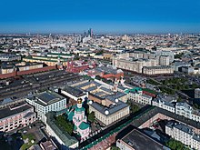
Kitai-Gorod ( Russian Кита́й-го́род ; ) is a historic district in the center of the Russian capital Moscow . It is one of the oldest areas in the city and is home to numerous listed buildings, some of which date back to the 16th and 17th centuries. Kitai-Gorod, which administratively belongs to the Tverskoi district of the Central District of Moscow, begins immediately east of Red Square and extends to the Lubyanka and adjacent squares and in the south to the banks of the Moscow River .
Kitai-Gorod is also the name of a subway station built in 1971 (see below in the subway station section ), which is located on the eastern edge of the district.
history
The name Kitai-Gorod is often mistakenly translated as Chinatown by city visitors , as Kitai (see Cathay ) means China and Gorod city in modern Russian . In fact, the name of the neighborhood has nothing to do with China. There are several versions of its origin, for example that Kitai should come from the word Katay , which in some Turkic languages means something like fortress. Some historians suggest that Kitai derives from the word kit , which was used to describe tied wooden beams that were used in the construction of protective walls.
The first settlements existed on the area of today's Kitai-Gorod before the city was founded in 1147. The location of the area not far from the Moscow Kremlin led to the settlement and development of the district very quickly after the city was founded. As early as the 14th century, today's Kitai-Gorod was predominantly settled by craftsmen and merchants; Numerous wooden houses and churches were built there, and today's Red Square was used as a marketplace. In the 14th century, the suburb burned down several times during Lithuanian and Tatar raids and was completely rebuilt each time. In order to better protect the settlement from attacks, a protective wall was built around it in the 16th century, which was supplemented a few years later by a stone wall up to nine meters high. A small part of this wall has been preserved to this day at the eastern end of the quarter, but none of the original 14 wall towers is left.
Secured behind the protective wall, Kitai-Gorod flourished as a business district from the 16th century. In addition to numerous houses of traders and master craftsmen, inns, numerous churches and four monasteries as well as foreign embassies were built here. Business activity increasingly played such an important role in the quarter that by the 19th century there were hardly any residential areas left in the quarter, as they were displaced by countless shops, offices and banks. Around Kitai-Gorod and the Kremlin was the historic district of Bely Gorod , which from 1593 was also surrounded by a defensive wall.
After the October Revolution and the subsequent nationalization of all shops and banks, Kitai-Gorod lost its importance as a business district within a few years. In the 1930s, parts of the district began to be demolished in the course of rebuilding Moscow. First, the old city wall including the towers was dismantled down to three small sections in order to be able to widen the adjacent streets. A large number of churches were also destroyed, the rest nationalized and misused. In the 1960s, almost the entire residential area of Sarjadje between Varwarka Street and the Moskva River was demolished in the course of the construction of the Hotel Rossija . Despite the demolitions, Kitai-Gorod is of great historical importance for Moscow to this day, as a large number of architectural monuments have been preserved and restored. Since the 1990s, Kitai-Gorod has regained importance as an administrative and business district.
Attractions
GUM department store
→ Main article: GUM department store
The GUM department store emerged from the upper trading rows, which existed immediately to the east of Red Square as early as the 18th century and which already underlined the importance of the district as an important marketplace. The current GUM building between Red Square, Nikolskaya Street, Wetoschny Street and Ilyinka Street was built between 1890 and 1893 based on a design by Alexander Pomeranzew and represents one of the most important monuments of Russian architecture of the late 19th century After the Communists came to power, it was nationalized and closed for a long time. Today, the GUM is once again one of the most important and noble temples of consumption in Moscow.
Nikolausstrasse
Nikolausstrasse ( Никольская улица ) runs from the Nikolausturm of the Kremlin on Red Square north of the GUM to Lubyanka Square and is now mainly a shopping street. Historically, it forms the northern border of Kitai-Gorod and for a long time was the beginning of the route from Moscow to Rostov , Suzdal and Vladimir . The name is derived from the Nikolaus monastery from 1330, which stood here until it was destroyed in 1935. From 1935 to 1994, after the date of the October Revolution , it was called October 25th Street ( У́лица 25 Октября́ ).
Today's sights in Nikolausstrasse and the adjacent streets include: The Theophany Church ( Хра́м Богоявле́ния ) from the late 17th century, which was the center of the Theophany Monastery, which was demolished in 1929; the former synod printing works (1810–1814), which had been replaced by the very first Russian printing works in 1564, in which Ivan Fyodorov printed the first precisely dated book in Russian; the baroque Spassky Cathedral ( Спа́сский собо́р ) from the early 18th century; the house number 7–9 (1821–1826) of the famous city architect Joseph Bové , in whose place the first university in Russia stood from 1687 until it burned down in 1812 - the Slavic-Greco-Latin Academy, forerunner of today's seminary in the Trinity Monastery of Sergiev Posad .
Ilyinka Street
Ilyinka Street ( У́лица Ильи́нка ) is the central street of the district and was first mentioned in writing at the end of the 14th century. Then as now it is a shopping street; Especially in the 19th century there was a lot of trade here, as the so-called upper and lower trading rows stretched on both sides of the street. Some side streets still bear the names of the earlier trading rows , such as the Fischgasse ( Ры́бный переу́лок ) instead of the fishmonger's rows . In Soviet times , from 1935 to 1994, the Ilyinka Kuibyshev Street was called ( У́лица Ку́йбышева ).
The most famous structures that have survived to this day are: The Lower Trading Ranks (1830, Joseph Bové ), known today as Gostiny Dwor ( Гости́ный двор , not to be confused with the Gostiny Dwor department store in St. Petersburg) and used as an exhibition hall; the Moscow Stock Exchange building from 1836–1839; also a number of administrative buildings such as the Russian Constitutional Court , the Ministry of Finance and the Supreme Court of the Russian Federation.
Zaryadye and Varvarka streets
Although this area immediately north of the banks of the Moscow River suffered most from the demolitions during the Soviet era, Warwarka Street ( У́лица Варва́рка ) is still one of the most architecturally interesting streets in central Moscow. The street starts south of St. Basil's Cathedral and runs to Slavyanskaya Square, where the Kitai-Gorod metro station is located. From 1933 to 1994 the street was called Rasin Street ( У́лица Ра́зина ), because in 1671 the insurgent Stenka Rasin was led exactly along the Varwarka to his execution on Red Square. The street used to form the northern border of the Zaryadye ( Заря́дье ) district, which largely disappeared in the 1960s with the construction of the Hotel Rossija and will be rebuilt as a business district in the near future, after the hotel has already been demolished.
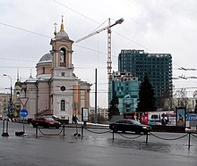
On the Varvarka you can find one of the oldest preserved buildings in Moscow outside the Kremlin, the so-called English Court ( Англи́йский двор ) from the 16th century, which served as the English embassy until the middle of the 17th century and now houses a museum, which was in attendance in 1994 was opened by Queen Elizabeth II and sheds light on the history of Russian-English relations. The Znamensky Church ( Храм Знаме́ния Бо́жией Ма́тери ) of the former Znamensky monastery, which was demolished in the 1960s, as well as the former house of the boyar family of the Romanovs , who ruled Russia from 1613 to 1917, date from the 17th century posed. Since 1859 and to this day, a museum belonging to the Romanov family has been located in this building. The street is named after St. Barbara , in whose honor a church was built here at the beginning of the 19th century, which also stands to this day.
Kitai-Gorod Metro Station
The metro station Kitai Gorod of Moscow Metro is located right below the Slavyanskaya Square between the mouths of the Varvarka and Iljinka. It was put into operation on January 3, 1971 and was called Ploshchad Nogina ( Площадь Ногина , literally Nogin Square) until November 5, 1990 . Although two metro lines intersect here, namely the Kalushsko-Rishskaya line, line 6 and the Tagansko-Krasnopresnenskaya line, line 7 , the station is to be regarded as a single subway station due to the design. It consists of two parallel central platform halls at the same depth , which are connected to one another by transitions above the tracks. The two tracks of the western platform are served by trains on the Kalushsko-Rishskaya line (line 6) to the south and the Tagansko-Krasnopresnenskaya line (line 7) to the south-east, while trains on the eastern platform of the Kalushsko-Rishskaya line (line 6) Head north and trains on the Tagansko-Krasnopresnenskaya Line (Line 7) stop north-west. This constellation gives passengers at Kitai-Gorod station the option of changing between the two lines on the same platform, provided that the direction of travel is maintained (otherwise the platform must be changed via the connecting corridor to which stairs lead in the middle of the two halls).
The two platform halls are located 29 meters below the surface and each have two entrances equipped with escalators , via which one leads into widely branched pedestrian underpasses at both ends of Slavyanskaya Square and from there directly to the historic streets Varwarka, Soljanka, Ilyinka and Marosseika arrives. Despite their symmetrical arrangement to each other and the simultaneous commissioning, the two platform halls differ architecturally in a certain way. The western hall is in three parts with two rows of ten-sided ("harmonica-like") pylons , which, like the outer walls, are clad with light marble. The color tones of the eastern hall are also characterized by white marble, but the shape of the pylons here make a more asymmetrical, “crystal-like” impression, and the rows of pylons close at the top with a cornice made of a copper-colored cornice that is also stylized as crystal due to the characteristic facets Frieze strips made of aluminum. Both halls share an arched vault between the rows of pylons, with the lights in the west hall arranged in rows directly on the vault, while in the east hall they are hidden behind the cornices.
See also
Web links
- http://moscow.gramota.ru/map501.shtml (Russian)
- Basic information about the subway station (Russian, English )
| Previous station | Moscow Metro | Next station | ||
|---|---|---|---|---|
|
Turgenevskaya ← Medvedkovo |
Kalushsko-Rishskaya line |
Tretyakovskaya Novoyassenevskaya → |
||
| Previous station | Moscow Metro | Next station | ||
|---|---|---|---|---|
|
Kuznetsky Most ← Planernaya |
Tagansko-Krasnopresnenskaya Line |
Taganskaya Wychino → |
||
Coordinates: 55 ° 45 ' N , 37 ° 37' E


