Krabbendijke
 flag |
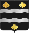
 coat of arms |
| province |
|
| local community |
|
|
Area - land - water |
15.73 km 2 15.66 km 2 0.07 km 2 |
| Residents | 4,365 (Jan 1, 2017) |
| Coordinates | 51 ° 26 ' N , 4 ° 7' E |
| Important traffic route |
|
| prefix | 0113 |
| Postcodes | 4411, 4413-4416, 4675 |
| Location of Krabbendijke in the municipality of Reimerswaal | |
Krabbendijke is a place in the southern Dutch province of Zeeland with 4,365 inhabitants and an area of 15.73 km² (as of January 1, 2017). In 1970 the previously independent municipality became a district of the newly created large municipality Reimerswaal on the Zuid-Beveland peninsula .
The place is only three to four kilometers wide on the peninsula between the Oosterschelde in the north and the Westerschelde in the south. Bergen op Zoom is 13 kilometers northeast, the Belgian port city of Antwerp 30 kilometers southeast and Middelburg 35 kilometers west-northwest (all distances as the crow flies to the respective city center).
The next motorway exits are a few kilometers away at Rilland in the east and Kruiningen in the west on the Dutch motorway 58 ( E312 ). The Station Krabbendijke is located about three kilometers east between Krabbendijke and Rilland at Stationsbuurt at the Zeeuwse Lijn to Vlissingen . There are nationally important airports near Antwerp and Rotterdam .
Web links
Individual evidence
- ↑ a b Kerncijfers wijken en buurten 2017 Centraal Bureau voor de Statistiek , accessed on April 7, 2018 (Dutch)


