Laranjeiras (Sergipe)
| Município de Laranjeiras "Atenas sergipana"
Laranjeiras
|
|||
|---|---|---|---|
|
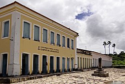
Historic city center
|
|||
|
|
|||
| Coordinates | 10 ° 48 ′ S , 37 ° 10 ′ W | ||
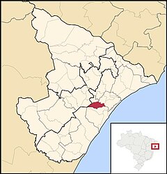
 Location of the municipality in the state of Sergipe Location of the municipality in the state of Sergipe
|
|||
| Symbols | |||
|
|||
|
Motto "Não parar, semper subir" not stop 'climb further |
|||
| founding | August 7, 1832, town charter (188 years) | ||
| Basic data | |||
| Country | Brazil | ||
| State | Sergipe | ||
| ISO 3166-2 | BR-SE | ||
| height | 9 m | ||
| Waters | Rio Cotinguiba | ||
| climate | tropical, As | ||
| surface | 162.3 km² | ||
| Residents | 26,902 (2010) | ||
| density | 165.8 Ew. / km² | ||
| estimate | 29,826 (July 1, 2019) | ||
| Parish code | IBGE : 2803609 | ||
| Telephone code | (+55) 79 | ||
| Time zone | UTC −3 | ||
| Website | laranjeiras.se (Brazilian Portuguese) | ||
| politics | |||
| City Prefect | Paulo Hagenbeck (2017-2020) | ||
| Political party | DEM | ||
| economy | |||
| GDP | 926,217 thousand R $ 31,186 R $ per person (2017) |
||
| HDI | 0.642 (medium) (2010) | ||
Laranjeiras , officially Portuguese Município de Laranjeiras , pronunciation [laɾɐ̃ˈʒejɾɐʃ] , is a city in northeastern Brazil. It is located in the state of Sergipe , had 26,902 inhabitants at the 2010 census and an area of around 162 km². The population was estimated on July 1, 2019 at 29,826 inhabitants, who are called Laranjeirens ( laranjeirenses ). It is located about 19 km from Aracaju , the capital of the state.
history
The town was granted town charter on August 7, 1832, but the first settlements went back to around 1530. The city has a listed historical center and architectural remains from the time of the Jesuits.
Other attractions are numerous caves.
geography
Surrounding places are Riachuelo , Areia Branca , Nossa Senhora do Socorro , São Cristóvão , Maruim and Santo Amaro das Brotas . The Rio Cotinguiba River flows through the city.
The biome is Mata Atlântica . Between the towns of Itabaiana and Laranjeiras lies the Parque Nacional Serra de Itabaiana (Serra de Itabaiana National Park), founded in 2005 , in which Laranjeiras has 2.67% of the area.
sons and daughters of the town
- Cândido Aragonez de Faria (1849–1911), caricaturist, illustrator and journalist
- Horácio Hora (1853–1890), painter
- João Ribeiro (1860–1934), writer and painter
- Elicarlos (* 1985), football player
- Joelinton Lima Santos (* 1993), called Mansur , football player
Web links
- City Prefecture website and citizens' portal, Prefeitura Municipal. (Brazilian Portuguese).
- City Council website, Câmara Municipal. (Brazilian Portuguese).
- Laranjeiras - panorama. In: cidades.ibge.gov.br. IBGE (Brazilian Portuguese, updated statistics).
Individual evidence
- ↑ Climate Laranjeiras: Weather, average temperature, weather forecast for Laranjeiras. In: climate-data.org. de.climate-data.org, accessed on May 17, 2020 .
- ↑ a b c Laranjeiras - Panorama. In: cidades.ibge.gov.br. IBGE , accessed May 17, 2020 (Brazilian Portuguese).
- ^ Christiane Donato: Caracterização dos Impactos Ambientais de Cavernas do Município de Laranjeiras, Sergipe . In: Caminhos de Geografia . tape 12 , no. 40 . Uberlândia 2011, p. 243-255 ( academia.edu ).
- ↑ Parna Serra de Itabaiana. In: gov.br. Instituto Chico Mendes de Conservação da Biodiversidade , accessed May 17, 2020 (Brazilian Portuguese).
- ↑ Parque Nacional Serra de Itabaiana - Plano de Manejo. Brasília 2016, p. 2 [PDF; 18.8 MB].


