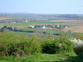
Layon
| Layon | ||
|
The valley of the Layon in Chaudefonds-sur-Layon |
||
| Data | ||
| Water code | FR : M5-0200 | |
| location | France , Nouvelle-Aquitaine regions and Pays de la Loire | |
| River system | Loire | |
| Drain over | Loire → Atlantic Ocean | |
| source | in the municipality of Saint-Maurice-la-Fougereuse, 47 ° 2 ′ 1 ″ N , 0 ° 28 ′ 7 ″ W |
|
| Source height | approx. 120 m | |
| muzzle | at Chalonnes-sur-Loire , in the Loire coordinates: 47 ° 21 '2 " N , 0 ° 45' 16" W 47 ° 21 '2 " N , 0 ° 45' 16" W |
|
| Mouth height | approx. 15 m | |
| Height difference | approx. 105 m | |
| Bottom slope | approx. 1.2 ‰ | |
| length | 90 km | |
| Catchment area | 950 km² | |
| Drain at the Saint-Lambert-du-Lattay gauge |
MQ |
4 m³ / s |
| Left tributaries | Hyrôme , Lys , Jeu | |
| Reservoirs flowed through | Étang de Beaurepaire | |
| Small towns | Chalonnes-sur-Loire | |
The Layon is a river in France that has its source in the Nouvelle-Aquitaine region and runs largely in the Pays de la Loire region . Its source is located in the municipality of Saint-Maurice-la-Fougereuse . The river initially drains to the northeast, then turns in a northwest direction and after 90 kilometers flows into the Loire as a left tributary at Chalonnes-sur- Loire . On its way, the Layon crosses the Deux-Sèvres and Maine-et-Loire departments .
Viticulture
The Chenin vines for the Coteaux-du-Layon , but also for the Chaume , the Quarts-de-Chaume and the Bonnezeaux wine grow on the slopes of the Layon Valley .
Places on the river
- Cléré-sur-Layon
- Nueil-sur-Layon
- Concourson-sur-Layon
- Faveraye-Mâchelles
- Thouarcé
- Rablay-sur-Layon
- Beaulieu-sur-Layon
- Saint-Aubin-de-Luigné
- Chaudefonds-sur-Layon
- Chalonnes-sur-Loire
Web links
Commons : Layon River - collection of pictures, videos and audio files
Remarks
- ↑ a b geoportail.fr (1: 16,000)
- ↑ a b The information on the length of the river is based on the information about the Layon at SANDRE (French), accessed on November 26, 2011, rounded to full kilometers.
- ↑ a b Banque Hydro - M5222010 Le Layon à Saint-Lambert-du-Lattay (menu item: Synthèse)
