
Lhuntse (District)
| Lhuntse District | |
|---|---|
  |
|
| Basic data | |
| Country | Bhutan |
| Capital | Lhuntse |
| surface | 2881 km² |
| Residents | 16,354 (2012) |
| density | 5.7 inhabitants per km² |
| ISO 3166-2 | BT-44 |
 |
|
Coordinates: 27 ° 42 ' N , 91 ° 0' E
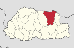
Lhuntse ( ལྷུན་ རྩེ་ རྫོང་ ཁག་ ), formerly Lhuntshi , is one of 20 Dzongkhag (districts) of Bhutan . It has an area of 2881 km² and 16,354 inhabitants. It includes 2506 households. Located in the north-east of the country, Lhuntse is one of the least developed districts of Bhutan. The main town is called Lhuntse of the same name .
Lhuntse is divided into 8 Gewogs :
- Gang to Weighed
- Jaray Weighed
- Khoma Weighed
- Kurtoe Weighed
- Menbi Weighed
- Metsho Weighed
- Minjay Weighed
- Tsenkhar Weighed
Web links
Commons : Lhuntse District - Collection of images, videos and audio files

Bumthang | Chukha | Dagana | Gasa | Haa | Lhuntse | Mongar | Paro | Pemagatshel | Punakha | Samdrup Jongkhar | Velvet | Sarpang | Thimphu | Trashigang | Trashiyangtse | Trongsa | Tsirang | Wangdue Phodrang | Zhemgang