List of bridges over the Glatt
The list of bridges over the Glatt , a Swiss tributary of the Rhine (the entire course of which lies in the canton of Zurich ), contains the bridges and other crossings from the source at the outflow from the Greifensee to the confluence at Rheinsfelden in the Upper Rhine .
| image | Surname | place | function | location | Remarks | |
|---|---|---|---|---|---|---|

|
Glattwehr pedestrian walkway with stairs | Schwerzenbach - Fällanden | Old regulation weir with dam and fishing platform | cards | Transition is not handicapped accessible
Fishing is only allowed from the weir towards the lake |
|

|
Footbridge with stairs | Schwerzenbach - Fällanden | Footpath | cards | trail
Transition is not handicapped accessible |
|

|
Glattbrücke Fällandenstrasse | Schwerzenbach - Fällanden | Three-lane road bridge (separate bus lane in the direction of Fällanden) with pavement | cards | Object 197-001
Top speed 80 km / h Skatingland Route 72 : Greifensee Skate, Greifensee – Maur – Greifensee |
|

|
Chimlibach pedestrian steel bridge | Schwerzenbach - Fällanden | Foot and bike path | cards | Opened in 2008 (gift from Hans-Rudolf Erzberger to the Schwerzenbach community )
Built by Schneider Stahlbau Jona |
|

|
Hermikon pedestrian boardwalk | Dübendorf - Fällanden | Footpath | cards | Object 191-301
trail |
|

|
Glattsteg (Buenstrasse) | Dubendorf | Single lane road bridge | cards | Historic steel lattice girder bridge
Maximum weight 8 t Veloland Route 29 : Glatt Route, Stage 2 Zurich (Schwamendingen) –Rapperswil trail |
|

|
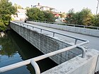
Faachweg wooden bridge | Dubendorf | Foot and bike path | cards | Object 191-302
Opened in 1978, renovated in 1985 trail |
|
|
Im Chreis Bridge | Dubendorf | Foot and bike path | cards | trail | |

|
Old mill weir | Dubendorf | Old regulating weir | cards | ||

|
Wooden footbridge over the Glatt-Oberwasser Canal | Dubendorf | Footpath | cards | Opened in 2012
Built by the civil defense in Dübendorf |
|

|
Obere Mühle Steg over the Glatt Canal | Dubendorf | Footpath | cards | ||

|
Upper mill water wheel on the Glatt Canal | Dubendorf | Water wheel with bridge | cards | The water wheel that still exists today was built in 1834. In 1962 the mill was shut down for financial reasons. | |

|
Usterstrasse bridge | Dubendorf | Two-lane road bridge with sidewalks | cards | Top speed 50 km / h
trail |
|

|
Glattpark Bridge | Dubendorf | Foot and bike path | cards | Opened in 2017 | |

|
Glattbrücke Bahnhofstrasse | Dubendorf | Two-lane road bridge with sidewalks | cards | Opened in 2017, replaced bridge from 1916
Top speed 50 km / h Veloland Route 45: Wyland – Downtown , Stage 2 Winterthur – Zurich |
|

|
Memphis footbridge | Dubendorf | Foot and bike path | cards | ||
|
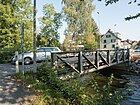
Dübendorfer Glattbrücke (Wallisellenstrasse) | Dubendorf | Single lane road bridge | cards |
Historic 1886 steel girder bridge, moved here in 1916
Maximum speed 50 km / h, maximum weight 12 t (excluding public transport) |
|
|
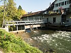
Birchlen-Mühle weir with wooden footbridge | Dubendorf | Old regulating weir | cards | ||

|
Upper Givaudan Bridge | Dubendorf | Private road bridge | cards |
|
|

|
Lower Givaudan Bridge | Dubendorf | Private road bridge | cards |
|
|
|
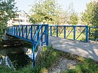
Breitibach Bridge | Dubendorf | Foot and bike path | cards | Object 191-202
Replaced Manfi Boardwalk, the 2009 by the Civil Defense Dübendorf was built Maximum weight 10.5 t |
|

|
Glattalbahn tram bridge | Dubendorf | Double-track tram bridge (line 12) | cards | Opened in 2010 | |
|
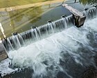
Pouring weir threshold | Dubendorf | Regulating weir with fish ladder | cards | ||

|
Glattbrücke Ringstrasse | Dubendorf | Five-lane road bridge with sidewalks | cards | Object 191-010
Top speed 50 km / h trail |
|

|
Glattbrücke overland road | Dubendorf | Four-lane road bridge with sidewalks | cards | Object 191-009
Top speed 60 km / h trail |
|

|
Glattbrücke Zwicky area | Dubendorf | Pedestrian and bicycle path (restricted road traffic) with 24 pipes below the road | cards | Steel arch bridge, built 2013/14
|
|

|
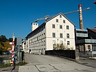
SBB railway viaduct | Dubendorf | Three-track railway bridge | cards | Object 191-024 | |
|
Zwickystrasse bridge | Wallisellen - Dübendorf | Two-lane road bridge with a separated sidewalk | cards | ||

|
Neugut Glatt tunnel | Dubendorf | tunnel | cards | ||

|
Motorway A1 "Aus-Einfahrt 65" ramps bridges | Wallisellen - Dübendorf |
|
cards | Objects 191-001, 191-002 | |

|
Glattweg Bridge | Zurich-Schwamendingen | Foot and bike path | cards |
Bridges No. 12F / W08 (Civil Engineering Office of the City of Zurich) Opened in 1968 |
|
|
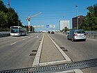
New Winterthurerstrasse bridge | Wallisellen - Zurich-Schwamendingen |
|
cards | Top speed 60 km / h | |

|
Pedestrian bridge (under Hauptstrasse 1) | Zurich-Schwamendingen | Foot and bike path | cards | ||

|
Luchswiesen Park Bridge | Zurich-Schwamendingen | Pedestrian and bicycle path with a public park | cards |
|
|

|
Weststrasse bridge | Wallisellen - Zurich-Schwamendingen | Three-lane road bridge with sidewalk | cards | Object 069-012
Top speed 60 km / h trail |
|
|
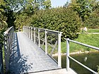
Glattstegweg bridge | Wallisellen - Zurich-Schwamendingen | Foot and bike path | cards | Bridges No. 12F / W02 (Civil Engineering Office of the City of Zurich)
Opened in 1898 Built by Schneider Stahlbau Jona |
|

|
A1L motorway "Aus-Einfahrt 64" ramps bridges | Wallisellen - Zurich-Schwamendingen |
|
cards | Object 069-007 (Aubrugg Viaduct) | |

|
Aubrugg Bridge (under the A1L motorway) | Zurich-Schwamendingen | Foot and bike path | cards | Replaced old bridge
Veloland Route 29 : Glatt Route, Stage 1 Glattfelden (Rheinsfelden) –Zürich (Schwamendingen) trail |
|

|
Pipeline bridge | Zurich-Schwamendingen | District heating pipeline | cards | ||

|
Aubruggstrasse bridge (south) | Zurich-Schwamendingen | Four-lane road bridge with sidewalk | cards | Top speed 50 km / h | |

|
Aubruggweg bridge | Zurich-Schwamendingen | Two-lane road bridge with sidewalk | cards |
Top speed 30 km / h |
|

|
Aubruggstrasse bridge (north) | Zurich-Schwamendingen | Two-lane road bridge | cards | Top speed 50 km / h | |

|
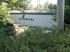
SBB stone arch bridge | Zurich-Schwamendingen | Double track railway bridge | cards | Top speed 125 km / h | |
|
Andreasstrasse bridge | Zurich-Schwamendingen | Foot and bike path | cards | At this point there was once a covered wooden bridge (built in 1810)
Veloland Route 29 : Glatt Route, Stage 1 Glattfelden (Rheinsfelden) –Zürich (Schwamendingen) |
|

|
Hagenholzstrasse bridge | Opfikon-Glattbrugg | Two-lane road bridge with sidewalks | cards | trail | |

|
Glattalbahn tram bridge | Opfikon-Glattbrugg | Double-track tram bridge (lines 11 and 12) | cards | Opened in 2006 | |

|
Aubrugg | Opfikon-Glattbrugg | Foot and bike path | cards | Covered arched wooden bridge, opened July 2, 2016 | |

|
Zunstrasse bridge | Opfikon-Glattbrugg | Two-lane road bridge with sidewalk | cards | Object 0066-03
Top speed 60 km / h |
|

|
A1 / A4 motorway bridges | Opfikon-Glattbrugg |
|
cards | Object 066-002 | |

|
A51 motorway bridges (south) | Opfikon-Glattbrugg |
|
cards | Object 066-013
Top speed 100 km / h |
|

|
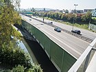
Glattbrücke Opfikon-Oberhausen | Opfikon-Glattbrugg | Pedestrian and bicycle path (limited traffic) | cards | Prestressed concrete trapezoidal frame bridge, built 1956
|
|
|
A51 motorway bridges (north) | Opfikon-Glattbrugg |
|
cards | Object 066-016 | |

|
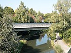
Thurgauerstrasse bridge | Opfikon-Glattbrugg | Three-lane road bridge with sidewalk | cards | Object 066-036
Top speed 60 km / h |
|
|
A51 motorway exit ramp 9 bridge | Opfikon-Glattbrugg |
|
cards | Object 066-017
Top speed 60 km / h |
|

|
Schulstrasse bridge | Opfikon-Glattbrugg | Two-lane road bridge with sidewalks | cards | Object 066-018
Top speed 50 km / h |
|

|
Bruggwiesen Bridge (East) | Opfikon-Glattbrugg | Foot and bike path | cards | Object 066-303 | |

|
Bruggwiesen Bridge (West) | Opfikon-Glattbrugg | Foot and bike path | cards |
Maximum weight 8.5 t |
|
|
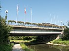
Schaffhauserstrasse bridge | Opfikon-Glattbrugg |
|
cards | Object 066-027
Top speed 50 km / h Skatingland Route 3 : Mittelland Skate, stage 5 Kloten (airport) –Brugg |
|

|
In the pipe wooden bridge | Opfikon-Glattbrugg | Footpath | cards | ||

|
SBB bridge (airport line) | Opfikon-Glattbrugg | Double track railway bridge | cards | Top speed 105 km / h | |

|
SBB bridge (main line) | Opfikon-Glattbrugg | Double track railway bridge | cards | Top speed 105 km / h | |
|
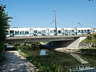
Glattalbahn tram bridge | Opfikon-Glattbrugg | Double-track tram bridge (lines 10 and 12) with pavement | cards | Opened in 2008 | |
|
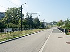
Flugofstrasse bridge | Opfikon-Glattbrugg | Single-lane road bridge (south-west to Rümlang ) with sidewalk | cards | Opened in 2008
Top speed 50 km / h |
|

|
Birchstrasse bridge | Opfikon-Glattbrugg | Three-lane road bridge (two lanes in the direction of Zurich-Seebach) | cards | Object 066-040
Top speed 60 km / h |
|

|
Schützenhaus bridge | Opfikon-Glattbrugg | Foot and bike path | cards | Object 066-201
Veloland route 5: Mittelland route , stage 3 Kloten – Aarau |
|

|
Glattbrücke Rümlang | Rümlang | Pedestrian and bicycle path (limited traffic) | cards | Object 097-301
Covered timber frame bridge was originally in Oberglatt (created in 1767 by Johannes Grubenmann ; was moved 4.5 km upstream in 1950)
Maximum weight 3.5 t, maximum height 2.9 m Veloland Route 29 : Glatt Route, Stage 1 Glattfelden (Rheinsfelden) –Zürich (Schwamendingen) |
|

|
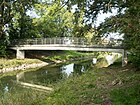
New Rohrstrasse bridge | Rümlang | Two-lane road bridge with pavement and bus stop | cards | Object 097-198
Top speed 80 km / h |
|
|
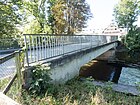
Rüebisbach Bridge | Rümlang | Footpath | cards | ||
|
Klotenerstrasse bridge | Rümlang | Two-lane road bridge with sidewalk | cards |
Top speed 50 km / h Skatingland Route 44 : Airport – Glatttal Skate, Kloten (airport) –Bülach – Glattfelden – Kloten (airport) Wanderland Route 892: Airport circular route, Kloten, Zurich Airport – Kloten, Zurich Airport |
|

|
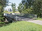
Glattbrücke Eberhard | Rümlang | Single-lane road bridge (connection to the airport area for rescue vehicles) | cards | Object 097-015
|
|
|
Schorenweg Bridge | Rümlang | Single lane road bridge with sidewalk | cards |
Wanderland Route 892: Airport circular route, Kloten, Zurich Airport – Kloten, Zurich Airport |
|

|
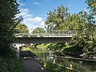
Hirschenbrücke Oberglatt | Oberglatt | Two-lane road bridge with sidewalks | cards | Object 092-303
Covered wooden bridge, opened December 16, 1993 Skatingland Route 44 : Airport – Glatttal Skate, Kloten (airport) –Bülach – Glattfelden – Kloten (airport) Veloland Route 29 : Glatt Route, Stage 1 Glattfelden (Rheinsfelden) –Zürich (Schwamendingen) trail |
|
|
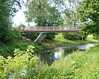
Bülachstrasse bridge | Oberglatt | Two-lane road bridge with sidewalks | cards | Object 092-001
Top speed 50 km / h |
|
|
Forbuckstrasse bridge | Oberglatt | Two-lane road bridge (only shuttle service permitted) with sidewalks | cards | Object 092-202
Veloland Route 29 : Glatt Route, Stage 1 Glattfelden (Rheinsfelden) –Zürich (Schwamendingen) trail |
|

|
SBB bridge | Niederglatt | Three-track railway bridge (two main lines and one freight line) | cards | Object 089-001
Top speed 125 km / h |
|

|
Grafschaftstrasse arch bridge | Niederglatt | Two-lane road bridge with sidewalks | cards | Object 089-201
Top speed 50 km / h |
|

|
Lütisburger covered wooden bridge | Niederglatt | Foot and bike path | cards | Opened in 1990 | |

|
Eichi Bridge | Niederglatt | Foot and bike path | cards | ||

|
Rütiwiesenstrasse bridge | Niederglatt | Single lane road bridge with sidewalk | cards | Object 089-202
T-beam bridge Top speed 50 km / h Veloland Route 29 : Glatt Route, Stage 1 Glattfelden (Rheinsfelden) –Zürich (Schwamendingen) trail |
|

|
Wehntalerstrasse bridge | Oberhöri | 348.1 Two-lane road bridge with sidewalk | cards | Object 060-007
Top speed 50 km / h trail |
|

|
Schulhausstrasse bridge | Niederhöri | Two-lane road bridge with separate foot and bike path bridge | cards | Object 060-202
Historic steel girder bridge, built in 1925 Top speed 50 km / h Veloland Route 29 : Glatt Route, Stage 1 Glattfelden (Rheinsfelden) –Zürich (Schwamendingen) Veloland Route 60 : Studenland-Töss-Römer-Route, Stage 1 Koblenz – Bülach trail |
|

|
Glattbrücke Jakobstal | Hochfelden | Single lane road bridge | cards | Object 059-302
Maximum speed 80 km / h, maximum weight 8 t trail |
|

|
Jakobstal bridge spinning mill | Bülach - Hochfelden | Abandoned private dirt road bridge | cards | Historic truss bridge
The area of the former Jakobstal spinning mill is completely fenced in with lattice barriers and is no longer accessible to private individuals. The cotton mill was built in 1863 and closed in 1982. |
|

|
Glattuferweg bridge | Hochfelden | Single lane road bridge | cards | Object 059-201
Opened in 1979
Skatingland Route 44 : Airport – Glatttal Skate, Kloten (airport) –Bülach – Glattfelden – Kloten (airport) Veloland Route 29 : Glatt Route, Stage 1 Glattfelden (Rheinsfelden) –Zürich (Schwamendingen) trail |
|

|
Bülacherstrasse bridge | Hochfelden | Two-lane road bridge with sidewalk | cards | Object 059-003
trail |
|

|
Zieglen Bridge | Bülach - Hochfelden | Single lane road bridge | cards | Object 059-202
Opened in 1980
Skatingland Route 44 : Airport – Glatttal Skate, Kloten (airport) –Bülach – Glattfelden – Kloten (airport) Veloland Route 29 : Glatt Route, Stage 1 Glattfelden (Rheinsfelden) –Zürich (Schwamendingen) trail |
|

|
Chellerhalsstrasse bridge | Bulach | Two-lane road bridge with sidewalks | cards | Object 053-201
Opened in 1993 Skatingland Route 44 : Airport – Glatttal Skate, Kloten (airport) –Bülach – Glattfelden – Kloten (airport) Veloland Route 29 : Glatt Route, Stage 1 Glattfelden (Rheinsfelden) –Zürich (Schwamendingen) trail |
|

|
Hundigsteg bridge | Glattfelden | Single lane road bridge | cards |
|
|

|
Schachen Bridge | Glattfelden | Two-lane road bridge with sidewalks | cards | Object 058-201
Created 1979 Skatingland Route 44 : Airport – Glatttal Skate, Kloten (airport) –Bülach – Glattfelden – Kloten (airport) Veloland Route 29 : Glatt Route, Stage 1 Glattfelden (Rheinsfelden) –Zürich (Schwamendingen) trail |
|

|
Hegsten Bridge | Glattfelden | Single lane road bridge with sidewalks | cards | Object 058-302
Covered arch timber bridge, built in 1980, replaced steel girder bridge in 1860 trail |
|

|
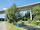
Hauptstrasse 7 bridge | Glattfelden |
|
cards | Top speed 50 km / h | |
|
Letten Viaduct | Glattfelden |
|
cards | Object 058-004
Top speed 120 km / h |
|

|
Spinnerei-Lettenstrasse bridge | Glattfelden | Two-lane road bridge | cards |
|
|
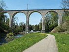
|
SBB viaduct | Glattfelden | Single-track railway bridge | cards | Top speed 95 km / h | |

View from the Glatt to the Rhine
View of the confluence with the Rhine |
Eglisau-Glattfelden power plant Glatt tunnel | Rheinsfelden | Tunnel flows into the Upper Rhine | cards | The tunnel is 261 meters long |
Web links
Individual evidence
- ↑ Schwerzenbach-Online.ch. Retrieved April 14, 2018 .
- ^ Line ZH 1033 Section 1: Glattsteg. (PDF) Federal inventory of historical traffic routes in Switzerland (IVS), accessed on January 14, 2020 .
- ^ Line ZH 1042, section 1: Glattbrücke. (PDF) Federal inventory of historical traffic routes in Switzerland (IVS), accessed on January 14, 2020 .
- ↑ Manfi bridge, Dübendorf (ZH). In: Swiss Timber Bridges. Retrieved May 15, 2018 .
- ^ Glattbrücke Zwicky area (Wallisellen, 2014). Structurae, October 10, 2016, accessed January 14, 2020 .
- ↑ Aubruggbrücke, Zurich, Schwamendingenstrasse (circle 12) (ZH). In: Swiss Timber Bridges. Retrieved April 17, 2018 .
- ^ Aubrugg, Schwamendingen (ZH). In: Swiss Timber Bridges. Retrieved May 15, 2018 .
- ↑ AUBRUGG. Retrieved April 17, 2018 .
- ^ Glattbrücke Opfikon-Oberhausen (Opfikon, 1956). Structurae, November 27, 2017, accessed January 14, 2020 .
- ↑ Glattbrücke Grubenmann Bridge, Rümlang (ZH). In: Swiss Timber Bridges. Retrieved May 15, 2018 .
- ^ Line ZH 425, Section 1: Glattbrücke Rümlang 1767. (PDF) Federal Inventory of Historic Traffic Routes in Switzerland (IVS), accessed on January 14, 2020 .
- ↑ Hirschenbrücke, Oberglatt (ZH). In: Swiss Timber Bridges. Retrieved May 15, 2018 .
- ^ Glattbrücke, Niederglatt (ZH). In: Swiss Timber Bridges. Retrieved May 15, 2018 .
- ^ Line ZH 470: Niederhöri. (PDF) Federal inventory of historical traffic routes in Switzerland (IVS), accessed on January 14, 2020 .
- ^ Line ZH 486: Jakobstal. (PDF) Federal inventory of historical traffic routes in Switzerland (IVS), accessed on January 14, 2020 .
- ↑ Hegstenbrücke, Glattfelden (ZH). In: Swiss Timber Bridges. Retrieved May 16, 2018 .
- ↑ Hegstenbrücke (Glattfelden, 1979). Structurae, October 4, 2002, accessed January 14, 2020 .
