List of geotopes in the Herzogtum Lauenburg district
This sortable list contains the geotopes of the Duchy of Lauenburg district in Schleswig-Holstein . It contains the official designations for names and numbers as well as their geographical location (as of 2015).
| Geotope number | Object number geotope potential area | Surname | Geotope type | Municipality / city | Coordinates | image | comment |
|---|---|---|---|---|---|---|---|
| You 037 | Inland dunes Besenhorster sand mountains | Dune , drift sand area | Geesthacht | 53 ° 26 ′ 36 " N , 10 ° 19 ′ 45" E | |||
| Fl 003 | Grinau basin clay area | Glazy surface element | |||||
| Kl 054 | Elbe riverside Börnsen - Geesthacht - Lauenburg (3 individual areas) | cliff | |||||
| Kl 055 | Kliff Stecknitz - Delvenau (7 individual areas) | cliff | |||||
| Qp 009 | Saale complex : Besenhorst | Exposure | |||||
| Qp 010 | Eem warm period : peat near Kuhgrund / Lauenburg (2 individual areas) | Exposure | |||||
| Te 001 | Miocene clays with whale finds, Gross Pampau | Exposure | Great Pampau | 53 ° 31 '45.2 " N , 10 ° 33' 43.2" E | |||
| Te 003 | Miocene brown coal sands Besenhorst | Exposure | |||||
| Mon 029 | Moraine Groß Grönau - Groß Sarau | moraine | |||||
| Mon 033 | Moraine east of Geesthacht | moraine | |||||
| Mon 034 | Segrahner Berg moraines | moraine | Gudow | 53 ° 33 ′ 0 ″ N , 10 ° 49 ′ 0 ″ E | |||
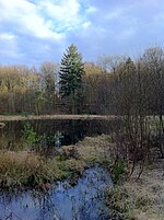
| Mr 007 | Vibrating lawns Grundlos Kolk near Mölln | moor | Mölln | 53 ° 37 '28 " N , 10 ° 42' 17.4" E |

|
||
| Mr 011 | Kesselmoor Schwarzsee with remaining lake | moor | Loam rade | 53 ° 33 '57 .7 " N , 10 ° 43' 40.7" E | |||
| Ni 015 | Niedertau landscape near Hevenbruch | Ice crumbling landscape | |||||
| Ni 016 | Niedertau landscape near Ritzerau | Ice crumbling landscape | |||||
| Os 015 | Os on the Ratzeburg lake | Os | |||||
| Os 019 | Os Farchau | Os | |||||
| Os 027 | Os near Ritzerau | Os | |||||
| Os 031 | Os Book Mountain | Os | |||||
| Ta 009 | Bachtal near Krümmel | Valley shape | |||||
| Ta 021 | Farchau valley / Küchensee - Wennsöhlengrund - Mölln | Valley shape | |||||
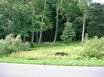
| Ta 022 | Dalbek Gorge near Escheburg / Börnsen (2 individual areas) | Valley shape | Escheburg , Börnsen | 53 ° 28 ′ 18 " N , 10 ° 17 ′ 42" E |

|
||
| Ta 026 | Einhaus - Fredeburg Valley | Valley shape | |||||
| Ta 030 | Breakthrough valley of the Bäk near Mechow | Valley shape | 53 ° 42 '40.4 " N , 10 ° 47' 0.3" E | ||||
| Ta 033 | Billetal between Mühlenrade and Bergedorf | Valley shape | 53 ° 33 ′ 23 " N , 10 ° 19 ′ 26" E | The Billetal is located in both the Duchy of Lauenburg and Stormarn | |||
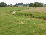
| Ta 040 | Bistal near Escheburg | Valley shape | Kröppelshagen-Fahrendorf , Escheburg | 53 ° 28 ′ 4 " N , 10 ° 20 ′ 12" E |

|
||
| Tu 018 | Valley of the Bille between Grande and Mühlenrade | Tunnel valley | 53 ° 36 '11.2 " N , 10 ° 25' 21.3" E | ||||
| Tu 019 | Valley of the Mühlenbach and Steinau from Duvenseerwall via Nusse to Hammer | Tunnel valley | |||||
| Do 020 | Mölln, Gudower Seenrinne | Tunnel valley | |||||
| Do 021 | Stecknitz-Delvenau valley with side valleys (Elbe-Lübeck Canal) | Tunnel valley | 53 ° 25 ′ 53 " N , 10 ° 37 ′ 4" E |

|
See also
- List of nature reserves in the Herzogtum Lauenburg district
- List of landscape protection areas in the Herzogtum Lauenburg district
- List of natural monuments in the Herzogtum Lauenburg district
source
- Geotope list planning area III. (PDF, 303 KB) Geological Service in the State Office for Agriculture, Environment and Rural Areas of the State of Schleswig-Holstein, May 2015, accessed on August 1, 2015 .
Web links
Commons : Geotopes in the Herzogtum Lauenburg district - collection of images, videos and audio files