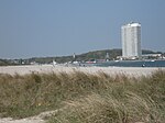
List of geotopes in the city of Lübeck
This sortable list contains the geotopes of the independent city of Lübeck in Schleswig-Holstein . It contains the official designations for names and numbers as well as their geographical location (as of 2015).
| Geotope number | Object number geotope potential area | Surname | Geotope type | District (s) | Coordinates | image | comment |
|---|---|---|---|---|---|---|---|
| Dr 007 | Drumlins at Gut Roggenhorst (2 individual areas) | Drumlin , drum-lined landscape | Lübeck-St. Lorenz North | 53 ° 51 '47.6 " N , 10 ° 35' 35.9" E | On Roggenhorst see also Lübeck-Schönböcken | ||
| You 035 | Inland dunes south of Eicholz / Lübeck (2 individual areas) | Dune , drift sand area | Lübeck-St. Gertrud | 53 ° 50 ′ 16 " N , 10 ° 44 ′ 40.8" E | The Lübeck part of the Herrenburger inland dune in the Mecklenburg nature reserve Wakenitzniederung ? | ||
| Fl 004 | Basin clay area Reecke, ice edge Weichsel ice age | Glazy surface element | Lübeck-Moisling | 53 ° 49 '51.1 " N , 10 ° 35' 26.2" E | |||
| Kl 026 | Vistula ice age cliff: Brodtener Ufer | cliff | Lübeck-Travemünde | 53 ° 58 ′ 56 " N , 10 ° 52 ′ 52" E |

|
||
| Kl 033 | Cliff Dummersdorfer Ufer | cliff | Lübeck-Kücknitz | 53 ° 55 '6.4 " N , 10 ° 51' 58.2" E |

|
||
| Ni 011 | Dummersdorf Niedertau landscape | Ice collapse landscape | Lübeck-Kücknitz | 53 ° 55 '16 " N , 10 ° 51' 16.8" E | |||
| Os 012 | Os system from Waldhusen-Kücknitz | Os | Lübeck-Kücknitz | 53 ° 55 '30.7 " N , 10 ° 48' 32.6" E | |||
| St 016 | Beach walls Priwall | Beach wall | Lübeck-Travemünde | 53 ° 57 '23.5 " N , 10 ° 53' 29" E |

|
The beach walls extend as far as Mecklenburg-Western Pomerania | |
| Ta 031 | Grienau brook valley south of Lübeck | Valley shape | Lübeck-Moisling | 53 ° 49 '50.4 " N , 10 ° 37' 9.6" E |
See also
- List of nature reserves in the city of Lübeck
- List of landscape protection areas in the city of Lübeck
- List of natural monuments in the city of Lübeck
source
- Geotope list planning area III. (PDF, 303 KB) Geological service in the State Office for Agriculture, Environment and Rural Areas of Schleswig-Holstein, May 2015, accessed on July 23, 2015 .
Web links
Commons : Geotopes in Lübeck - Collection of images, videos and audio files