
Lübeck-Kücknitz
|
Kücknitz
City of Lübeck
Coordinates: 53 ° 54 ′ 50 ″ N , 10 ° 48 ′ 0 ″ E
|
|
|---|---|
| Area : | 24.6 km² |
| Residents : | 18,771 (Jan. 26, 2016) |
| Population density : | 763 inhabitants / km² |
| Postal code : | 23569 |
| Area code : | 0451 |
 Location of the Kücknitz district in Lübeck with the names of the city districts
|
|
Kücknitz is the ninth of ten districts in Lübeck .
location
Kücknitz is located north of the Trave , northeast of the center of Lübeck between the other districts of St. Gertrud and Schlutup in the south, St. Lorenz North in the southwest and Travemünde in the northeast. Is reachable Kücknitz from Lübeck center by the toll Herrentunnel or via highways A 1 and A 226 .
District structure
Kücknitz consists of the four districts of Lübeck :
- 27: Dänischburg / Siems / Rangenberg / Wallberg
- 28: Herrenwyk
- 29: Alt-Kücknitz / Dummersdorf / Roter Hahn
- 30: Pöppendorf
The district of Kücknitz is surrounded by a lot of forest, landscape and nature reserves and you are close to the Trave and the Baltic Sea .
Population structure
The population structure largely corresponds to the Lübeck average. The share of unemployed in the population is slightly above the average of Lübeck, as is the percentage of residents with other than German citizenship .
history
In the vicinity of Pöppendorf are the Neolithic Pöppendorfer stone grave and the Wagrian Pöppendorfer ring wall .
In 1715 a wood bailiff took up his duties in the Waldhusener forest. In 1765 the forest house Waldhusen was built, which is considered to be the oldest residence and office of a forester in Germany.

In July 1945 the British military government set up the Pöppendorf camp in the Waldhusener Forest near the Kücknitz train station as an internment camp for members of the Wehrmacht . From November 1945 it was used as a transit camp for German refugees from the eastern regions. With a total of over 500,000 refugees from the east during the existence of the camp, Pöppendorf was the largest camp in Schleswig-Holstein . The "Am Stau" camp, which was built by the SS as a forced labor camp on Herreninsel near today 's Herrentunnel , was used in the summer of 1947 for Polish displaced persons . Polish and Baltic nationals were sometimes returned to their homeland through both camps against their will. The military government evacuated both camps in the summer of 1947. On September 9, 4,319 exodus passengers were accommodated as part of Operation Oasis , who had been brought to Palestine by the British as illegal immigrants on July 18, 1947 about 20 kilometers from Gaza . Since there were considerable difficulties between the Jewish self-government and the British military authorities and the camps did not offer safe accommodation in winter, both camps were cleared from November 2nd to 5th. The 2342 residents of the “Pöppendorf camp” were taken by train to a former barracks in Emden, while the 1550 residents of the “Am Stau” camp were taken to the naval camp in Wilhelmshaven- Sengwarden . The Pöppendorf and Am Stau camps were then extensively renovated and were again available as transit camps for refugees from the east from November 17th. Then the camp was demolished; today only the graves of the children who died in Pöppendorf in the Jewish cemetery in Lübeck-Moisling are reminiscent of the camp. A memorial plaque in the Waldhusener Forest was vandalized several times.
In 1999, the Lübeck history experience space was set up, which was awarded an international prize in 2006. In May 2007, the construction of the Church of St. Nikolai began on the historical experience space. It is a replica of a medieval Norwegian stave church. The church was consecrated in 2008 with the participation of the Lübeck bishop Bärbel Wartenberg-Potter .
traffic
With the two stops Lübeck-Dänischburg IKEA and Lübeck-Kücknitz on the Lübeck – Lübeck-Travemünde Strand railway line, Kücknitz has a direct local rail connection to Lübeck Central Station and Travemünde .
The place is served by the bus routes 30, 31, 32, 33, 39 and the express bus route 40 of the LVG as a subsidiary of Stadtverkehr Lübeck (SL).
The A1 motorway touches the district to the west. The A 226 branches off from the A 1 and ends in the middle of the village, at the beginning of the B 104 . The B 75 comes from the north in the direction of Travemünde and runs together with the B 104 through the Herrentunnel towards Lübeck center.
.JPG)
Nature reserves
An important nature reserve in Kücknitz, which goes back to the Heimatschützer Wilhelm Ohnesorge , is the Dummersdorfer Ufer on the Untertrave shipping route .
Churches

Trinity Church

St. John's Church

St. Nikolai
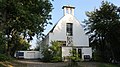
former St. Michael Church


- Evangelical Lutheran
- St. Paulus Church, Dänischburger Landstrasse (consecrated 1965)
- St. John's Church, Dummersdorfer Strasse (consecrated 1910)
- Dreifaltigkeitskirche, Schlesienring (consecrated 1965)
- St. Nikolai (Kücknitz) (consecrated 2008)
- Evangelical Free Church Congregation (Baptists), Hüttenstrasse
- Roman Catholic
- Parish Church of St. Joseph, Josephstrasse (designated 1910)
The St. John's Church was designed by Carl Mühlenpfordt around 1908 , as was the parsonage and the elementary school. The St. Joseph Church was also designed by him.
- Former churches
- St. Michael Church (Evangelical Lutheran), Rangenberg (consecrated 1951 - deedication in 2008, building sold in 2009)
schools
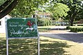
Elementary school Roter Hahn

- Support centers
- Matthias Leithoff School (opened in 1962), Haferkoppel, 156 students in 16 classes
- Elementary schools
- Rangenberg School, Rangenberg, (opened in 1939), 90 students in 4 classes
- Roter Hahn elementary school , Schneidemühlstrasse, (opened in 1960), 249 students in 13 classes
- Utkiek Primary School, Utkiek, (opened in 1964), 140 students in 7 classes
- Elementary and community schools
- Trave elementary and community school, Kücknitzer Hauptstrasse, 560 students in 26 classes
- High schools
- Trave-Gymnasium , Kücknitzer Hauptstrasse, (opened 1973, in the school center since 1979), 386 students in 17 classes
- Vocational schools
- Ludwig Fresenius School, Hochofenstrasse
- Former schools
- Luisenhofschule, Siemser Landstrasse (until 2011)
Student numbers from the school year 2018/2019
Cultural monuments
Individual evidence
- ↑ http://www.luebeck.de/stadt_politik/statistiken/kapitel2.html Punk 215
- ^ Jan H. Fahlbusch: Pöppendorf instead of Palestine , the passengers of the 'Exodus 1947' were forced to stay in Lübeck
- ↑ http://netzplan-sv-luebeck.de/index.php/de/netzplan accessed on July 19, 2016
- ↑ http://netzplan-sv-luebeck.de/index.php/de/netzplan accessed on July 19, 2016
- ↑ Dummersdorfer Ufer nature reserve ( memento from November 23, 2005 in the Internet Archive )
- ↑ Statistical Office for Hamburg and Schleswig-Holstein: Directory of general education schools in Schleswig-Holstein 2018/2019
literature
- Uwe Müller: Kücknitz. A district in transition from a monastery village to an industrial area. (Small booklets on city history, edited by the archive of the Hanseatic City of Lübeck , No. 3) Lübeck 1987, ISBN 3-7950-3102-8
- Werner Macziey (Hrsg.): Kücknitzer history 1900–2005 from the point of view of the non-profit association Kücknitz eV from 1911. Persistence and change of bourgeois community spirit. Lübeck 2005.
- Jan H. Fahlbusch: Pöppendorf instead of Palestine , forced stay of the passengers of the 'Exodus 1947' in Lübeck, ISBN 3-933374-29-4
Web links
- District profiles 2011 (static information on all districts and districts)
- Map of the city districts and districts with topographical background (PDF file; 519 kB)
- A short history of the hereditary estates in Kücknitz (PDF; 2.2 MB)
- Werner Macziey, Renate Giercke, Sabine Scholz: Kücknitzer district history. Website of the non-profit association Kücknitz e. V., accessed on October 21, 2015 .
