List of geotopes in the Rendsburg-Eckernförde district
This sortable list contains the geotopes of the Rendsburg-Eckernförde district in Schleswig-Holstein . It contains the official designations for names and numbers as well as their geographical location (as of 2015).
| Geotope number | Object number geotope potential area | Surname | Geotope type | Municipality / city | Coordinates | image | comment |
|---|---|---|---|---|---|---|---|
| Dr 003 | Drumlinfeld Boksee - Schönhorst - Bothkamp - Bissee | Drumlin , drum-lined landscape | The Drumlinfeld is located in both the Rendsburg-Eckernförde and Plön districts. | ||||
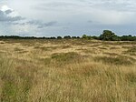
| You 019 | Inland dunes near Lohklindt - Hörsten - Moltkestein | Dune , drift sand area | |||||
| You 017 | Inland dunes of Krummenort / Sorgbrück (4 individual areas) | Dune, drift sand area | Owschlag | 54 ° 21 ′ 33 " N , 9 ° 34 ′ 46" E |

|
See also Sorgwohld | |
| You 018 | Inland dunes near Bargstall (7 individual areas) | Dune, drift sand area | |||||
| You 020 | Inland dunes near Rüsterberge | Dune, drift sand area | Schülp | 54 ° 14 '50.1 " N , 9 ° 37' 4.2" E |
 |
||
| You 021 | Inland dunes near Schülp-Westerrönfeld (2 individual areas) | Dune, drift sand area | Schülp | ||||
| You 022 | Inland dunes near Altenkattbek (2 individual areas) | Dune, drift sand area | |||||
| You 023 | Inland dunes near Nienkattbek | Dune, drift sand area | |||||
| You 024 | Inland dunes near Brammerau (2 individual areas) | Dune, drift sand area | Brammer | ||||
| You 025 | Bokel inland dunes | Dune, drift sand area | |||||
| You 026 | Inland dunes near Hamweddel | Dune, drift sand area | |||||
| You 027 | Inland dunes near Stits | Dune, drift sand area | |||||
| You 028 | Inland dunes on the Bünzener Au | Dune, drift sand area | |||||
| Qp 025 | Vistula glacial period : Diapir - structures of Eemzeit humus deposits near Jahrsdorf (2 individual areas) | Geological information | |||||
| Fl 005 | Bordesholm glacier edge | Glazy surface element | |||||
| Hy 006 | Farbberg spring peak | Source , source form | Nindorf (near Hohenwestedt) | ||||
| Ka 007 | Karst area of Osterby (2 individual areas) | Karst shape | |||||
| Kl 008 | Schoenhagen cliff | cliff | Brodersby (Schwansen) | 54 ° 37 '35.6 " N , 10 ° 1' 58.4" E |

|
||
| Kl 009 | Kliff Bookniseck - Waabs | cliff | |||||
| Class 010 | Hemmelmark cliff | cliff | |||||
| Kl 011 | Kliff Jellenbek, Surendorf, Danish - Nienhof, Stohl, Bülk (2 individual areas) | cliff | |||||
| Kl 027 | Cliff Lehmbergstrand / Karlsminde | cliff | |||||
| Kl 028 | Cliff at Hemmelmarker See (3 individual areas) | cliff | |||||
| Kl 029 | Kliff Aschau (3 individual areas) | cliff | |||||
| Kl 030 | Kliff Noer - Jellenbek (4 individual areas) | cliff | |||||
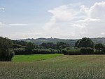
| Mon 010 | Hüttener Mountains | moraine | 54 ° 25 ′ 0 ″ N , 9 ° 45 ′ 0 ″ E |

|
|||
| Mon 011 | Duvenstedter Mountains | moraine | |||||
| Mon 012 | Moraine range Wacken - Bokhorst - Siezbüttel - Gokels | moraine | The moraine range is located both in the Rendsburg-Eckernförde district and in the Steinburg district. | ||||
| Mon 013 | Oldenhütten at the edge of the glacier | moraine | |||||
| Mon 014 | Tongue basin Goossee / Eckernförde (2 individual areas) | moraine | Goosefeld , Altenhof , Eckernförde | 54 ° 26 ′ 29 ″ N , 9 ° 51 ′ 20 ″ E |

|
||
| Mon 015 | Boxberg - Hennstedt (Aukrug) | moraine | Aukrug | 54 ° 4 '13.1 " N , 9 ° 44' 14.1" E |

|
||
| Mr 004 | Bargstedter Moor | moor | Bargstedt (Holstein) | 54 ° 9 ′ 40.9 " N , 9 ° 48 ′ 10" E | |||
| Mr 009 | Kesselmoor Eidertal | moor | Grevenkrug | 54 ° 13 '12.6 " N , 10 ° 1' 42.3" E | |||
| Mr 014 / Qp 028 | Vistula - glacial period: pingo - similar structure Moor lake - lowland, south of Kiel | moor | 54 ° 15 '30.2 " N , 10 ° 8' 7.1" E | The area is located in the Rendsburg-Eckernförde district, as well as in the Plön district and Kiel. | |||
| Ni 009 | Lower Pohlsee area | Ice crumbling landscape | Langwedel (Holstein) | 54 ° 13 '53 " N , 9 ° 55' 53" E |

|
||
| Ni 010 | Niedertau landscapes in Steinsieken | Ice crumbling landscape | |||||
| Os 003 | Os from Rieseby | Os | |||||
| Os 004 | Os system from Loose / Losau | Os | |||||
| Os 005 | Os von Neu - Duvenstedt | Os | |||||
| Os 006 | Os von Höbek, Ohe | Os | |||||
| Os 020 | Os von Steinsieken | Os | |||||
| Os 024 | Os near Bistensee (2 individual areas) | Os | |||||
| Os 025 | Os near Damendorf (huts) | Os | |||||
| Os 030 | Os - Kolholm system | Os | |||||
| St 028 | Strandwall - System and Haffsee Schwansener See | Beach wall | |||||
| Ta 027 | Breakthrough valley of the Schirnau Bünsdorf - Gut Schirnau | Valley shape | Bünsdorf | 54 ° 21 '23.4 " N , 9 ° 44' 59.8" E | |||
| Do 007 | Fuhlenseetal - Schusterkrug / Kiel | Tunnel valley | 54 ° 25 '54.8 " N , 10 ° 9' 46.1" E | The valley lies both in the Rendsburg-Eckernförde district and in Kiel. | |||
| Tu 008 | Westensee valley - Emkendorf | Tunnel valley | Emkendorf , Westensee | ||||
| Tu 009 | Valley of Fuhlenau / Mühlenau, Gut Westensee - Pohlsee - Brahmsee - Nortorf and valley of Olendieksau | Tunnel valley | |||||
| Do 010 | Eidertal | Tunnel valley | 54 ° 16 '47.2 " N , 10 ° 5' 25.5" E | The valley lies both in the Rendsburg-Eckernförde district and in Kiel. | |||
| To 001 | Goossees / Eckernförde glacier scraper | Glacier ponds | |||||
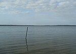
| To 008 | Wittensee | Glacier ponds | Gross Wittensee | 54 ° 23 ′ 9 ″ N , 9 ° 45 ′ 33 ″ E |

|
See also
- List of nature reserves in the Rendsburg-Eckernförde district
- List of landscape protection areas in the Rendsburg-Eckernförde district
- List of natural monuments in the Rendsburg-Eckernförde district
source
- Geotope list planning area II. (PDF, 293 KB) Geological service in the State Office for Agriculture, Environment and Rural Areas of Schleswig-Holstein, May 2015, accessed on October 20, 2015 .
Web links
Commons : Geotopes in the Rendsburg-Eckernförde district - collection of images, videos and audio files