List of geotopes in the Stormarn district
This sortable list contains the geotopes of the Stormarn district in Schleswig-Holstein . It contains the official designations for names and numbers as well as their geographical location (as of 2015).
| Geotope number | Object number geotope potential area | Surname | Geotope type | Municipality / city | Coordinates | image | comment |
|---|---|---|---|---|---|---|---|
| Dr 002 | Drumlin landscape near Bad Oldesloe / Rethwischhof | Drumlin , drum-lined landscape | 53 ° 47 ′ 40 "N, 10 ° 24 ′ 2" E | ||||
| Dr 005 | Drumlins in the Travetal (7 individual areas) | Drumlin, drum-lined landscape | |||||
| Fl 001 | Grander (Rausdorfer) Sander (3 individual areas) | Glazy surface element | 53 ° 35 '23 "N, 10 ° 20' 12" E | ||||
| Hy 003 | Salt moors Travetal and Heilsau | Source , source form | 53 ° 53 ′ 47 "N, 10 ° 35 ′ 10" E | ||||
| Qp 007 | Saale complex / Weichsel ice age : Klingberg | Exposure | Grabau | 53 ° 49 ′ 10 ″ N, 10 ° 15 ′ 3 ″ E | |||
| Qp 008 | Saale complex: Fossil Saale-Drumlin Stemwarde | Exposure | 53 ° 33 ′ 51 ″ N, 10 ° 14 ′ 37 ″ E | ||||
| Qp 014 | Eem warm period : Quaternary outcrop southwest of Wilstedt | Exposure | 53 ° 42 '57 "N, 10 ° 1' 54" E | ||||
| Qp 022 | Weichsel Ice Age: Type locality Meiendorf-Interstadial | Exposure | 53 ° 37 ′ 16 ″ N, 10 ° 11 ′ 7 ″ E | ||||
| Qp 029 | Vistula glacial period: Pingo - similar structure near Ahrensfelde | Exposure | 53 ° 45 ′ 56 "N, 10 ° 30 ′ 32" E | ||||
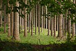
| Mon 006 | Hahnheide | moraine | Trittau | 53 ° 37 ′ 0 ″ N, 10 ° 27 ′ 0 ″ E |

|
||
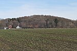
| Mon 031 | Vistula glacial period: Wartenberg mountains with debris from the Ahrensburg clan | moraine | |||||
| Mon 032 | Upside down moraines Bocksberg - Schübarg - mountain range | moraine | Ahrensburg , Ammersbek | 53 ° 41 ′ 15 "N, 10 ° 10 ′ 31" E |

|
||
| Mr 003 | Nienwohlder Moor | moor | Nienwohld , Jersbek | 53 ° 47 ′ 38 "N, 10 ° 11 ′ 24" E |

|
The Nienwohlder Moor is located in both the Segeberg district and the Stormarn district. | |
| Mr 005 | Salt moors Travetal ( Brenner Moor ) (3 individual areas) | moor | Bad Oldesloe | 53 ° 49 ′ 5 ″ N, 10 ° 21 ′ 10 ″ E |

|
||
| Ni 001 | Niedertau and Kames landscape near Sülfeld / Neritz | Ice crumbling landscape | |||||
| Ni 002 | Ice collapse - Lütjensee / Seebergen landscape | Ice crumbling landscape | |||||
| Ni 012 | Kameslandschaft near Fahrenhorst, east of Elmenhorst | Ice crumbling landscape | |||||
| Os 014 | Questionable Os of Zarpen (3 individual areas) | Os | |||||
| Os 018 | Os east of the Lütjensee, Seebergen | Os | |||||
| Os 021 | Oser in the area of the Ahrensburg - Stellmoorer - tunnel valley (4 individual areas) | Os | |||||
| Os 028 | Os - system in the area of the Ahrensburg Stellmoorer tunnel valley / Vierbergen (5 individual areas) | Os | |||||
| Ta 020 | Alster valley between Ehlersberg and Wulksfelde | Valley shape | Tangstedt | 53 ° 44 ′ 43 "N, 10 ° 7 ′ 42" E | |||
| Ta 033 | Billetal between Mühlenrade and Bergedorf | Valley shape | 53 ° 33 ′ 23 "N, 10 ° 19 ′ 26" E | The Billetal is located in both the Duchy of Lauenburg and Stormarn | |||
| Ta 034 | Barnitz Valley | Valley shape | |||||
| Ta 035 | Süderbeste - valley | Valley shape | |||||
| Ta 038 | Hangzertalung Lütjensee | Valley shape | |||||
| Ta 039 | Lütjensee dry valleys | Valley shape | |||||
| Tu 016 | Stellmoorer tunnel valley | Tunnel valley | 53 ° 39 ′ 10 ″ N, 10 ° 13 ′ 7 ″ E | ||||
| Tu 006 | Großenseerinne | Tunnel valley | |||||
| Tu 017 | Corbek valley between Großensee and Rausdorf | Tunnel valley | Großensee , Rausdorf | 53 ° 35 ′ 45 "N, 10 ° 19 ′ 50" E |
See also
- List of nature reserves in the Stormarn district
- List of landscape protection areas in the Stormarn district
- List of natural monuments in the Stormarn district
source
- Geotope list planning area III. (PDF, 303 kB) Geological service in the State Office for Agriculture, Environment and Rural Areas of Schleswig-Holstein, May 2015, accessed on August 1, 2015 .
Web links
Commons : Geotopes in the Stormarn district - collection of images, videos and audio files