List of geotopes in the Steinburg district
This sortable list contains the geotopes of the Steinburg district in Schleswig-Holstein . It contains the official designations for names and numbers as well as their geographical location (as of 2015).
| Geotope number | Object number geotope potential area | Surname | Geotope type | Municipality / city | Coordinates | image | comment |
|---|---|---|---|---|---|---|---|
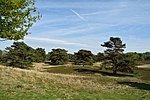
| You 030 | Inland dunes between Störkathen and Kellinghusen | Dune , drift sand area | 53 ° 58 '14.4 " N , 9 ° 44' 44.7" E |

|
Within the geotope are the nature reserve Heidefläche bei Kellinghusen and the nature reserve Waldfläche bei Kellinghusen | ||
| You 038 | Inland dunes Münsterdorfer Geestinsel (2 individual areas) | Dune, drift sand area | Munsterdorf , Breitenburg | 53 ° 53 ′ 28 " N , 9 ° 31 ′ 42" E |

|
||
| Ka 002 | Peissen hole | Karst shape | Peeing | 54 ° 0 ′ 50 " N , 9 ° 36 ′ 34.9" E | |||
| Ka 003 | Sinkholes Münsterdorfer Geest with burglar funnel " Knickenkuhle " | Karst shape | Munsterdorf | 53 ° 54 '13 " N , 9 ° 31' 3.5" E | |||
| Ka 004 | Sinkfalls near Lägerdorf and Heidestrasse (3 individual areas) | Karst shape | |||||
| Kl 046 | Cliff south of Nutteln (4 individual areas) | cliff | |||||
| Kl 047 | Cliffs Oeschenbüttel - Kellinghusen - Mühlenbarbek, Winseldorf - Itzehoe, Krempermoor Dägeling (6 individual areas) | cliff | |||||
| Ma 004 | Marshland west of Wilster (Diekdorf) | Marsh / mudflat landscape | |||||
| Me 002 | Chalk pits Lägerdorf and Kronsmoor / Breitenburg | Exposure | |||||
| Qh 003 | Holocene : Turf iron stone and vivianite occurrence Störkathen | Exposure |
53 ° 58 ′ 31 " N , 9 ° 44 ′ 47.6" E 53 ° 58 ′ 40 " N , 9 ° 44 ′ 54.3" E |
||||
| Qp 002 | Holstein and Wacken Warm Period: Wacken clay pit (2 individual areas) | Exposure | |||||
| Qp 003 | Holstein and Wacken Warm Period: Muldsberg clay pit | Exposure | Mehlbek | 53 ° 59 ′ 41.3 " N , 9 ° 25 ′ 21.6" E |

|
||
| Qp 005 | Elster Cold Age / Saale Complex : Lägerdorf, Saturn pit | Exposure | Kronsmoor , Breitenburg | 53 ° 54 '7.2 " N , 9 ° 35' 6.8" E |

|
||
| Qp 031 | Pleistocene : Faults and rift structures in the overburden of the writing chalk on the Peissen structure | Exposure | |||||
| Mon 009 | Edge of ice on the heights of Itzehoe | moraine | |||||
| Mon 012 | Moraine range Wacken - Bokhorst - Siezbüttel - Gokels | moraine | The moraine range lies both in the Steinburg district and in the Rendsburg-Eckernförde district. | ||||
| Os 017 | Os - System Forst Steinburg | Os | |||||
| Ta 024 | Dry valleys on the Glasberg east of Wiedenborstel | Valley shape | |||||
| Ta 025 | Dry valley near Hohenfierth | Valley shape |
See also
- List of nature reserves in the Steinburg district
- List of landscape protection areas in the Steinburg district
- List of natural monuments in the Steinburg district
source
- Geotope list planning area III. (PDF, 303 KB) Geological Service in the State Office for Agriculture, Environment and Rural Areas of the State of Schleswig-Holstein, May 2015, accessed on August 1, 2015 .
Individual evidence
- ^ Announcements of the German Soil Science Society. Excursion guide annual conference 1993 Kiel vol. 70 (1993) pp. 94-97.
Web links
Commons : Geotopes in the Steinburg district - collection of images, videos and audio files