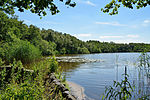
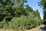
List of landscape protection areas in the Steinburg district
The list of landscape protection areas in the Steinburg district contains the landscape protection areas of the Steinburg district in Schleswig-Holstein .
| image | number | Name of the area | Area in hectares | map | Coordinates | Parish (noun) | Date of the ordinance number in the nature conservation book |
Reference |
|---|---|---|---|---|---|---|---|---|
|
|
61-IZ-01 | The Steinburg district has combined several areas under the common name of "landscape components and landscape parts in the area of several municipalities".
No. 1: "Lehmwohld" forest area |
No. 1:20 |
location | position |
No. 1: Itzehoe |
October 22, 1940 | regulation |
| 61-IZ-02 | Geesthang near Dägeling with Bockwischer Moor | 158.07 | location | position | Dägeling , Krempermoor | September 13, 1957 No. 32 |
regulation | |
| 61-IZ-03 | Twiedtberge with surroundings | 18.41 | location | position | Itzehoe | February 24, 1961 No. 33 |
regulation | |
| 61-IZ-04 | Joachimsquelle | 100.71 | location | position | Poyenberg , Hennstedt | August 28, 1980 No. 34 |
regulation | |
| 61-IZ-05 | Lohmühlenteich | 30.15 | location | position | Hohenlockstedt | January 18, 1963 No. 35 |
regulation | |
| 61-IZ-06 | Charlottenhöhe | 119.67 | location | position | Oelixdorf | February 24, 1964 and March 4, 1965 No. 36 |
regulation | |
| 61-IZ-07 | Koenigsmoor | 1336.60 | location | position | Altenmoor , row of lapwing | July 21, 1982 No. 37 |
regulation | |
| 61-IZ-08 | Horstmühle | 22.22 | location | position | horst | November 30, 1972 No. 38 |
regulation | |
| 61-IZ-09 | Kollmar March | 4782.24 | location | position | Kollmar , Neuendorf , Glückstadt | July 10, 1980 No. 39 |
regulation | |
| 61-IZ-10 | Hohenfelder Moor | 54.18 | location | position | Hohenfelde | August 27, 1982 No. 40 |
regulation |
Remarks
- ↑ The coordinates correspond to the center of a rectangle that frames the boundaries of the landscape protection area. Due to the shape of an area, they can also be located outside the actual area. The map column shows the exact limits.
See also
- List of nature reserves in the Steinburg district
- List of natural monuments in the Steinburg district
- List of geotopes in the Steinburg district


